East Fork (Arizona)
| East Fork | |
|---|---|
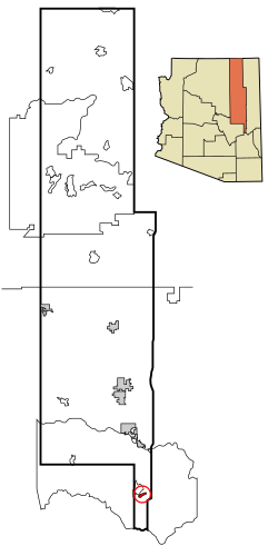 Lage im County und in Arizona | |
| Basisdaten | |
| Staat: | Vereinigte Staaten |
| Bundesstaat: | Arizona |
| County: | Navajo County |
| Koordinaten: | 33° 48′ N, 109° 56′ W33.800277777778-109.928611111111597Koordinaten: 33° 48′ N, 109° 56′ W |
| Zeitzone: | Mountain Standard Time (UTC−7) |
| Einwohner: | 672 (Stand: 2020) |
| Haushalte: | 108 (Stand: 2020) |
| Fläche: | 7,5 km² (ca. 3 mi²) davon 7,5 km² (ca. 3 mi²) Land |
| Bevölkerungsdichte: | 90 Einwohner je km² |
| Höhe: | 1597 m |
| FIPS: | 04-21310 |
| GNIS-ID: | 0025319 |
East Fork (Westliche Apachen: Hawú'ishįįhé) ist ein Census-designated place im Navajo County im US-Bundesstaat Arizona. Das U.S. Census Bureau hat bei der Volkszählung 2020 eine Einwohnerzahl von 672[1] auf einer Fläche von 7,5 km² ermittelt. East Fork liegt auf 1597 m. ü. M. in der Fort-Apache-Reservation im Süden des Countys.
Bildung
East Fork liegt im Whiteriver Unified School District.
Verkehr
Westlich von East Fork verläuft die Arizona State Route 73.
Einzelnachweise
- ↑ Explore Census Data East Fork CDP, Arizona. Abgerufen am 22. Oktober 2022.
County Seat: Holbrook
| Cities | Holbrook • Show Low • Winslow | |
| Towns | Pinetop-Lakeside • Snowflake • Taylor | |
| CDPs | Chilchinbito • Cibecue • Clay Springs • Dilkon • East Fork • First Mesa • Fort Apache • Greasewood • Hard Rock • Heber-Overgaard • Hondah • Hotevilla-Bacavi • Indian Wells • Jeddito • Joseph City • Kayenta • Keams Canyon • Kykotsmovi Village • Lake of the Woods • Linden • Low Mountain • McNary1 • North Fork • Oljato-Monument Valley • Pinedale • Pinetop Country Club • Pinon • Rainbow City • Seba Dalkai • Second Mesa • Seven Mile • Shongopovi • Shonto • Shumway • Sun Valley • Tees Toh • Turkey Creek • Wagon Wheel • White Mountain Lake • Whitecone • Whiteriver • Winslow West2 • Woodruff |


