Árneshreppur
Municipality in Westfjords, Iceland

Coat of arms
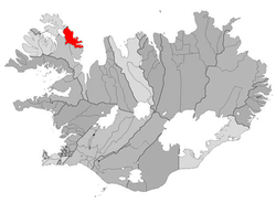
Location of Árneshreppur
524
Árneshreppur (Icelandic pronunciation: [ˈaurˌnɛsˌr̥ɛhpʏr̥] ⓘ) is an Icelandic municipality, located in the Westfjords peninsula of northwestern Iceland.[2] It is Iceland's lowest-populated municipality with a population of 53 based on the 2024 census.[2]
The village Djúpavík at the Reykjarfjörður [ˈreiːcarˌfjœrðʏr̥] is situated in the municipality. Other villages are Gjögur [ˈcœːɣʏr̥], Norðurfjörður [ˈnɔrðʏrˌfjœrðʏr̥] and Krossnes [ˈkʰrɔsːˌnɛːs]. The area is served by Gjögur Airport.
Árneshreppur is renowned for its stunning natural beauty with diverse hiking paths, the exhibitions in Djúpavík and the museum Kört in Trékyllisvík. One of the main tourist attractions is Krossneslaug, a unique swimming pool by the seaside.
References
- ^ "Census: Population by sex, age and municipality 2011 and 2021". Statistics Iceland. Retrieved 5 May 2023.
- ^ a b "Árneshreppur", Iceland Review. Accessed 14 June 2016.
- v
- t
- e
Municipalities of Iceland
- Garðabær
- Hafnarfjarðarkaupstaður
- Kjósarhreppur
- Kópavogsbær
- Mosfellsbær
- Reykjavíkurborg
- Seltjarnarneskaupstaður
- Grindavíkurbær
- Reykjanesbær
- Suðurnesjabær
- Sveitarfélagið Vogar
- Húnabyggð
- Húnaþing vestra
- Skagabyggð
- Sveitarfélagið Skagafjörður
- Sveitarfélagið Skagaströnd
| Authority control databases |
|
|---|
 | This Iceland location article is a stub. You can help Wikipedia by expanding it. |
- v
- t
- e


