1902 eruption of Santa María
VEI 6 volcanic eruption in Guatemala
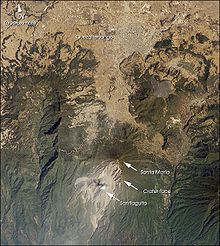
14°45′25″N 91°33′07″W / 14.757°N 91.552°W / 14.757; -91.552The 1902 eruption of Santa María was one of the largest eruptions of the 20th century, measuring a six on the volcanic explosivity index of eight. The main eruption began on 24 October 1902 and lasted no more than 20 hours.[1] Prior to its catastrophic eruption, Santa María had no record of an eruption. The eruption killed between 5,000 and 8,700 people. Immediate knowledge about the eruption was suppressed by President Manuel Estrada Cabrera due to the occurrence of a propaganda festival at around the same time of the eruption. Aid did not reach the affected areas immediately and only arrived in December.
Background
The formation of Santa María occurred approximately 30,000 years BP, constructing the present cone to a volume of 20 km3 (4.8 cu mi). It comprise predominantly of basaltic andesites and pyriclastic material. It is part of a large volcanic belt that straddles the Pacific coast of Middle America. Prior to the 1902 eruption, there were no historical records of activity on the volcano.[2] It was previously considered extinct.[3]
In early 1902, Guatemala was affected by a series of damaging earthquakes; the first in this sequence occurring on 18 January. This event affected San Martín and the country's Pacific coastal region. Ouezaltenango and San Marcos were razed during the 18 April earthquake, which was also the largest of the sequence and killing 1,000 people. This event caused major damage to buildings and was felt in other countries. The epicenter of the April shock was thought to be near Santa María. A series of local earthquakes occurring with high frequency was felt within the volcano's vicinity for six weeks. Another major shock occurred on 23 September that was felt as far as Mexico.[2]
Eruption
On 24 October, slight earthquakes were perceived. Santa María began discharging steam in the afternoon, before rumbling noises were heard within its vicinity at 17:00.[4] In San Felipe, the sound was described by people as either reminiscent of a waterfall or large boiler. These sounds emanated from the direction of the volcano and persisted for 30 minutes. At about the same period, people in Quezaltenango began to report a dark cloud from the volcano. As the evening progressed, a white sand-like substance began showering and blanketing the area, discoloring the landscape with its witish color.[5]
At 18:15, ash particles were reported in Finca Helvetia, about 14 km (8.7 mi) west of the volcano. By 20:00, the volcano produced a large eruption column accompanied by lightning flashes. This column took on cauliflower-like shapes.[3] Large lithics began to rain down the volcano's southern flanks at 01:00 of 25 October, signifying that the eruption had entered its plinian stage. Pea-sized lapilli ash began to fall in Quezaltenago at 03:00.[4] Meanwhile, in Finca Helvetia, pumice measuring 15–25 cm (5.9–9.8 in) and between 0.5–0.75 lb (0.23–0.34 kg) began to rain onto the village at 03:00. The initial fallout was cold before hot pumice was introduced. The material in this fallout later included hot, fist-sized rocks and lava bombs. By 11:00, the eruption had reached its climax.[5] The eruption persisted into the night, though its intensity gradually decreased. The main eruption ended before the morning of 26 October.[3]
Blasts were heard in Costa Rica, some 850 km (530 mi) southeast of the volcano. In Oaxaca and Belize, explosions could be heard. The eruption continued to shake windows in Cobán until mid-day and its residents detected a sulfrous smell. The captain of the S.S. Newport used her sextant to measure the height of the eruption column and placed his estimation at 27–29 km (17–18 mi). Another sailor measured the column at 48 km (30 mi) which has been deemed errorneous. The ash fallout made its way into Motozintla in Mexico, some 104 km (65 mi) northwest of the volcano, at 06:00. The ash traveled further into the country and reached Mexico City. The initial plinian eruption ceased after 18 to 20 hours before another eruptive phase initiated in the early hours of 26 October. This new activity was phreatomagmatic and accompanied by steam eruptions.[4] Light steam explosions continued to occur in 1903. Earthquake activity was frequent and residents could detect the stench of hydrogen sulphide.[3]
During the course of the eruption, it generated a dense-rock equivalent (DRE) volume of 8 km3 (1.9 cu mi) of magma. The dacite measured in DRE was estimated at 5 km3 (1.2 cu mi). The tephra volume was estimated at 2.0×10¹⁰ cubic meters. Unlike most large eruptions of its kind, Santa María's plinian column did not collapse. The eruption also did not create a caldera although it expelled a large volume of magma. This was probably attributed to a deep-than-usual location for its magma chamber, which, during the 1902 eruption, was not entirely emptied. The Santiaguito lava dome which formed in 1922 had a nearly identical lava composition with the lava that erupted in 1902.[4]
Although a caldera did not form, a new, oval-shaped crater had emerged.[5] Karl Sapper reported that three explorers visited the crater in late November. The explorers described a crater with an east-west axis of 1 km (0.62 mi) and was 500–600 m (1,600–2,000 ft) at its widest base diameter. It also extended to a depth of 200–250 m (660–820 ft). The crater floor hosted six vents; the largest was circular and 30 m (98 ft) across, and situated in the center of the crater. The remaining vents were distributed along the edge of the crater and were constantly emmitting steam. The second largest of these vents was actively spewing debris some 20 m (66 ft) into the air. A section of the volcano's flank was destroyed, exposing steep cliffs and revealing layers of lava flows and ash deposits extending 1,200 m (3,900 ft) high.[1] This major scarp nearly reached the summit of the volcano. Large pieces of rocks were observed falling and accumulating at the bottom of the scarp in a 150 m (490 ft) debris cone. They also estimated the crater wall's slope to be 60 degrees.[3]
Impact

All trees and shrubs within a 32 km (20 mi) by 113 km (70 mi) area that stretched halfway towards the Pacific were stripped of its leaves and severely damaged by the rushing volcanic debris. Many trees were entirely uprooted, snapped at their branches; many others were also split by lightning. All vegetation was destroyed within a 5 km (3.1 mi) reach of the crater. Within a month of the eruption, new leaves began to sprout from undamaged tree branches. Coffee plants also began producing new branches as their existing ones were torn away by the eruption. Up to 18 m (59 ft) of ash covered the ground within the immediate vicinity of the explosion crater.[6]
Portions of coffee plantations in Xolhuitz, Costa Cuca, Chuva, Progreso and Tumbador were devastated and unrestored.[5] The total losses for coffee was placed at over 300 thousand quintals.[7] In areas where the native vegetation died, the leaves and berries Liberian coffee plants were unscathed. Though the Arabian coffee plants withered, their berries were salvaged for low-quality coffee.[6]
During the initial eruption phase, birds were observed in a dazed condition on roads. The stench of animal corpses rotting beneath volcanic debris was intense according to Gustav Eisen who reported the forest conditions in 1903. The loss of life among mammals was believed to be enormous, greater than that of avian creatures. Cattle also died in large numbers; some perished during the eruption or in the subsequent days from consuming ash-contaminated water and grass. Insects were among the fauna that recovered quicker; Eisen found butterflies, beetles, mosquitoes and flies in abundance. He also noticed zompopos ants, a species of leafcutter ants carrying the buried brown soil towards the surface of ash. Blackbirds also returned to the area a month after the eruption.[6]
Estimates of the death toll range from 5,000 to 8,700.[8] Those in close proximity to the crater likely died while many more were killed by roof collapses. Many buildings sustained collapsed roof due to the weight of ash it had collected.[6] A malaria outbreak added to the fatalities.[9] In Suiza, a building heavily occupied by those escaping the eruption collapsed under the accumulated ash, killing 18.[5]
Aftermath
President Manuel Estrada Cabrera attempted to downplay the impact of the eruption. The eruption occurred hours before the Fiestas Minervalias, a propaganda fair, was supposed to begin. The 26 October issue of Diario de Centro América was heavily focused on the festival while it made no mention of the eruption. No issues were published on 27 and 28 October due to the festival. The first story about the eruption was only published on 3 November. There were no official actions in attempting to calculate the number of fatalities and aid only reached the affected departments in December.[7]
While the eruption continued, the regional authorities of Quetzaltenango became responsible for handling the crisis, as attention of the national government was focused on Fiestas Minervalias. In an attempt to suppress the impact of the eruption, citizens were informed the eruption occurred in México. Furthermore, the official government informed Quetzaltenango authorities that no funds were available for recovery, as were absorbed by the response missions following the April earthquake.[10] Quetzaltenango regional authorities announced that the West zone agricultural harvest was destroyed, and forecasted a famine due to food shortages. The deaths of cattle also led to a meat shortage. They were allowed by the central government to import flour free of taxes for the next few months.[11]
On top of food shortages, the lack of water and power supply due to ash added to the turmoil of residents. It took several months for these services to be fully functional. Residents began to clear ash from their roofs to prevent further cave-ins. On 12 November, President Cabrera established the General Supply of Aid for Agriculture to support struggling farmers and the agricultural industry. In late November, Quetzaltenango officials allocated 15,000 pesos for cleaning works an another 5,000 to repair its aqueducts.[12]
See also
- List of largest volcanic eruptions
- List of volcanic eruptions by death toll
- List of volcanoes in Guatemala
References
- ^ a b "Santa María". Global Volcanism Program. Smithsonian Institution.
- ^ a b Rose, W. I.; Grant, N. K.; Hahn, G. A.; Lange, I. M.; Powell, J. L.; Easter, J.; Degraff, J. M. (1977). "The Evolution of Santa María Volcano, Guatemala". The Journal of Geology. 85 (1): 63–87. doi:10.1086/628269.
- ^ a b c d e Sapper, Karl (1903). Die vuleanischen Ereignisse in Mittelamerika im Jahre 1902 [The Vulean events in Central America in 1902]. Neues Jahrbuch für Mineralogie, Geologie and Paläontologie (in German). Tübingen. pp. 39–90.
{{cite book}}: CS1 maint: location missing publisher (link) - ^ a b c d Williams, Stanley N.; Self, Stephen (1983). "The October 1902 plinian eruption of Santa Maria volcano, Guatemala". Journal of Volcanology and Geothermal Research. 16 (1–2): 33–56. doi:10.1016/0377-0273(83)90083-5.
- ^ a b c d e Anderson, Tempest (1908). "The Volcanoes of Guatemala" (PDF). The Geographical Journal. 31 (5): 473–485.
- ^ a b c d Eisen, Gustav (1903). "The Earthquake and Volcanic Eruption in Guatemala in 1902". Bulletin of the American Geographical Society. 35 (4): 325–352. doi:10.2307/197952.
- ^ a b Galicia, Néstor (26 October 2016). "Un desastre que Estrada Cabrera insistió en negar" [A disaster that Estrada Cabrera insisted on denying]. Prensa Libre (in Spanish). Retrieved 31 August 2024.
- ^ "Octubre de 1902 explosión del volcán Santa María, e" [October 1902 explosion of the Santa Maria volcano, and]. Diario de Los Altos (in Spanish). 25 October 2020. Retrieved 31 August 2024.
- ^ Angelis, Silvio De; Rietbrock, Andreas; Lavallee, Yan; Carter, William; Wallace, Paul; Gottschämmer, Ellen; Rohnacher, Alicia (2019). An international partnership to develop volcano monitoring capacities in Guatemala. SEG International Exposition and 89th Annual Meeting. pp. 4782–4785. doi:10.1190/segam2019-3215154.1.
- ^ Arévalo Martínez, Rafael (1945). ¡Ecce Pericles! (in Spanish). Guatemala: Tipografía Nacional.
- ^ Aragón, Magda (2013). "Cuando el día se volvió noche; La erupción del volcán Santa María de 1902". Revista Estudios Digital (in Spanish) (1). Archived from the original on 8 November 2014. Retrieved 7 November 2014.
- ^ de León, Oscar Arnoldo Soto, Centenario de la erupción del Volcán Santa María (1902-2002) [Centennial of the eruption of the Santa María Volcano (1902-2002)] (PDF), Historiador Pedagogo (in Spanish), Rafael Landívar University
- v
- t
- e


|
| Culture | |
|---|---|
- Category
- Portal


