Afogados da Ingazeira
Municipality in Northeast, Brazil
Afogados da Ingazeira Município de Afogados da Ingazeira | |
|---|---|
Municipality | |
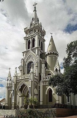 Cathedral of Senhor Bom Jesus dos Remédios | |
 Flag  Seal | |
| Nickname: Princesa do Pajeú | |
 Location of Afogados da Ingazeira in Pernambuco | |
| 7°45′3″S 37°38′20″W / 7.75083°S 37.63889°W / -7.75083; -37.63889 | |
| Country |  Brazil Brazil |
| Region | Northeast |
| State |  Pernambuco Pernambuco |
| Founded | July 1, 1909 |
| Government | |
| • Mayor | Alessandro Palmeira de Vasconcelos Leite (PSB, 2021-2024) |
| Area | |
| • Total | 377.696 km2 (145.829 sq mi) |
| Elevation | 525 m (1,722 ft) |
| Population (2020 [1]) | |
| • Total | 37,404 |
| • Density | 99/km2 (260/sq mi) |
| Demonym | Afogadense |
| Time zone | UTC−3 (BRT) |
| Website | afogadosdaingazeira |
Afogados da Ingazeira is a Brazilian municipality in the state of Pernambuco. The estimated population in 2020 according to the IBGE was 37,404, and the total area is 377.70 square kilometres (145.83 sq mi).[2] It has a population density of 97 inhabitants per square kilometer. In 2000, Afogados da Ingazeira had the second highest Human Development Index (HDI) in the Alto do Pajeú sertão region of Pernambuco state. Nonetheless, its score (0.683) was still below the state (0.718) and national (0.789) averages. The city is the seat of the Roman Catholic Diocese of Afogados da Ingazeira.
Geography
- State - Pernambuco
- Region - Sertão Pernambucano
- Boundaries - Solidão (N); Tabira and Iguaraci (E); Carnaíba (S and W);
- Area - 377.70 square kilometres (145.83 sq mi)
- Elevation - 525 metres (1,722 ft)
- Hydrography - Pajeú River
- Vegetation - Caatinga hiperxerófila.
- Climate - Semi arid ( Sertão) - hot and dry
- Annual average temperature - 24.1 °C (43 °F)
- Distance to Recife - 380 kilometres (240 mi)
Economy
The main economic activities in Afogados da Ingazeira are industry, commerce and agribusiness, especially farming of cattle, goats, sheep, chickens; and plantations of beans, corn and manioc.
Economic indicators
| Population | GDP x(1000 R$).[3] | GDP pc (R$) | PE |
|---|---|---|---|
| 35.528 | 140.504 | 4.127 | 0.24% |
Economy by Sector 2006
| Primary sector | Secondary sector | Service sector |
|---|---|---|
| 6.34% | 17.44% | 76.22% |
Health indicators
[4]
| HDI (2000) | Hospitals (2007) | Hospitals beds (2007) | Children's Mortality every 1000 (2005) |
|---|---|---|---|
| 0.683 | 2 | 192 | 15.2 |
References
External links
- Afogados da Ingazeira City Hall
- Afogados da Ingazeira Portal
- v
- t
- e

Capital: Recife
Agreste Pernambucano
| Alto Capibaribe | |
|---|---|
| Brejo Pernambucano | |
| Garanhuns | |
| Médio Capibaribe | |
| Vale do Ipanema | |
| Vale do Ipojuca |

Mata Pernambucana
| Mata Meridional Pernambucana | |
|---|---|
| Mata Setentrional Pernambucana | |
| Vitoria de Santo Antão |
Metropolitana de Recife
| Itamaracá | |
|---|---|
| Recife | |
| Porto de Suape | |
| Fernando de Noronha |
Sao Francisco Pernambucano
| Itaparica | |
|---|---|
| Petrolina |
Sertão Pernambucano
| Araripina | |
|---|---|
| Pajeú | |
| Salgueiro | |
| Sertão do Moxotó |
Authority control databases | |
|---|---|
| International |
|
| National |
|
 | This Pernambuco, Brazil location article is a stub. You can help Wikipedia by expanding it. |
- v
- t
- e


