Aizkraukle District
District of Latvia
District in Latvia
Aizkraukle District Aizkraukles rajons | |
|---|---|
District | |
 Coat of arms | |
 | |
| Country | Latvia |
| Area | |
| • Total | 2,566.8 km2 (991.0 sq mi) |
| Population [1] | |
| • Total | 39,971 |
| • Density | 16/km2 (40/sq mi) |
| Website | aizkrauklesrajons.lv |
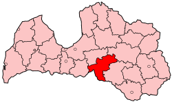
Aizkraukle District (Latvian: Aizkraukles rajons, [aizkraukles rajuons]) was an administrative division of Latvia from 1967 to 2009. It was located in Vidzeme and Selonia regions, in the country's centre.
Districts were introduced during the Soviet occupation of Latvia and were eliminated during the administrative-territorial reform in 2009.
References
- ^ "RESIDENT POPULATION BY REGION, CITY AND DISTRICT AT THE BEGINNING OF THE YEAR". Centrālās statistikas pārvaldes datu bāzes. Archived from the original on 2009-01-10. Retrieved 2009-01-23.
- v
- t
- e
Cities, Municipalities and Parishes of the defunct Aizkraukle District
- Aizkraukle
- Jaunjelgava
- Pļaviņas
- Aizkraukle
56°39′N 25°15′E / 56.650°N 25.250°E / 56.650; 25.250
 | This Vidzeme location article is a stub. You can help Wikipedia by expanding it. |
- v
- t
- e


