Assin Fosu
Considered as a secondary city and Municipal Capital in Central Region, Ghana
Assin Fosu Assin Fosu | |
|---|---|
Considered as a secondary city and Municipal Capital | |
| 5°42′00″N 1°16′40″W / 5.70000°N 1.27778°W / 5.70000; -1.27778 | |
| Country |  Ghana Ghana |
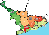
| Region |  Central Region Central Region |
| District | Assin Central Municipal Assembly |
| Elevation | 351 ft (107 m) |
| Population (2013) | |
| • Total | 80,541[1] |
| Ranked 65th in Ghana | |
| Demonym | Assin Fosan |
| Time zone | GMT |
| • Summer (DST) | GMT |
| Ethnicity | Akan people |
Assin Fosu is the capital of Assin Central Municipal Assembly , in the Central Region of Ghana, considered as a secondary city.[2] Assin Fosu is the 65th most populous settlement in Ghana, with a population of 70,541.[1] The town is known for the Obiri Yeboah Secondary School School.[3][4] The school is a second cycle institution.[5]
References
- ^ a b "World Gazetteer online". World-gazetteer.com. Archived from the original on 2012-01-11.
- ^ Touring Central Region Archived 2012-05-17 at the Wayback Machine
- ^ "Educational Institutions". www.centralregion.gov.gh. Archived from the original on 1 August 2017. Retrieved 12 August 2011.
- ^ "References » Schools/Colleges". Retrieved 12 August 2011.
- ^ "List of Secondary Schools in Assin Fosu". Retrieved 12 August 2011.
- v
- t
- e
Cities and towns of Ghana by population
- Kumasi (Ashanti)
- Accra (Greater Accra)


- Sekondi-Takoradi (Western)
- Tamale (Northern)
- Sunyani (Brong-Ahafo)
- Cape Coast (Central)
- Obuasi (Ashanti)
- Koforidua (Eastern)
- Ho (Volta)
- Nungua (Greater Accra)
- Lashibi (Greater Accra)
- Dome (Greater Accra)
- Gbawe (Greater Accra)
- Kasoa (Central)
- Ejura (Ashanti)
- Taifa (Greater Accra)
- Bawku (Upper East)
- Aflao (Volta)
- Agona Swedru (Central)
- Bolgatanga (Upper East)
- Tafo (Ashanti)
- Berekum (Brong-Ahafo)
- Nkawkaw (Eastern)
- Akim Oda (Eastern)
- Winneba (Central)
- Hohoe (Volta)
- Yendi (Northern)
- Suhum (Eastern)
- Kintampo (Brong-Ahafo)
- Adenta East (Greater Accra)
- Nsawam (Eastern)
- Mampong (Ashanti)
- Konongo (Ashanti)
- Asamankese (Eastern)
- Wenchi (Brong-Ahafo)
- Japekrom (Brong-Ahafo)
- Savelugu (Northern)
- Agogo (Ashanti)
- Anloga (Volta)
- Prestea (Western)
- Effiakuma (Western)
- Tarkwa (Western)
- Elmina (Central)
- Dunkwa-on-Offin (Central)
- Begoro (Eastern)
- Kpandu (Volta)
- Navrongo (Upper East)
- Axim (Western)
- Apam (Central)
- Salaga (Northern)
- Saltpond (Central)
- Akwatia (Eastern)
- Shama (Western)
- Keta (Volta)
- Nyakrom (Central)
- Bibiani (Western)
- Goaso (Ahafo Region)
- Somanya (Eastern)
- Assin Foso (Central)
- Aburi (Eastern)
- Banda Ahenkro (Brong-Ahafo)
- Mumford (Central)
- Bechem (Brong-Ahafo)
- Duayaw Nkwanta (Brong-Ahafo)
- Kade (Eastern)
- Anomabu (Central)
- Akropong (Eastern)
- Kete Krachi (Volta)
- Kibi (Eastern)
- Kpandae (Northern)
- Mpraeso (Eastern)
- Akim Swedru (Eastern)
- Aboso (Western)
- Bekwai (Ashanti)
- Regional capitals in bold
- Kumasi
- Accra
- Sekondi-Takoradi
- Tamale
- Sunyani
- Cape Coast
- Koforidua
- Wa
- Ho
- Bolgatanga
| ||
|---|---|---|
| Metropolitan (1) |
|  |
| Municipal (7) |
| |
| Ordinary (14) |
| |
This Central Region, Ghana location article is a stub. You can help Wikipedia by expanding it. |
- v
- t
- e


