Atoka Municipal Airport
Airport

AQR

AQR
| Direction | Length | Surface | |
|---|---|---|---|
| ft | m | ||
| 18/36 | 3,015 | 919 | Asphalt |
| Aircraft operations | 3,500 |
|---|
Source: Federal Aviation Administration[1]
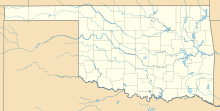
Atoka Municipal Airport (ICAO: KAQR, FAA LID: AQR) is a mile north of Atoka, in Atoka County, Oklahoma.[1] The National Plan of Integrated Airport Systems for 2021-2025 categorized it as a general aviation airport.[2]
Most U.S. airports use the same three-letter location identifier for the FAA and IATA, but this airport is AQR to the FAA[1] and has no IATA code.[3][4]
Facilities
The airport covers 490 acres (198 ha) at an elevation of 590 feet (180 m). Its single runway, 18/36, is 3,015 by 40 feet (919 x 12 m) asphalt. In the year ending July 28, 2009 the airport had 3,500 general aviation aircraft operations, average 291 per month.[1]
See also
References
- ^ a b c d FAA Airport Form 5010 for AQR PDF. Federal Aviation Administration. Effective May 31, 2012.
- ^ "National Plan of Integrated Airport Systems (2021-2025), page A-83" (PDF). FAA. Retrieved December 28, 2020.
- ^ "Atoka Municipal Airport (FAA: AQR, ICAO: KAQR, IATA: none)". Great Circle Mapper. Retrieved December 15, 2012.
- ^ "IATA Airport Code Search". International Air Transport Association. Retrieved December 15, 2012.
External links
- Atoka Municipal Airport (AQR) at Oklahoma Aeronautics Commission
- Aerial image as of March 1995 from USGS The National Map
- Resources for this airport:
- FAA airport information for AQR
- AirNav airport information for KAQR
- FlightAware airport information and live flight tracker
- NOAA/NWS weather observations: current, past three days
- SkyVector aeronautical chart, Terminal Procedures


