Begoña (Madrid Metro)
Madrid Metro station
| Preceding station | Madrid Metro | Following station | ||
|---|---|---|---|---|
| Fuencarral towards Hospital Infanta Sofía | Line 10 | Chamartín towards Puerta del Sur | ||
Location | |
|---|---|
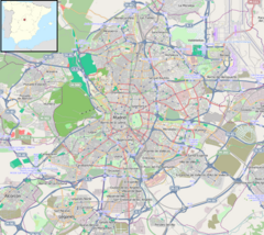  Begoña Location within Madrid |
Begoña [beˈɣoɲa] is a station on Line 10 of the Madrid Metro, serving the Colonia Virgen de Begoña ("Virgin of Begoña colony") development. It is located in fare Zone A.[1] It lies directly below the major road Paseo de la Castellana which separates the districts of Fuencarral-El Pardo (La Paz neighbourhood) to the west and Chamartín to the east, though access is only via the west side of the road (a pedestrian subway access allows access to the station from the east).
Despite giving service to the Cuatro Torres Business Area and two large hospitals—La Paz and Ramón y Cajal—the station continues to have no disabled access as of 2020. This has caused much discontent with its frequent users, although there are plans for the construction of new elevator shafts.[2]
References
- v
- t
- e
Madrid Metro stations
- Hospital Infanta Sofía
- Reyes Católicos
- Baunatal
- Manuel de Falla
- Marqués de la Valdavia
- La Moraleja
- La Granja
- Ronda de la Comunicación
- Las Tablas
- Montecarmelo
- Tres Olivos
- Fuencarral
- Begoña
- Chamartín
- Plaza de Castilla
- Cuzco
- Santiago Bernabéu
- Nuevos Ministerios
- Gregorio Marañón
- Alonso Martínez
- Tribunal
- Plaza de España
- Príncipe Pío
- Lago
- Batán
- Casa de Campo
- Colonia Jardín
- Aviación Española
- Cuatro Vientos
- Joaquín Vilumbrales
- Puerta del Sur
 | This article about a Spanish railway station is a stub. You can help Wikipedia by expanding it. |
- v
- t
- e
 | This Madrid Metro article is a stub. You can help Wikipedia by expanding it. |
- v
- t
- e


