Bnachii
City in North Governorate
Bnachii بنشعي | |
|---|---|
City | |
| 34°19′58″N 35°53′43″E / 34.33278°N 35.89528°E / 34.33278; 35.89528 | |
| Country |  Lebanon Lebanon |
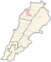
| Governorate | North Governorate |
| District | Zgharta District |
| Elevation | 450 m (1,480 ft) |
| Time zone | UTC+2 (EET) |
| • Summer (DST) | UTC+3 (EEST) |
| Dialing code | +961 |
Bnashii (also Bnashaai, Bneshaai, Bnechaai, Bnash'i, Arabic: بنشعي) is a village located in the Zgharta District in the North Governorate of Lebanon.[1]
The altitude of the village is 450 meters above sea level. It has a leisure base around its artificial lake.[2]
In 1866, the village was the witness of an important battle between 800 lebanese nationalists led by Youssef Bey Karam and a numerically superior ottoman contingent led by Daoud Pasha.
References
External links
- Ehden Family Tree
- Bnashii Lake On Google Maps Street View By Paul Saad
- v
- t
- e
 Zgharta District, North Governorate
Capital: Zgharta
- Aarjes
- Aintourine
- Aitou
- Alma
- Arbet Kozhaya
- Ardeh
- Ashashe
- Aslout
- Asnoun
- Basloukit
- Bchennine
- Beit Awkar
- Beit Obeid
- Besbeel
- Bhairet Toula
- Bnachii
- Bousit
- Daraya
- Ehden
- Ejbeh
- Fraydiss
- Haret Al Fawar
- Harf Ardeh
- Harf Miziara
- Hawqa
- Hilan
- Houmeiss
- Iaal
- Jdaydeh
- Kadrieh
- Karahbache
- Karmsaddeh
- Kfardlakos
- Kfarfou
- Kfarhawra
- Kfarsghab
- Kfarshakhna
- Kfarhata
- Kfaryachit
- Kfarzeina
- Mazraat Al Nahr
- Mazraat Al Toufah
- Mazraat Hraikis
- Mejdlaya
- Miriata
- Miziara
- Sakhra
- Morh Kfarsghab
- Rachiine
- Raskifa
- Sebhel
- Sereel
- Toula
- Zgharta
- Patriarch Estephan El Douaihy
- Youssef Bey Karam
- Suleiman Frangieh
- René Moawad
- Anis Bey Moawad
- Hamid Frangieh
- Youssef Salim Karam
- Rvd. Seemaan El Douaihy
- Nayla Moawad
- Suleiman Frangieh, Jr.
- Salim Bey Karam
- Estephan El Douaihy
- Tony Frangieh
- Jawad Boulos
- Samir Frangieh
- Youakim Moubarac
- Marie al-Khazen
 | This Lebanon location article is a stub. You can help Wikipedia by expanding it. |
- v
- t
- e


