Bokiddick
Hamlet in Cornwall, England
50°25′38″N 4°44′44″W / 50.4272°N 4.7456°W / 50.4272; -4.7456

class=notpageimage|
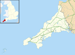
Bokiddick shown within CornwallBokiddick is a hamlet in Cornwall, England, United Kingdom. It is approximately one mile south of Lanivet[1] at grid reference SX 051 622 and is centred on four farms.
References
- ^ Ordnance Survey: Landranger map sheet 200 Newquay & Bodmin ISBN 978-0-319-22938-5
External links
 Cornwall portal

![]() Media related to Bokiddick at Wikimedia Commons
Media related to Bokiddick at Wikimedia Commons
- v
- t
- e

Cornwall Portal
- Cornwall Council
- Council of the Isles of Scilly
(cities in italics)
- Bodmin
- Bude
- Callington
- Camborne
- Camelford
- Falmouth
- Fowey
- Hayle
- Helston
- Hugh Town
- Launceston
- Liskeard
- Looe
- Lostwithiel
- Marazion
- Newlyn
- Newquay
- Padstow
- Penryn
- Penzance
- Porthleven
- Redruth
- St Austell
- St Blazey
- St Columb Major
- St Ives
- St Just in Penwith
- Saltash
- Stratton
- Torpoint
- Truro
- Wadebridge
See also: List of civil parishes in Cornwall
 | This article about a location in the former district of North Cornwall, England is a stub. You can help Wikipedia by expanding it. |
- v
- t
- e


