Bole, Ghana
District Capital in Savannah Region, Ghana
9°2′N 2°29′W / 9.033°N 2.483°W / 9.033; -2.483 (2013)
Bole is a small town and is the capital of Bole district, a district in the Savannah Region of northern Ghana.[1] Bole is connected by road to the town of Sawla and the town of Bamboi. Bole is home to the Bole District Hospital and post office.[1] The Bole District covers an area of 4800 km2 land mass and has a population of about 87,656.[2]
History
Bole was founded as a trading center by Soninke Wangara immigrants, the same group that were the progenitors of the Dyula of Begho, Bouna, Bondoukou and Kong.[3] The town was located on an important regional trade route for kola nuts linking the Manding region with Hausaland. In 1818 Bole fought a war against the Ashanti Empire. When they lost, the victors deposed the ruling Timite family of imams and replaced them with the Kamaghate.[4]
Institutions
- Bole Senior High School[5]
- Bole District Police Command[6]
- Bole District Government Hospital[6]
- Nkilgi FM[7]
Notable natives
Climate
| Climate data for Bole (1991–2020) | |||||||||||||
|---|---|---|---|---|---|---|---|---|---|---|---|---|---|
| Month | Jan | Feb | Mar | Apr | May | Jun | Jul | Aug | Sep | Oct | Nov | Dec | Year |
| Record high °C (°F) | 39.6 (103.3) | 41.2 (106.2) | 41.5 (106.7) | 41.0 (105.8) | 38.5 (101.3) | 36.1 (97.0) | 34.4 (93.9) | 34.0 (93.2) | 33.8 (92.8) | 36.0 (96.8) | 38.1 (100.6) | 39.0 (102.2) | 41.5 (106.7) |
| Mean daily maximum °C (°F) | 35.5 (95.9) | 37.0 (98.6) | 37.0 (98.6) | 35.0 (95.0) | 33.2 (91.8) | 31.2 (88.2) | 29.7 (85.5) | 29.2 (84.6) | 30.2 (86.4) | 32.2 (90.0) | 34.3 (93.7) | 35.1 (95.2) | 33.3 (91.9) |
| Daily mean °C (°F) | 26.8 (80.2) | 29.1 (84.4) | 30.4 (86.7) | 29.6 (85.3) | 28.3 (82.9) | 26.8 (80.2) | 25.7 (78.3) | 25.4 (77.7) | 25.9 (78.6) | 26.9 (80.4) | 27.0 (80.6) | 26.2 (79.2) | 27.3 (81.1) |
| Mean daily minimum °C (°F) | 18.1 (64.6) | 21.1 (70.0) | 23.7 (74.7) | 24.1 (75.4) | 23.4 (74.1) | 22.4 (72.3) | 21.8 (71.2) | 21.6 (70.9) | 21.5 (70.7) | 21.6 (70.9) | 19.7 (67.5) | 17.3 (63.1) | 21.4 (70.5) |
| Record low °C (°F) | 11.0 (51.8) | 13.5 (56.3) | 15.6 (60.1) | 19.2 (66.6) | 19.2 (66.6) | 18.7 (65.7) | 18.7 (65.7) | 18.0 (64.4) | 17.2 (63.0) | 15.0 (59.0) | 9.5 (49.1) | 10.1 (50.2) | 9.5 (49.1) |
| Average precipitation mm (inches) | 3.2 (0.13) | 15.9 (0.63) | 46.0 (1.81) | 104.7 (4.12) | 128.9 (5.07) | 139.6 (5.50) | 137.2 (5.40) | 155.4 (6.12) | 198.7 (7.82) | 111.0 (4.37) | 18.5 (0.73) | 4.2 (0.17) | 1,063.3 (41.86) |
| Average precipitation days (≥ 1.0 mm) | 0.2 | 1.0 | 3.5 | 6.3 | 8.5 | 9.5 | 9.2 | 9.9 | 14.1 | 9.0 | 1.8 | 0.3 | 73.3 |
| Mean monthly sunshine hours | 255.0 | 228.2 | 228.2 | 225.0 | 232.8 | 180.3 | 151.5 | 133.0 | 155.2 | 230.1 | 243.9 | 244.1 | 2,507.3 |
| Source: NOAA[8] | |||||||||||||
References
- ^ a b "Bole District". Ghana Districts. 3 May 2008. Archived from the original on 14 June 2013. Retrieved 19 January 2024.
- ^ "Bole". mofa.gov.gh. Retrieved 2022-06-12.
- ^ Massing, Andrew (2000). "The Wangara, an Old Soninke Diaspora in West Africa?". Cahiers d’Études Africaines. 40 (158): 294. Retrieved 24 May 2024.
- ^ Massing, Andrew (2012). "Imams of Gonja The Kamaghate and the Transmission of Islam to the Volta Basin". Cahiers d’Études Africaines. 52 (205): 75-85. Retrieved 24 May 2024.
- ^ "Assistant Headmaster of Bole SHS arrested for alleged rape". Graphic Online. Retrieved 2022-05-27.
- ^ a b www.3news .com (2022-05-25). "Bole SHS Asst. Head accused of raping final-year student". 3NEWS.com. Retrieved 2022-05-27.
{{cite web}}: CS1 maint: numeric names: authors list (link) - ^ Agyeman, Adwoa (2022-04-11). "Bole SHS old students stop auctioning of school bus". Adomonline.com. Retrieved 2022-05-27.
- ^ "Bole Normals 1991–2020". World Meteorological Organization Climatological Standard Normals (1991–2020). National Oceanic and Atmospheric Administration. Archived from the original on 29 September 2023. Retrieved 29 September 2023.
- v
- t
- e
- East Gonja Municipal (Capital: Salaga)
- West Gonja Municipal (Capital: Damongo)
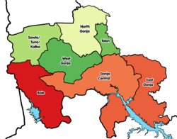
- Bole (Capital: Bole)
- Central Gonja (Capital: Buipe)
- North Gonja (Capital: Daboya)
- North East Gonja (Capital: Kpalbe)
- Sawla-Tuna-Kalba (Capital: Sawla)


Authority control databases | |
|---|---|
| International |
|
| National |
|
09°02′N 02°29′W / 9.033°N 2.483°W / 9.033; -2.483


