Carr Square, St. Louis
Neighborhood of St. Louis in Missouri, United States
Carr Square | |
|---|---|
Neighborhood of St. Louis | |
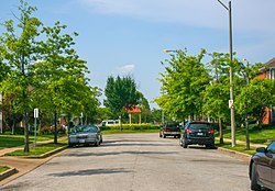 Carr Square residential area, July 2013 | |
 Location (red) of Carr Square within St. Louis | |
| Country | United States |
| State | Missouri |
| City | St. Louis |
| Wards | 14 |
| Government | |
| • Aldermen | Rasheen Aldridge |
| Area | |
| • Total | 0.41 sq mi (1.1 km2) |
| Population (2020)[1] | |
| • Total | 2,236 |
| • Density | 5,500/sq mi (2,100/km2) |
| ZIP code(s) | Part of 63106 |
| Area code(s) | 314 |
| Website | stlouis-mo.gov |
Carr Square is a neighborhood of St. Louis, Missouri. The neighborhood is bounded by Cass Avenue on the north, Carr Street on the south, North Tucker Boulevard and North 13th Street on the east, and North Jefferson on the west.
Demographics
In 2020 Carr Square's racial makeup was 94.9% Black, 2.1% White, 2.0% Two or More Races, and 0.7% Some Other Race. 0.9% of the population was of Hispanic or Latino origin.[2]
| Census | Pop. | Note | %± |
|---|---|---|---|
| 1990 | 3,070 | — | |
| 2000 | 2,339 | −23.8% | |
| 2010 | 2,774 | 18.6% | |
| 2020 | 2,236 | −19.4% | |
| Sources:[3][4] | |||
New Carr Square streetcar line
In June 2013 Forbes magazine profiled new streetcar systems of ten American cities that had built or were building new modern streetcar systems.[5] According to Forbes, St. Louis is considering building a new modern line to connect downtown to Carr Square.
References
- ^ "2020 Census Neighborhood Results".
- ^ "City of St. Louis" (PDF). Retrieved 2021-09-19.
- ^ "Carr Square Neighborhood Statistics". St Louis, MO. Retrieved 26 January 2023.
- ^ "Neighborhood Census Data". City of St. Louis. Retrieved 26 January 2023.
- ^ "Will St. Louis Be Home To The Trolley Once More?". Forbes magazine. June 2013. Archived from the original on July 1, 2013. Retrieved 2013-06-27.
Its backers want a new system to connect downtown, Carr Square, and a series of neighborhoods.
- v
- t
- e
- Academy
- Baden
- Benton Park
- Benton Park West
- Bevo Mill
- Botanical Heights
- Boulevard Heights
- Carondelet
- Carr Square
- Central West End
- Cheltenham
- Chinatown (defunct since 1966)
- Clayton/Tamm
- Clifton Heights
- College Hill
- Columbus Square
- Compton Heights
- Covenant Blu Grand Center
- DeBaliviere Place
- "Dogtown"
- Downtown
- Downtown West
- Dutchtown
- Ellendale
- Fairground
- Forest Park Southeast
- Fountain Park
- Fox Park
- Franz Park
- Gate District
- Gravois Park
- Greater Ville
- Hamilton Heights
- The Hill
- Hi-Pointe
- Holly Hills
- Hyde Park
- JeffVanderLou
- Kings Oak
- Kingsway East
- Kingsway West
- Kosciusko
- Lafayette Square
- LaSalle Park
- Lewis Place
- Lindenwood Park
- Marine Villa
- Mark Twain
- Mark Twain/I-70 Industrial
- McKinley Heights
- Midtown
- Mill Creek Valley (defunct since 1960s)
- Mount Pleasant
- Near North Riverfront
- Northampton
- North Point
- North Riverfront
- O'Fallon
- Old North St. Louis
- Patch
- Peabody–Darst–Webbe
- Penrose
- Princeton Heights
- Riverview
- Shaw
- Skinker DeBaliviere
- Soulard
- Southampton
- Southwest Garden
- St. Louis Hills
- St. Louis Place
- Tiffany
- Tower Grove East
- Tower Grove South
- Vandeventer
- The Ville
- Visitation Park
- Walnut Park East
- Walnut Park West
- Wells/Goodfellow
- West End
- Wydown/Skinker
38°38′22″N 90°12′09″W / 38.6395°N 90.2024°W / 38.6395; -90.2024
 | This St. Louis location article is a stub. You can help Wikipedia by expanding it. |
- v
- t
- e


