Carrizo Peak
Mountain in New Mexico, United States

Carrizo Peak
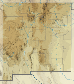
Location in New Mexico
Show map of New Mexico
Carrizo Peak
Carrizo Peak (the United States)
Show map of the United StatesCarrizo Peak is a 9,626-foot-elevation (2,934-meter) mountain summit in Lincoln County, New Mexico, United States.
Description
Carrizo Peak is a prominent mountain located nine miles (14 km) east-northeast of Carrizozo, New Mexico, and can be seen from highways 54 and 380. Topographic relief is significant as the summit rises 3,600 feet (1,097 meters) above surrounding terrain in 2.5 miles (4.0 km). Access to the summit is via the Carrizo Peak Trail which is 2.5 miles long.[4] The nearest higher mountain is Nogal Peak, 13.67 miles (22.00 km) to the south-southwest.[5] Precipitation runoff from the mountain drains into the Rio Grande watershed.[5] This landform's toponym has been officially adopted by the United States Board on Geographic Names.[2] Carrizo Peak is the highest point of Carrizo Mountain, and should not be confused with the Carrizo Mountains of Arizona.
Climate
According to the Köppen climate classification system, Carrizo Peak is located in a cool semiarid climate zone (Köppen BSk).[6] The summers are hot during the day, but the high altitude and low humidity mean that nights remain distinctly cool. Most rain falls in the summer from afternoon thunderstorms, and winter snow is common and sometimes heavy.
See also
References
- ^ a b c d e "Carrizo Peak - 9,626' NM". listsofjohn.com. Retrieved 2024-08-18.
- ^ a b "Carrizo Peak". Geographic Names Information System. United States Geological Survey, United States Department of the Interior. Retrieved 2024-08-18.
- ^ a b c The Carrizo Mountain stock and associated intrusions, Lincoln County, New Mexico, David J. Pertl, 1991, p. 148, 149.
- ^ Carrizo Peak Trail (T72), Lincoln National Forest, fs.usda.gov, Retrieved 2024-08-18.
- ^ a b "Carrizo Peak, New Mexico". Peakbagger.com. Retrieved 2024-08-18.
- ^ Peel, M. C.; Finlayson, B. L.; McMahon, T. A. (2007). "Updated world map of the Köppen−Geiger climate classification". Hydrol. Earth Syst. Sci. 11. ISSN 1027-5606.
External links
- Weather: Carrizo Peak
- v
- t
- e
Places adjacent to Carrizo Peak
| U.S. Route 54 | Baxter Mountain | Patos Mountain |
 | ||
| Carrizozo volcanic field |  Carrizo Peak Carrizo Peak | Carrizo Creek |
 | Benado Canyon | |
| Carrizozo | U.S. Route 380 | Vera Cruz Mountains |
Portals:
 Geography
 Geology
 Mountains
 New Mexico


