Chaobai River
River in northern China
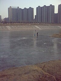
The Chaobai River (Chinese: 潮白河; pinyin: cháobái hé) is a river in northern China.[1] The river is 458 km long and flows from the confluence of the Chao and Bai Rivers at the Miyun Reservoir in Beijing Municipality through Hebei Province and into the Grand Canal of the Hai River system in Tianjin Municipality. Its average depth is 2.5 meters.
References
- ^ Chaobai River Encyclopædia Britannica
40°20′52″N 116°48′30″E / 40.34778°N 116.80833°E / 40.34778; 116.80833
- v
- t
- e

- Hun
- Taizi
- Xar Moron
- Xinkai
- Western Liao
- Eastern Liao
- Tarim
- Ejin
- Karatash
- Ili
- Shule
- Dang
- Tumen
- Yalu
- Luan
- Red
- Minjiang
- Longjiang
- Lancang
- Beilun
- Nujiang
- Lion Spring
- Elephant Spring
- Yarlung Tsangpo
- Nyang
- Subansiri
- Irtysh
- Suifen
- Qiantang
- Puyang
- Jiao (Shandong)
- Dai
- Si
- Shu
- Cao'e
- Jiao (Zhejiang)
- Ou
- Mulan
- Jin (Fujian)
- Han (Guangdong)
- Nandu
- Wanquan
- Taping
- Xiaoqing
 | This article related to a river in China is a stub. You can help Wikipedia by expanding it. |
- v
- t
- e


