Esteban Arze Province
 | |
| San José church in Esteban Arze square (Moko Pata), Tarata | |
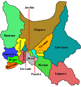
| Location of Esteban Arze Province within Bolivia | |
|---|---|
 | |
| General Data | |
| Country |  Bolivia Bolivia |
| Department | Cochabamba Department |
| Capital | Tarata |
| Municipalities | 4 |
| Cantons | 15 |
| Area | 1,245 km2 |
| Elevation | 2,750 m |
| Population | 53,964(2024) |
| Density | 41.1 inhabitants/km2 (2024) |
| Sub-prefect | |
| Languages | Quechua, Spanish |
| ISO 3166-2 | BO.CB.EA |
| Cochabamba Department | |
 | |
Esteban Arze (Quechua: T'arata) is a province in Cochabamba Department, Bolivia. Its capital is Tarata. Many people from the Esteban Arze province (Tarata and Arbieto) have migrated abroad,mainly to Argentina and to the Washington DC area (Arlington county, Fairfax county, and Alexandria Virginia, and Montgomery County Maryland.) https://pulitzercenter.org/reporting/only-bridge-matters-now
Subdivision

The province is divided into four municipalities which are further subdivided into cantons. The municipalities with their seats are:
| Section | Municipality | Seat |
|---|---|---|
| 1st | Tarata Municipality | Tarata |
| 2nd | Anzaldo Municipality | Anzaldo |
| 3rd | Arbieto Municipality | Arbieto |
| 4th | Sacabamba Municipality | Sacabamba |

Places of interest
Holidays and Feasts
The province's primary feast is in honor of Saint Severin, which is celebrated the last Sunday of November in the town of Tarata.
See also
- Atuq Wachana
- Jatun Mayu
- Jatun Urqu
- Jatun Urqu (Matarani)
- Jaya Mayu
- Misuk'ani
- Puka Qawiña
- Pukara
External links
- Map of Esteban Arze Province
- www.ine.gov.bo
- v
- t
- e


Capital: Cochabamba

(and seats)
- Aiquile (Aiquile)
- Alalay (Alalay)
- Anzaldo (Anzaldo)
- Arani (Arani)
- Arbieto (Arbieto)
- Arque (Arque)
- Ayopaya (Ayopaya)
- Bolívar (Bolívar)
- Capinota (Capinota)
- Chimoré (Chimoré)
- Cliza (Cliza)
- Cocapata (Cocapata)
- Cochabamba (Cochabamba)
- Colcapirhua (Colcapirhua)
- Colomi (Colomi)
- Cuchumuela (Cuchumuela)
- Entre Ríos Municipality (Entre Ríos)
- Mizque (Mizque)
- Morochata (Morochata)
- Omereque (Omereque)
- Pasorapa (Pasorapa)
- Pocona (Pocona)
- Pojo (Pojo)
- Puerto Villarroel (Puerto Villarroel)
- Punata (Punata)
- Quillacollo (Quillacollo)
- Sacaba (Sacaba)
- Sacabamba (Sacabamba)
- San Benito (San Benito)
- Santiváñez (Santiváñez)
- Shinahota (Shinahota)
- Sicaya (Sicaya)
- Sipe Sipe (Sipe Sipe)
- Tacachi (Tacachi)
- Tacopaya (Tacopaya)
- Tapacarí (Tapacarí)
- Tarata (Tarata)
- Tiquipaya (Tiquipaya)
- Tiraque (Tiraque)
- Toco (Toco)
- Tolata (Tolata)
- Totora (Totora)
- Vacas (Vacas)
- Vila Vila (Vila Vila)
- Villa Rivero (Villa Rivero)
- Villa Tunari (Villa Tunari)
- Vinto (Vinto)
Authority control databases | |
|---|---|
| International |
|
| National |
|
17°50′S 66°20′W / 17.833°S 66.333°W / -17.833; -66.333
This Cochabamba Department location article is a stub. You can help Wikipedia by expanding it. |
- v
- t
- e


