Filipino–American Friendship Highway
Secondary national road in Pampanga, Philippines
 | ||||
|---|---|---|---|---|
| Friendship Circumferential Road | ||||
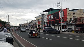 The Fil-Am Friendship Highway in the Koreatown area of Angeles City | ||||
| Route information | ||||
| Maintained by the Department of Public Works and Highways – Pampanga 1st District Engineering Office and Pampanga 3rd District Engineering Office | ||||
| Component highways | ||||
| Major junctions | ||||
| North end | Don Juico Avenue in Angeles City | |||
| Major intersections |
| |||
| South end | ||||
| Location | ||||
| Country | Philippines | |||
| Provinces | Pampanga | |||
| Major cities | Angeles City and San Fernando | |||
| Highway system | ||||
| ||||
| ||||


The Filipino–American Friendship Highway, officially the Friendship Circumferential Road (or simply the Friendship Highway), is a secondary national road traversing the cities of Angeles City and San Fernando in Pampanga, Philippines.[1][2]
The entire highway is designated as National Route 216 (N216) of the Philippine highway network.
External links
 Media related to Filipino–American Friendship Highway at Wikimedia Commons
References
- v
- t
- e
 Philippine highway network
| Luzon |
|---|
| Visayas |
|---|
| Mindanao |
|---|

| Luzon |
|
|---|---|
| Visayas |
|
| Mindanao |
|
See also: Philippine expressway network
 | This Philippine road or road transport-related article is a stub. You can help Wikipedia by expanding it. |
- v
- t
- e


