Forty Mile Colony, Montana
Census-designated place in Montana, United States
45°16′56″N 107°21′22″W / 45.28222°N 107.35611°W / 45.28222; -107.35611[1]
[2]
(2020)
59050 (Lodge Grass)
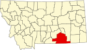
Forty Mile Colony is a Hutterite colony[3] and census-designated place (CDP) in Big Horn County, Montana, United States, within the Crow Indian Reservation. It is in the valley of the Little Bighorn River, 3 miles (5 km) south of the town of Lodge Grass.
The location was first listed as a CDP prior to the 2020 census.[2]
Demographics
| Census | Pop. | Note | %± |
|---|---|---|---|
| 2020 | 28 | — | |
| U.S. Decennial Census[4] | |||
References
- ^ "ArcGIS REST Services Directory". United States Census Bureau. Retrieved September 5, 2022.
- ^ a b c U.S. Geological Survey Geographic Names Information System: Forty Mile Colony, Montana
- ^ Morton, Claudette, ed. (2010). Essential Understandings of Montana Hutterites: A Resource for Educators and Students (PDF). Montana Office of Public Instruction. p. 2. Archived from the original (PDF) on June 9, 2021. Retrieved June 9, 2021.
- ^ "Census of Population and Housing". Census.gov. Retrieved June 4, 2016.
- v
- t
- e
Municipalities and communities of Big Horn County, Montana, United States
County seat: Hardin
- Busby
- Crow Agency
- Fort Smith
- Forty Mile Colony
- Muddy
- Pryor
- St. Xavier
- Wyola
communities
‡This populated place also has portions in an adjacent county or counties
- Montana portal
- United States portal
 | This Big Horn County, Montana state location article is a stub. You can help Wikipedia by expanding it. |
- v
- t
- e


