Frolosh
Village in Kyustendil Province, Bulgaria
Frolosh Фролош | |
|---|---|
Village | |
| 42°7′N 22°53′E / 42.117°N 22.883°E / 42.117; 22.883 | |
| Country |  Bulgaria Bulgaria |
| Province | Kyustendil Province |
| Municipality | Kocherinovo |
| Area | |
| • Total | 52.094 km2 (20.114 sq mi) |
| Elevation | 816 m (2,677 ft) |
| Population (2013)[1] | |
| • Total | 120 |
| Time zone | UTC+2 (EET) |
| • Summer (DST) | UTC+3 (EEST) |
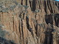
Frolosh (Bulgarian: Фролош) is a village in Kocherinovo Municipality, Kyustendil Province, south-western Bulgaria. As of 2013 it has 120 inhabitants.[1] It is situated in the picturesque northern section of the Vlahina mountain range with views to Bulgaria's highest mountain range Rila and the village of Mursalevo to the west.[1]
Frolosh Point on the coast of the Anvers Island in Antarctica is named after the village.[1][2]
Citations
- ^ a b c d "Frolosh". Guide Bulgaria. Retrieved 6 July 2018.
- ^ Frolosh Point: SCAR Composite Gazetteer of Antarctica.
- v
- t
- e

Capital: Kocherinovo
- Barakovo
- Borovets
- Buranovo
- Dragodan
- Frolosh
- Krumovo
- Mursalevo
- Porominovo
- Stob
- Tsarvishte
- Vladimir Dimitrov
- Binyo Ivanov
42°07′00″N 22°53′00″E / 42.1167°N 22.8833°E / 42.1167; 22.8833
 | This Kyustendil Province, Bulgaria location article is a stub. You can help Wikipedia by expanding it. |
- v
- t
- e


