Grade II* listed buildings in Derbyshire Dales
Map all coordinates using OpenStreetMap
Download coordinates as:
- KML
- GPX (all coordinates)
- GPX (primary coordinates)
- GPX (secondary coordinates)
There are over 20,000 Grade II* listed buildings in England. This page is a list of these buildings in the district of Derbyshire Dales in Derbyshire.
List of buildings
| Name | Location | Type | Completed [note 1] | Date designated | Grid ref.[note 2] Geo-coordinates | Entry number [note 3] | Image |
|---|---|---|---|---|---|---|---|
| 37–39 St John's Street | Ashbourne | Town house | 18th century | 14 February 1974 | SK1813146787 53°01′05″N 1°43′52″W / 53.018079°N 1.731178°W / 53.018079; -1.731178 (37–39 St John's Street) | 1335154 |  Upload Photo |
| Church of St John with street railings, gates, piers and front steps | Ashbourne | Church | 1871 | 14 February 1974 | SK1802346966 53°01′11″N 1°43′58″W / 53.019692°N 1.732777°W / 53.019692; -1.732777 (Church of St John with street railings, gates, piers and front steps) | 1279720 |  More images |
| Churchyard gate piers and gates to the parish church of St Oswald | Ashbourne | Gate | 18th century | 14 February 1974 | SK1767546490 53°00′56″N 1°44′17″W / 53.015424°N 1.737991°W / 53.015424; -1.737991 (Churchyard gate piers and gates to the parish church of St Oswald) | 1109551 | 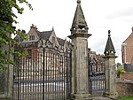 |
| Dove House | Ashbourne | House | Early 18th century | 15 June 1951 | SK1787246774 53°01′05″N 1°44′06″W / 53.017971°N 1.735039°W / 53.017971; -1.735039 (Dove House) | 1109519 | Upload Photo |
| Owlfields Almshouses | Ashbourne | Almshouse | Shortly after 1640 | 15 June 1951 | SK1776446530 53°00′57″N 1°44′12″W / 53.015781°N 1.736662°W / 53.015781; -1.736662 (Owlfields Almshouses) | 1207678 | 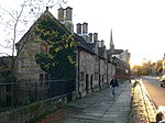 More images |
| Pegg's Almshouses | Ashbourne | Almshouse | 1848 | 15 June 1951 | SK1779146539 53°00′57″N 1°44′11″W / 53.015861°N 1.736259°W / 53.015861; -1.736259 (Pegg's Almshouses) | 1109548 | 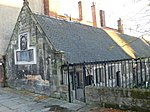 More images |
| Smiths Wine Tavern | Ashbourne | Shop | Late 18th/early 19th century | 15 June 1951 | SK1809146729 53°01′03″N 1°43′54″W / 53.017559°N 1.731777°W / 53.017559; -1.731777 (Smiths Wine Tavern) | 1109503 |  |
| Summerhouse in grounds of Mansion House | Ashbourne | Summerhouse | Mid-18th century | 15 June 1951 | SK1776646498 53°00′56″N 1°44′12″W / 53.015493°N 1.736634°W / 53.015493; -1.736634 (Summerhouse in grounds of Mansion House) | 1109549 | Upload Photo |
| The Green Man and Black's Head Hotel, attached inn sign bridging road | Ashbourne | Inn sign | Mid-18th century | 15 June 1951 | SK1802646674 53°01′01″N 1°43′58″W / 53.017067°N 1.732749°W / 53.017067; -1.732749 (The Green Man and Black's Head Hotel, attached inn sign bridging road) | 1293246 |  More images |
| The Grey House | Ashbourne | House | 1760–70 | 15 June 1951 | SK1773546547 53°00′57″N 1°44′14″W / 53.015935°N 1.737094°W / 53.015935; -1.737094 (The Grey House) | 1109543 | 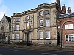 More images |
| 20 and 22, Market Place | Ashbourne | House | Late 17th/early 18th century | 15 June 1951 | SK1806046814 53°01′06″N 1°43′56″W / 53.018324°N 1.732234°W / 53.018324; -1.732234 (20 and 22, Market Place) | 1208191 | 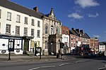 |
| Ashford Hall | Ashford-in-the-Water | Country house | c. 1785 | 12 July 1967 | SK1996469772 53°13′29″N 1°42′09″W / 53.224623°N 1.702432°W / 53.224623; -1.702432 (Ashford Hall) | 1109281 | 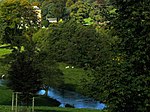 More images |
| Sheepwash Bridge | Ashford-in-the-Water | Bridge | 18th century | 12 July 1967 | SK1943169612 53°13′24″N 1°42′38″W / 53.223205°N 1.710425°W / 53.223205; -1.710425 (Sheepwash Bridge) | 1335270 |  More images |
| Bagshaw Hall | Bakewell | Townhouse | 1684 | 13 March 1951 | SK2161868637 53°12′52″N 1°40′40″W / 53.214357°N 1.677735°W / 53.214357; -1.677735 (Bagshaw Hall) | 1147985 |  More images |
| Burton Closes | Bakewell | Country house | c.1845–48 | 13 March 1951 | SK2205467664 53°12′20″N 1°40′17″W / 53.205593°N 1.671273°W / 53.205593; -1.671273 (Burton Closes) | 1148032 | 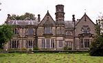 More images |
| Old House Museum including mounting block | Bakewell | House | c.16th and 17th century | 20 April 1954 | SK2147868541 53°12′49″N 1°40′47″W / 53.213499°N 1.679838°W / 53.213499; -1.679838 (Old House Museum including mounting block) | 1247512 |  More images |
| Church of St Anne | Baslow and Bubnell | Church | 13th century | 12 July 1967 | SK2518072331 53°14′51″N 1°37′27″W / 53.247404°N 1.624106°W / 53.247404; -1.624106 (Church of St Anne) | 1088200 |  More images |
| Beeley Hilltop House | Beeley | Manor house | Early 17th century | 12 July 1967 | SK2694068412 53°12′44″N 1°35′53″W / 53.212092°N 1.59806°W / 53.212092; -1.59806 (Beeley Hilltop House) | 1088204 | 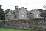 More images |
| Church of St Anne | Beeley | Church | 12th century | 12 July 1967 | SK2648867646 53°12′19″N 1°36′18″W / 53.205229°N 1.604892°W / 53.205229; -1.604892 (Church of St Anne) | 1063739 |  More images |
| Old Hall, attached walls and doorway | Beeley | Manor house | Early 17th century | 12 July 1967 | SK2666267561 53°12′16″N 1°36′08″W / 53.204457°N 1.602294°W / 53.204457; -1.602294 (Old Hall, attached walls and doorway) | 1356550 | Upload Photo |
| Green House and attached garden walls and gate piers | Birchover | House | 1774 | 12 July 1967 | SK2377462084 53°09′19″N 1°38′45″W / 53.155362°N 1.645935°W / 53.155362; -1.645935 (Green House and attached garden walls and gate piers) | 1109893 | Upload Photo |
| Market Cross | Bonsall | Cross | Late 14th century | 22 June 1950 | SK2791858292 53°07′16″N 1°35′03″W / 53.121076°N 1.584296°W / 53.121076; -1.584296 (Market Cross) | 1248285 |  More images |
| Parish Church of St James | Bonsall | Church | 13th–14th century | 22 June 1950 | SK2798758133 53°07′11″N 1°35′00″W / 53.119644°N 1.583279°W / 53.119644; -1.583279 (Parish Church of St James) | 1263911 |  More images |
| Church of St John the Baptist | Boylestone | Church | Early 14th century | 13 September 1967 | SK1816335825 52°55′10″N 1°43′53″W / 52.919539°N 1.731312°W / 52.919539; -1.731312 (Church of St John the Baptist) | 1109778 |  More images |
| Bradbourne Hall | Bradbourne | House | Late 16th/early 17th century | 11 October 1983 | SK2084652751 53°04′18″N 1°41′25″W / 53.071591°N 1.690323°W / 53.071591; -1.690323 (Bradbourne Hall) | 1109477 | 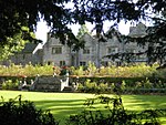 More images |
| Church of All Saints | Bradley | Church | Late 14th century and earlier | 13 September 1967 | SK2234145970 53°00′38″N 1°40′07″W / 53.010577°N 1.668478°W / 53.010577; -1.668478 (Church of All Saints) | 1109352 |  More images |
| Church of St James | Brassington | Church | 14th century | 13 September 1967 | SK2302654325 53°05′08″N 1°39′28″W / 53.08565°N 1.657675°W / 53.08565; -1.657675 (Church of St James) | 1109483 | 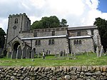 More images |
| The Gate Inn | Brassington | House | 1616 | 13 September 1967 | SK2298454209 53°05′05″N 1°39′30″W / 53.084609°N 1.65831°W / 53.084609; -1.65831 (The Gate Inn) | 1109450 |  More images |
| Callow Hall | Callow | Farmhouse | 17th century | 11 October 1983 | SK2688751800 53°03′46″N 1°36′01″W / 53.062774°N 1.600242°W / 53.062774; -1.600242 (Callow Hall) | 1111886 |  More images |
| Calver Bridge | Calver | Road bridge | c.1800 | 12 July 1967 | SK2463474422 53°15′58″N 1°37′56″W / 53.266225°N 1.632127°W / 53.266225; -1.632127 (Calver Bridge) | 1088212 | 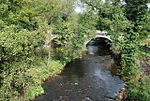 More images |
| Church of St Margaret | Carsington | Church | 1648 | 13 September 1967 | SK2524253429 53°04′39″N 1°37′29″W / 53.077497°N 1.624661°W / 53.077497; -1.624661 (Church of St Margaret) | 1109458 |  More images |
| Queen Mary's Bower | Chatsworth | Viewing platform | 16th century | 12 July 1967 | SK2575870306 53°13′45″N 1°36′56″W / 53.229175°N 1.615607°W / 53.229175; -1.615607 (Queen Mary's Bower) | 1334745 |  More images |
| The First Duke's Greenhouse | Chatsworth Gardens, Chatsworth | Glasshouse | 1697 98 | 12 July 1967 | SK2614370174 53°13′41″N 1°36′35″W / 53.22797°N 1.609851°W / 53.22797; -1.609851 (The First Duke's Greenhouse) | 1334741 | 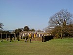 More images |
| The Hunting Tower | Chatsworth | Hunting tower | c.1582 | 12 July 1967 | SK2650070628 53°13′55″N 1°36′16″W / 53.232033°N 1.604465°W / 53.232033; -1.604465 (The Hunting Tower) | 1372877 | 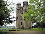 More images |
| Church of St John the Baptist | Chelmorton | Church | 13th century | 12 July 1967 | SK1155570262 53°13′45″N 1°49′42″W / 53.229275°N 1.828366°W / 53.229275; -1.828366 (Church of St John the Baptist) | 1109264 |  More images |
| Hanging Bridge and attached retaining walls to road (that part in Ashbourne Road) | Clifton and Compton | Road bridge | 14th century | 12 January 1966 | SK1583145802 53°00′33″N 1°45′56″W / 53.009297°N 1.76551°W / 53.009297; -1.76551 (Hanging Bridge and attached retaining walls to road (that part in Ashbourne Road)) | 1109712 | 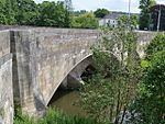 More images |
| Bridge House | Cromford | House | Early 17th century | 22 June 1950 | SK3005557271 53°06′42″N 1°33′09″W / 53.111783°N 1.55246°W / 53.111783; -1.55246 (Bridge House) | 1247939 |  More images |
| Cromford Bridge (over River Derwent) | Cromford | Road bridge | 15th century | 22 June 1950 | SK3001457180 53°06′39″N 1°33′11″W / 53.110968°N 1.553081°W / 53.110968; -1.553081 (Cromford Bridge (over River Derwent)) | 1263846 |  More images |
| Greyhound Hotel | Cromford | Inn | Mid-18th century | 22 June 1950 | SK2950856922 53°06′31″N 1°33′38″W / 53.108677°N 1.560664°W / 53.108677; -1.560664 (Greyhound Hotel) | 1248007 |  More images |
| High Peak Pump House (Leawood Pump House) | High Peak Junction, Cromford | Pumphouse | Early 19th century | 26 October 1972 | SK3152855682 53°05′51″N 1°31′50″W / 53.097416°N 1.530611°W / 53.097416; -1.530611 (High Peak Pump House (Leawood Pump House)) | 1247889 | 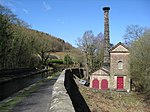 More images |
| The Arkwright Houses | Cromford | House | 1776 77 | 21 January 1964 | SK2944656735 53°06′25″N 1°33′42″W / 53.106999°N 1.561607°W / 53.106999; -1.561607 (The Arkwright Houses) | 1248131 |  |
| The Arkwright Houses and unnumbered house to left of Number 1 | Cromford | House | 1776 77 | 21 January 1964 | SK2946656749 53°06′26″N 1°33′41″W / 53.107124°N 1.561307°W / 53.107124; -1.561307 (The Arkwright Houses and unnumbered house to left of Number 1) | 1263811 |  |
| Willersley Castle | Cromford | Country house | 1792 | 22 June 1950 | SK2964857226 53°06′41″N 1°33′31″W / 53.111402°N 1.558545°W / 53.111402; -1.558545 (Willersley Castle) | 1248280 | 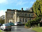 More images |
| Darley Bridge (over River Derwent) | Darley Bridge, Darley Dale | Road bridge | 15th century | 22 June 1950 | SK2705262076 53°09′18″N 1°35′49″W / 53.155134°N 1.596917°W / 53.155134; -1.596917 (Darley Bridge (over River Derwent)) | 1248041 | 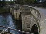 More images |
| Holt House | Darley Dale | House | Late 18th century | 22 June 1950 | SK2839662758 53°09′40″N 1°34′36″W / 53.161195°N 1.576759°W / 53.161195; -1.576759 (Holt House) | 1263879 | Upload Photo |
| Parish Church of St Helen | Darley Dale | Church | Norman to Perpendicular | 22 June 1950 | SK2667662984 53°09′48″N 1°36′09″W / 53.163315°N 1.602465°W / 53.163315; -1.602465 (Parish Church of St Helen) | 1247836 |  More images |
| Home Farmhouse | West Broughton, Doveridge | Farmhouse | 16th century | 13 September 1967 | SK1466532634 52°53′27″N 1°47′01″W / 52.890961°N 1.783479°W / 52.890961; -1.783479 (Home Farmhouse) | 1274524 | Upload Photo |
| Lowerstreet Farmhouse | Doveridge | Farmhouse | Early 16th century | 13 September 1967 | SK1183233735 52°54′03″N 1°49′32″W / 52.900927°N 1.825546°W / 52.900927; -1.825546 (Lowerstreet Farmhouse) | 1237735 |  More images |
| Manor House | Doveridge | House | Early 18th century | 13 September 1967 | SK1221833872 52°54′08″N 1°49′11″W / 52.90215°N 1.819802°W / 52.90215; -1.819802 (Manor House) | 1238121 |  |
| Castle Lodge and attached railings | Edensor | Gate lodge | 1842 | 12 July 1967 | SK2510870004 53°13′35″N 1°37′31″W / 53.226491°N 1.625367°W / 53.226491; -1.625367 (Castle Lodge and attached railings) | 1088160 | 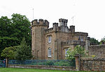 More images |
| Chatsworth Estate Office and Village Institute | Edensor | Hotel | c.1776–77 | 12 July 1967 | SK2501370208 53°13′42″N 1°37′36″W / 53.228329°N 1.626774°W / 53.228329; -1.626774 (Chatsworth Estate Office and Village Institute) | 1054089 |  More images |
| House west of Park View occupied by Mr Hubbuck | Edensor | House | c.1830–40 | 12 July 1967 | SK2514269943 53°13′33″N 1°37′30″W / 53.225941°N 1.624863°W / 53.225941; -1.624863 (House west of Park View occupied by Mr Hubbuck) | 1088157 |  More images |
| Norman Villa and attached garden walls | Edensor | House | c.1830–40 | 12 July 1967 | SK2498869908 53°13′32″N 1°37′38″W / 53.225634°N 1.627172°W / 53.225634; -1.627172 (Norman Villa and attached garden walls) | 1334748 |  More images |
| One Arch Bridge | Edensor | Road bridge | 1759–60 | 12 July 1967 | SK2607168441 53°12′45″N 1°36′40″W / 53.212396°N 1.61107°W / 53.212396; -1.61107 (One Arch Bridge) | 1052356 | 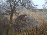 More images |
| Tudor Lodge | Edensor | House | 1837–39 | 12 July 1967 | SK2501970102 53°13′39″N 1°37′36″W / 53.227376°N 1.626693°W / 53.227376; -1.626693 (Tudor Lodge) | 1334736 |  More images |
| Church of St James | Edlaston | Church | Early 14th century | 13 September 1967 | SK1811842674 52°58′52″N 1°43′54″W / 52.981107°N 1.7316°W / 52.981107; -1.7316 (Church of St James) | 1158423 |  More images |
| Church of St Lawrence | Eyam | Church | 1775 | 12 July 1967 | SK2177476417 53°17′03″N 1°40′30″W / 53.284282°N 1.67487°W / 53.284282; -1.67487 (Church of St Lawrence) | 1110019 | 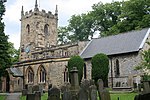 More images |
| Eyam Hall | Eyam | Country house | Early 17th century | 29 September 1951 | SK2164076493 53°17′06″N 1°40′37″W / 53.28497°N 1.676874°W / 53.28497; -1.676874 (Eyam Hall) | 1334913 |  More images |
| Cherry Orchard Farmhouse and attached outbuildings | Fenny Bentley | Farmhouse | Late 17th century | 5 February 1952 | SK1760050181 53°02′55″N 1°44′20″W / 53.048605°N 1.738909°W / 53.048605; -1.738909 (Cherry Orchard Farmhouse and attached outbuildings) | 1109314 |  More images |
| Church of St Edmund | Fenny Bentley | Church | c.1300 | 13 September 1967 | SK1745750189 53°02′55″N 1°44′28″W / 53.048682°N 1.741042°W / 53.048682; -1.741042 (Church of St Edmund) | 1335262 |  More images |
| Flagg Hall | Flagg | Farmhouse | 17th century | 27 July 1984 | SK1376968484 53°12′48″N 1°47′43″W / 53.213241°N 1.795277°W / 53.213241; -1.795277 (Flagg Hall) | 1109266 | Upload Photo |
| Old Farmhouse, Town Head Farm | Flagg | Farmhouse | 1639 | 27 July 1984 | SK1288969017 53°13′05″N 1°48′30″W / 53.218054°N 1.808433°W / 53.218054; -1.808433 (Old Farmhouse, Town Head Farm) | 1109265 | 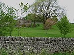 More images |
| The Hall | Great Longstone | Country house | 17th century | 29 September 1951 | SK1985571954 53°14′39″N 1°42′14″W / 53.24424°N 1.703929°W / 53.24424; -1.703929 (The Hall) | 1109904 | Upload Photo |
| Stoke Hall | Grindleford | Country house | 1757 | 8 August 1985 | SK2402776138 53°16′54″N 1°38′28″W / 53.281677°N 1.641098°W / 53.281677; -1.641098 (Stoke Hall) | 1158686 |  More images |
| Biggin Hall | Biggin | House | c.1642 | 10 August 1951 | SK1517259570 53°07′59″N 1°46′29″W / 53.133077°N 1.774687°W / 53.133077; -1.774687 (Biggin Hall) | 1087837 | Upload Photo |
| Church of St Giles | Hartington | Church | Late 13th century | 10 August 1951 | SK1296160478 53°08′29″N 1°48′28″W / 53.141296°N 1.807697°W / 53.141296; -1.807697 (Church of St Giles) | 1087851 |  More images |
| Hassop Hall | Hassop | Country house | 17th century | 29 September 1951 | SK2219572216 53°14′47″N 1°40′08″W / 53.246503°N 1.668847°W / 53.246503; -1.668847 (Hassop Hall) | 1088171 |  More images |
| Hathersage Hall | Hathersage | Country house | 1496 | 29 September 1951 | SK2334981670 53°19′53″N 1°39′03″W / 53.331432°N 1.650862°W / 53.331432; -1.650862 (Hathersage Hall) | 1109807 | Upload Photo |
| Roman Catholic Church of St Michael | Hathersage | Church | Early 18th century | 12 July 1967 | SK2295281602 53°19′51″N 1°39′25″W / 53.330838°N 1.656828°W / 53.330838; -1.656828 (Roman Catholic Church of St Michael) | 1109804 |  More images |
| Hazlebadge Hall | Hazlebadge | House | 1549 | 29 September 1951 | SK1716879998 53°19′00″N 1°44′38″W / 53.316638°N 1.743762°W / 53.316638; -1.743762 (Hazlebadge Hall) | 1356169 | 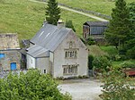 More images |
| Gateway to Highlow Hall | Highlow | Gate | Early 17th century | 12 July 1967 | SK2189180111 53°19′03″N 1°40′22″W / 53.317481°N 1.672861°W / 53.317481; -1.672861 (Gateway to Highlow Hall) | 1334994 | 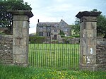 |
| Highlow Hall | Highlow | Manor house | Late 16th century | 29 September 1951 | SK2191280096 53°19′02″N 1°40′21″W / 53.317345°N 1.672547°W / 53.317345; -1.672547 (Highlow Hall) | 1311217 | More images |
| Church of St Bartholomew | Hognaston | Church | 12th century | 13 September 1967 | SK2352250585 53°03′07″N 1°39′02″W / 53.05201°N 1.650542°W / 53.05201; -1.650542 (Church of St Bartholomew) | 1138313 |  More images |
| Bentley Hall | Hungry Bentley | House | Early 17th century | 13 June 1967 | SK1776038102 52°56′24″N 1°44′14″W / 52.940021°N 1.737181°W / 52.940021; -1.737181 (Bentley Hall) | 1335022 | Upload Photo |
| The Barley Mow Inn | Kirk Ireton | Inn | c.1600 | 20 October 1983 | SK2662950136 53°02′52″N 1°36′15″W / 53.047829°N 1.604228°W / 53.047829; -1.604228 (The Barley Mow Inn) | 1335227 | 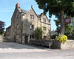 More images |
| Horsley Farmhouse | Kniveton | Farmhouse | Mid-18th century | 13 September 1967 | SK1990551572 53°03′40″N 1°42′16″W / 53.061029°N 1.70444°W / 53.061029; -1.70444 (Horsley Farmhouse) | 1146373 | Upload Photo |
| The Manor House | Little Hucklow | House | 1661 | 12 July 1967 | SK1642978565 53°18′14″N 1°45′18″W / 53.303781°N 1.754929°W / 53.303781; -1.754929 (The Manor House) | 1334904 | 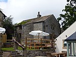 |
| Cressbrook Mill | Litton | Cotton mill | 1779 | 12 July 1967 | SK1729972709 53°15′04″N 1°44′32″W / 53.251116°N 1.74219°W / 53.251116; -1.74219 (Cressbrook Mill) | 1158897 |  More images |
| Barn at Longford Hall Farm | Longford | Barn | 1760 | 13 June 1967 | SK2149838432 52°56′34″N 1°40′54″W / 52.942852°N 1.68154°W / 52.942852; -1.68154 (Barn at Longford Hall Farm) | 1109788 | Upload Photo |
| Gates and gatepiers to east of Longford Hall | Longford | Gates | Early 18th century | 19 July 1985 | SK2159438250 52°56′28″N 1°40′48″W / 52.941212°N 1.680123°W / 52.941212; -1.680123 (Gates and gatepiers to east of Longford Hall) | 1204005 |  |
| Longford Hall and attached garden wall | Longford | Country house | Late 16th century | 13 June 1967 | SK2150538249 52°56′28″N 1°40′53″W / 52.941206°N 1.681448°W / 52.941206; -1.681448 (Longford Hall and attached garden wall) | 1109787 | 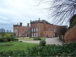 More images |
| Stable block and coach house at Longford Hall Farm | Longford | Stable | Early 19th century | 13 June 1967 | SK2147438372 52°56′32″N 1°40′55″W / 52.942313°N 1.681901°W / 52.942313; -1.681901 (Stable block and coach house at Longford Hall Farm) | 1281396 |  |
| Church of St Mary | Mapleton | Church | Mid-18th century | 13 September 1967 | SK1659348039 53°01′46″N 1°45′15″W / 53.029383°N 1.75404°W / 53.029383; -1.75404 (Church of St Mary) | 1335265 |  More images |
| Manor House | Mapleton | House | Early 18th century | 13 September 1967 | SK1633047428 53°01′26″N 1°45′29″W / 53.023899°N 1.757992°W / 53.023899; -1.757992 (Manor House) | 1109317 |  More images |
| Okeover Almshouses | Mapleton | Almshouses | 1727–30 | 13 September 1967 | SK1649048097 53°01′48″N 1°45′20″W / 53.029907°N 1.755573°W / 53.029907; -1.755573 (Okeover Almshouses) | 1203564 |  |
| Church of St Giles | Marston Montgomery | Church | 12th century | 13 September 1967 | SK1349437888 52°56′18″N 1°48′02″W / 52.938221°N 1.800667°W / 52.938221; -1.800667 (Church of St Giles) | 1204368 |  More images |
| The Manor House | Marston Montgomery | House | Late 17th century | 5 February 1952 | SK1339537840 52°56′16″N 1°48′08″W / 52.937792°N 1.802142°W / 52.937792; -1.802142 (The Manor House) | 1109755 |  More images |
| Dale Cottage | Matlock Bath | House | 1820 | 22 June 1950 | SK2955659464 53°07′53″N 1°33′35″W / 53.131523°N 1.559714°W / 53.131523; -1.559714 (Dale Cottage) | 1247891 |  More images |
| Masson Mills | Cromford | Cotton mill | c.1783 | 13 July 1955 | SK2942657348 53°06′45″N 1°33′43″W / 53.11251°N 1.56185°W / 53.11251; -1.56185 (Masson Mills) | 1247935 |  More images |
| Chapel of St John the Baptist, supporting retaining wall and attached boundary walls | Matlock Bath | Chapel | 1897 | 26 October 1972 | SK2942659416 53°07′52″N 1°33′42″W / 53.131099°N 1.561661°W / 53.131099; -1.561661 (Chapel of St John the Baptist, supporting retaining wall and attached boundary walls) | 1248139 |  More images |
| Church of St Giles | Matlock | Church | 15th century | 22 June 1950 | SK3008359769 53°08′03″N 1°33′07″W / 53.134236°N 1.551809°W / 53.134236; -1.551809 (Church of St Giles) | 1247838 | 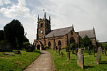 More images |
| Riber Manor | Riber | House | 1633 | 22 June 1950 | SK3095959094 53°07′41″N 1°32′20″W / 53.128118°N 1.538781°W / 53.128118; -1.538781 (Riber Manor) | 1278030 |  More images |
| Matlock Bridge (over River Derwent) | Matlock | Bridge | 15th century | 22 June 1950 | SK2978460174 53°08′16″N 1°33′22″W / 53.137893°N 1.55624°W / 53.137893; -1.55624 (Matlock Bridge (over River Derwent)) | 1247890 |  More images |
| Riber Hall | Riber | House | Early 17th century | 22 June 1950 | SK3087258977 53°07′37″N 1°32′24″W / 53.127072°N 1.540092°W / 53.127072; -1.540092 (Riber Hall) | 1278020 |  More images |
| St Andrew's House | The Cliff, Matlock | House | Mid-18th century | 5 September 1972 | SK3082759916 53°08′08″N 1°32′26″W / 53.135515°N 1.540675°W / 53.135515; -1.540675 (St Andrew's House) | 1247886 | Upload Photo |
| Wheatsheaf Farmhouse | Matlock | Farmhouse | 1681 | 22 June 1950 | SK3002359709 53°08′01″N 1°33′10″W / 53.1337°N 1.552711°W / 53.1337; -1.552711 (Wheatsheaf Farmhouse) | 1247840 |  More images |
| Church of St Leonard | Monyash | Church | Early 13th century | 12 July 1967 | SK1514466473 53°11′42″N 1°46′29″W / 53.195127°N 1.774782°W / 53.195127; -1.774782 (Church of St Leonard) | 1087822 |  More images |
| Garden terraces and steps to south east of Haddon Hall | Haddon Hall | Steps | Mid-18th century | 12 July 1967 | SK2354966366 53°11′38″N 1°38′56″W / 53.193862°N 1.648986°W / 53.193862; -1.648986 (Garden terraces and steps to south east of Haddon Hall) | 1158083 | 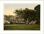 |
| Offerton Hall | Offerton | Manor house | 16th century | 29 September 1951 | SK2139681051 53°19′33″N 1°40′49″W / 53.32595°N 1.680228°W / 53.32595; -1.680228 (Offerton Hall) | 1109771 |  More images |
| Church of St Martin | Osmaston | Church | 1845 | 13 September 1967 | SK1994744011 52°59′35″N 1°42′15″W / 52.993061°N 1.704278°W / 52.993061; -1.704278 (Church of St Martin) | 1335071 |  More images |
| North Lees Hall | Hathersage | House | Late 16th century | 29 September 1951 | SK2353983451 53°20′51″N 1°38′52″W / 53.347432°N 1.647877°W / 53.347432; -1.647877 (North Lees Hall) | 1109774 |  More images |
| Church of St Peter | Parwich | Church | 12th century | 14 June 1984 | SK1883454351 53°05′10″N 1°43′13″W / 53.086047°N 1.720259°W / 53.086047; -1.720259 (Church of St Peter) | 1109332 |  More images |
| Parwich Hall | Parwich | House | Before c.1747 | 5 February 1952 | SK1863854606 53°05′18″N 1°43′23″W / 53.088346°N 1.72317°W / 53.088346; -1.72317 (Parwich Hall) | 1281585 | 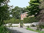 More images |
| Caudwell's Mill | Rowsley | Feed mill | 1874 | 2 December 1977 | SK2557365743 53°11′17″N 1°37′07″W / 53.188169°N 1.618742°W / 53.188169; -1.618742 (Caudwell's Mill) | 1088147 |  More images |
| Rowsley Bridge (over River Derwent) | Little Rowsley, Rowsley | Bridge | 15th century | 22 June 1950 | SK2567365898 53°11′22″N 1°37′02″W / 53.189557°N 1.617233°W / 53.189557; -1.617233 (Rowsley Bridge (over River Derwent)) | 1263843 | 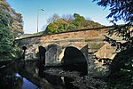 More images |
| The Peacock Hotel | Rowsley | Hotel | 1652 | 29 September 1951 | SK2560065867 53°11′21″N 1°37′06″W / 53.189282°N 1.618328°W / 53.189282; -1.618328 (The Peacock Hotel) | 1045804 |  More images |
| Church of St Michael | Shirley | Church | 14th century | 13 September 1967 | SK2188741656 52°58′19″N 1°40′32″W / 52.971817°N 1.675535°W / 52.971817; -1.675535 (Church of St Michael) | 1109692 |  More images |
| Saw Mill (Osmaston Mill) | Shirley | Sawmill | c.1845 | 12 July 1985 | SK2074242826 52°58′57″N 1°41′33″W / 52.982379°N 1.69251°W / 52.982379; -1.69251 (Saw Mill (Osmaston Mill)) | 1109698 | 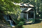 More images |
| Church of St Peter | Snelston | Church | 15th century | 13 September 1967 | SK1554043332 52°59′14″N 1°46′12″W / 52.987103°N 1.769965°W / 52.987103; -1.769965 (Church of St Peter) | 1109768 | 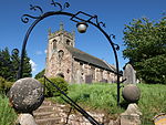 More images |
| Montgomery House | Somersal Herbert | House | Early 17th century | 13 September 1967 | SK1392135177 52°54′50″N 1°47′40″W / 52.91384°N 1.794429°W / 52.91384; -1.794429 (Montgomery House) | 1238456 | Upload Photo |
| Holly House | Stanton in Peak | House | Late 17th century | 12 July 1967 | SK2404964331 53°10′32″N 1°38′30″W / 53.175547°N 1.641655°W / 53.175547; -1.641655 (Holly House) | 1334986 |  |
| Stanton Hall | Stanton in Peak | House | Early 18th century | 12 July 1967 | SK2409464164 53°10′27″N 1°38′28″W / 53.174044°N 1.640994°W / 53.174044; -1.640994 (Stanton Hall) | 1158182 |  More images |
| The Manor House, Stanton Woodhouse | Stanton in Peak | Country house | 16th century | 12 July 1967 | SK2561864285 53°10′30″N 1°37′05″W / 53.175061°N 1.618185°W / 53.175061; -1.618185 (The Manor House, Stanton Woodhouse) | 1311580 | Upload Photo |
| Church of St Martin | Stoney Middleton | Church | 15th century | 12 July 1967 | SK2316875479 53°16′33″N 1°39′15″W / 53.275792°N 1.654029°W / 53.275792; -1.654029 (Church of St Martin) | 1109973 |  More images |
| Church of All Saints | Sudbury | Church | 12th century | 13 September 1967 | SK1576832174 52°53′12″N 1°46′02″W / 52.886795°N 1.767107°W / 52.886795; -1.767107 (Church of All Saints) | 1273942 |  More images |
| Folly or deercote in Park | Sudbury | Hunting lodge | Mid-18th century | 13 September 1967 | SK1622532729 52°53′30″N 1°45′37″W / 52.89177°N 1.760288°W / 52.89177; -1.760288 (Folly or deercote in Park) | 1238617 | 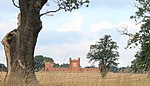 More images |
| South Viaduct | Millers Dale, Taddington | Railway viaduct | 1862–63 | 4 October 1985 | SK1395673215 53°15′21″N 1°47′32″W / 53.255762°N 1.792271°W / 53.255762; -1.792271 (South Viaduct) | 1087894 |  More images |
| Knoll House | Tansley | House | 1788 | 5 September 1969 | SK3217260139 53°08′15″N 1°31′14″W / 53.13744°N 1.520549°W / 53.13744; -1.520549 (Knoll House) | 1247942 | Upload Photo |
| Church of St Mary | Tissington | Church | 12th century | 13 September 1967 | SK1764852276 53°04′03″N 1°44′17″W / 53.067436°N 1.738079°W / 53.067436; -1.738079 (Church of St Mary) | 1109271 |  More images |
| Tissington Hall | Tissington | House | Early 17th century | 5 February 1952 | SK1746352347 53°04′05″N 1°44′27″W / 53.06808°N 1.740836°W / 53.06808; -1.740836 (Tissington Hall) | 1335283 |  More images |
| Wheston Cross | Wheston | Cross | 15th century | 12 July 1967 | SK1319476438 53°17′05″N 1°48′13″W / 53.284752°N 1.80356°W / 53.284752; -1.80356 (Wheston Cross) | 1215269 |  More images |
| The Market Hall | Winster | Market hall | 16th century | 29 September 1951 | SK2414860550 53°08′30″N 1°38′26″W / 53.141556°N 1.640458°W / 53.141556; -1.640458 (The Market Hall) | 1245115 |  More images |
| Winster Hall | Winster | Country house | Early 18th century | 29 September 1951 | SK2412060586 53°08′31″N 1°38′27″W / 53.141881°N 1.640873°W / 53.141881; -1.640873 (Winster Hall) | 1109367 | 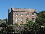 More images |
| Babington House | Wirksworth | House | c.1630 | 24 October 1950 | SK2860254132 53°05′01″N 1°34′28″W / 53.083647°N 1.574445°W / 53.083647; -1.574445 (Babington House) | 1335118 | Upload Photo |
| Grammar School | Wirksworth | School | 1828 | 24 October 1950 | SK2878553969 53°04′56″N 1°34′18″W / 53.082172°N 1.571727°W / 53.082172; -1.571727 (Grammar School) | 1109616 |  More images |
| Haarlem Mill | Wirksworth | Mill | 18th century | 23 January 1973 | SK2837252573 53°04′11″N 1°34′41″W / 53.069646°N 1.578015°W / 53.069646; -1.578015 (Haarlem Mill) | 1335116 | 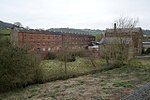 More images |
| Old Manor House | Wirksworth | House | Early 17th century | 23 January 1973 | SK2885454021 53°04′57″N 1°34′14″W / 53.082636°N 1.570692°W / 53.082636; -1.570692 (Old Manor House) | 1335096 | Upload Photo |
| Red Lion Hotel | Wirksworth | Hotel | Mid-18th century | 24 October 1950 | SK2867354046 53°04′58″N 1°34′24″W / 53.08287°N 1.573392°W / 53.08287; -1.573392 (Red Lion Hotel) | 1112540 |  More images |
| The Gate House | Wirksworth | House | Early 17th century | 24 October 1950 | SK2854653866 53°04′53″N 1°34′31″W / 53.081259°N 1.575304°W / 53.081259; -1.575304 (The Gate House) | 1109609 | Upload Photo |
| Wigwell Grange | Wirksworth | House | Regency | 24 October 1950 | SK3063454385 53°05′09″N 1°32′39″W / 53.085809°N 1.544085°W / 53.085809; -1.544085 (Wigwell Grange) | 1109565 |  More images |
| 1 Coldwell Street | Wirksworth | House | Late 18th century | 24 October 1950 | SK2869054041 53°04′58″N 1°34′23″W / 53.082824°N 1.573139°W / 53.082824; -1.573139 (1 Coldwell Street) | 1335095 | |
| 15 Market Place | Wirksworth | House | Mid-18th century | 24 October 1950 | SK2864754041 53°04′58″N 1°34′26″W / 53.082827°N 1.573781°W / 53.082827; -1.573781 (15 Market Place) | 1109590 | 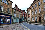 More images |
| Stydd Hall and attached garden wall | Yeaveley | Farmhouse | c.1840 | 5 February 1952 | SK1720040019 52°57′26″N 1°44′43″W / 52.957271°N 1.745413°W / 52.957271; -1.745413 (Stydd Hall and attached garden wall) | 1204898 | 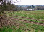 |
| Old Hall Farmhouse | Youlgreave | Farmhouse | 1630 | 12 July 1967 | SK2096164303 53°10′32″N 1°41′16″W / 53.175426°N 1.687856°W / 53.175426; -1.687856 (Old Hall Farmhouse) | 1335002 | 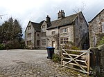 More images |
| Matlock Bath War Memorial | Matlock Bath | War memorial | 1921 | 12 February 2018 | SK2960758373 53°07′18″N 1°33′33″W / 53.121714°N 1.5590517°W / 53.121714; -1.5590517 (Matlock Bath War Memorial) | 1451237 | 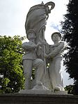 More images |
See also
- Grade I listed buildings in Derbyshire
- Grade II* listed buildings in Derbyshire
- Grade II* listed buildings in Amber Valley
- Grade II* listed buildings in Bolsover (district)
- Grade II* listed buildings in Chesterfield
- Grade II* listed buildings in Derby
- Grade II* listed buildings in Erewash
- Grade II* listed buildings in High Peak
- Grade II* listed buildings in North East Derbyshire
- Grade II* listed buildings in South Derbyshire
Notes
- ^ The date given is the date used by Historic England as significant for the initial building or that of an important part in the structure's description.
- ^ Sometimes known as OSGB36, the grid reference is based on the British national grid reference system used by the Ordnance Survey.
- ^ The "List Entry Number" is a unique number assigned to each listed building and scheduled monument by Historic England.
External links
- v
- t
- e
- Bedfordshire
- Berkshire
- Bristol
- Buckinghamshire
- Cambridgeshire
- Cheshire
- Cornwall
- Cumbria
- Derbyshire
- Devon
- Dorset
- Durham
- East Sussex
- East Riding of Yorkshire
- Essex
- Gloucestershire
- Greater London
- Greater Manchester
- Hampshire
- Herefordshire
- Hertfordshire
- Isle of Wight
- Kent
- Lancashire
- Leicestershire
- Lincolnshire
- Merseyside
- Norfolk
- North Yorkshire
- Northamptonshire
- Northumberland
- Nottinghamshire
- Oxfordshire
- Rutland
- Shropshire
- Somerset
- South Yorkshire
- Staffordshire
- Suffolk
- Surrey
- Tyne and Wear
- Warwickshire
- West Midlands
- West Sussex
- West Yorkshire
- Wiltshire
- Worcestershire
- Allerdale
- Amber Valley
- Ashford
- Babergh
- Barrow-in-Furness
- Basildon
- Basingstoke and Deane
- Bath and North East Somerset
- Bolsover
- Boston
- Bournemouth
- Bradford
- Braintree
- Breckland
- Brentwood
- Brighton and Hove
- Bristol
- Broadland
- Calderdale
- Cambridge
- Camden
- Canterbury
- Carlisle
- Castle Point
- Chelmsford
- Cheltenham
- Cherwell
- Cheshire East
- Cheshire West and Chester
- Chesterfield
- Chiltern
- Christchurch
- Colchester
- Copeland
- Corby
- Cotswold
- Dartford
- Daventry
- Dover
- East Cambridgeshire
- Exeter
- Mendip
- North Somerset
- North Yorkshire (district)
- Poole
- Sedgemoor
- South Somerset
- Stoke-on-Trent
- Taunton Deane
- West Somerset
- York


