Greenville, Oklahoma
Census-designated place in Oklahoma, United States
34°00′18″N 97°07′50″W / 34.00500°N 97.13056°W / 34.00500; -97.13056[1]
[2]
(2020)
73448 (Marietta)
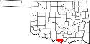
Greenville is an unincorporated community and census-designated place (CDP) in Love County, Oklahoma, United States. It was first listed as a CDP following the 2010 census.[2]
The CDP is in northeastern Love County, along U.S. Route 77, 5 miles (8 km) north of Marietta, the county seat, and 12 miles (19 km) south of Ardmore. Interstate 35 passes just west of Greenville, with access from Exit 21 (Oswalt Road) 2 miles (3 km) to the north.
Demographics
| Census | Pop. | Note | %± |
|---|---|---|---|
| 2020 | 167 | — | |
| U.S. Decennial Census[3] | |||
References
- v
- t
- e
Municipalities and communities of Love County, Oklahoma, United States
County seat: Marietta
- Burneyville
- Greenville
communities
‡This populated place also has portions in an adjacent county or counties
- Oklahoma portal
- United States portal
 | This Oklahoma state location article is a stub. You can help Wikipedia by expanding it. |
- v
- t
- e


