Huaquechula (municipality)
Municipality in Puebla, Mexico

Seal

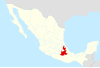
Location of the municipality in Puebla
 Mexico
Huaquechula Municipality is a municipality in Puebla in south-eastern Mexico.[1]
The municipality
The town of Huaquechula is the local governmental authority for thirty communities, which together cover an area of 223.25 km2. The municipal government consists of a municipal president, one syndic, and eight representatives for the various communities. This municipality of the same name borders the municipalities of Atzitzihuacán, Atlixco, Tlapanala, Tepeojuma and Tepemaxalco. (encmuc) The largest of the communities outside of the seat are Santa Ana Coatepec, El Tronconal, Teocalco de Dorantes, Tezonteopan de Bonilla, San Juan Huiluco, Cacaloxuchil, Soledad Morelos, San Antonio Cuautla, Santiago Tetla and San Diego Organal.[2]
The municipality is located mostly in the Atlixco Valley, with a small portion in the Matamoros Valley, wedged between the Sierra Mixteca and the Popocatépetl volcano.[2][3] It has altitudes ranging from 1700 meters above sea level to 1500 from north to south. The highest elevation inside the municipality is the Cerro el Metate.[2]
Its rivers run north to south descending from Popocatepetl, including the Río Grande, the Ahuehuello, the Matadero, the Atila and the Nexapa. There is also a system of canals connected to these natural waterways especially in the northeast.[2]
The municipality has three main climate zones. The first is semi hot and semi humid with rains in the summer. This extends over most of the territory, except the northeast and the southwest. The southeast has a hot and semi moist climate with rains in the summer. The rainy season extends from June to November with a short dry spell in the middle. Freezing temperatures can occur from ten to thirty days per year.[2]
Wild vegetation in the municipality varies from low deciduous rainforest, areas of secondary vegetation, dry scrub, grassland and areas dominated by palm trees. Dominant wildlife includes the squirrel, skunk and deer.[2]
References
- ^ "-". Enciclopedia de los Municipios de México. Instituto Nacional para el Federalismo y el Desarrollo Municipal. Archived from the original on April 5, 2007. Retrieved January 4, 2010.
- ^ a b c d e f "Huaquechula". Enciclopedia de Los Municipios y Delegaciones de México Estado de Puebla (in Spanish). INAFED. Archived from the original on May 6, 2018. Retrieved November 19, 2013.
- ^ Francisco Marín de Hoyos. "Los espectaculares altares de Día de Muertos en Huaquechula, Puebla" (in Spanish). Mexico City: Mexico Desconocido magazine. Retrieved November 19, 2013.
- v
- t
- e
 State of Puebla
Puebla (capital)
towns
- Acajete
- Acateno
- Acatzingo
- Acteopan
- Ahuacatlán
- Ahuatlán
- Ahuazotepec
- Ahuehuetitla
- Ajalpan
- Albino Zertuche
- Aljojuca
- Altepexi
- Amixtlán
- Amozoc
- Aquixtla
- Atempan
- Atexcal
- Atlequizayan
- Atlixco
- Atoyatempan
- Atzala
- Atzitzihuacán
- Atzitzintla
- Axutla
- Ayotoxco de Guerrero
- Calpan
- Caltepec
- Camocuautla
- Cañada Morelos
- Caxhuacan
- Coatepec
- Coatzingo
- Cohetzala
- Cohuecán
- Coronango
- Coxcatlán
- Coyomeapan
- Coyotepec
- Cuapiaxtla de Madero
- Cuautempan
- Cuautinchán
- Cuautlancingo
- Cuayuca de Andrade
- Cuetzalan del Progreso
- Cuyoaco
- Chalchicomula de Sesma
- Chapulco
- Chiautla de Tapia
- Chiautzingo
- Chiconcuautla
- Chichiquila
- Chietla
- Chigmecatitlán
- Chignahuapan
- Chignautla
- Chila
- Chila de la Sal
- Chilchotla
- Chinantla
- Domingo Arenas
- Eloxochitlán
- Epatlán
- Esperanza
- Francisco Z. Mena
- General Felipe Angeles
- Guadalupe
- Guadalupe Victoria
- Hermenegildo Galeana
- Honey
- Huaquechula
- Huatlatlauca
- Huauchinango
- Huehuetla
- Huehuetlán el Chico
- Huehuetlán el Grande
- Huejotzingo
- Hueyapan
- Hueytamalco
- Hueytlalpan
- Huitzilan de Serdán
- Huitziltepec
- Ixcamilpa de Guerrero
- Ixcaquixtla
- Ixtacamaxtitlán
- Ixtepec
- Izúcar de Matamoros
- Jalpan
- Jolalpan
- Jonotla
- Jopala
- Juan C. Bonilla
- Juan Galindo
- Juan N. Méndez
- Lafragua
- Libres
- Magdalena Tlatlauquitepec, La
- Mazapiltepec de Juárez
- Mixtla
- Molcaxac
- Naupan
- Nauzontla
- Nealtican
- Nicolás Bravo
- Nopalucan
- Ocotepec
- Ocoyucan
- Olintla
- Oriental
- Pahuatlán
- Palmar de Bravo
- Pantepec
- Petlalcingo
- Piaxtla
- Puebla
- Quecholac
- Quimixtlán
- Rafael Lara Grajales
- Reyes de Juárez, Los
- San Andrés Cholula
- San Antonio Cañada
- San Diego la Meza Tochimiltzingo
- San Felipe Teotlalcingo
- San Felipe Tepatlán
- San Gabriel Chilac
- San Gregorio Atzompa
- San Jerónimo Tecuanipan
- San Jerónimo Xayacatlán
- San José Chiapa
- San José Miahuatlán
- San Juan Atenco
- San Juan Atzompa
- San Juan Raboso
- San Martín Texmelucan
- San Martín Totoltepec
- San Matías Tlalancaleca
- San Miguel Ixitlán
- San Miguel Xoxtla
- San Nicolás Buenos Aires
- San Nicolás de Los Ranchos
- San Pablo Anicano
- San Pedro Cholula
- San Pedro Yeloixtlahuaca
- San Salvador el Seco
- San Salvador el Verde
- San Salvador Huixcolotla
- San Sebastián Tlacotepec
- Santa Catarina Tlaltempan
- Santa Inés Ahuatempan
- Santa Isabel Cholula
- Santiago Miahuatlán
- Santo Tomás Hueyotlipan
- Soltepec
- Tecali de Herrera
- Tecamachalco
- Tecomatlán
- Tehuacán
- Tehuitzingo
- Tenampulco
- Teopantlán
- Teotlalco
- Tepanco de López
- Tepango de Rodríguez
- Tepatlaxco de Hidalgo
- Tepeaca
- Tepemaxalco
- Tepeojuma
- Tepetzintla
- Tepexco
- Tepexi de Rodríguez
- Tepeyahualco
- Tepeyahualco de Cuauhtémoc
- Tetela de Ocampo
- Teteles de Ávila Castillo
- Teziutlán
- Tianguismanalco
- Tilapa
- Tlacotepec de Benito Juárez
- Tlacuilotepec
- Tlachichuca
- Tlahuapan
- Tlaltenango
- Tlanepantla
- Tlaola
- Tlapacoya
- Tlapanalá
- Tlatlauquitepec
- Tlaxco
- Tochimilco
- Tochtepec
- Totoltepec de Guerrero
- Tulcingo
- Tuzamapan de Galeana
- Tzicatlacoyan
- Venustiano Carranza
- Vicente Guerrero
- Xayacatlán de Bravo
- Xicotepec
- Xicotlán
- Xiutetelco
- Xochiapulco
- Xochiltepec
- Xochitlán de Vicente Suárez
- Xochitlán Todos Santos
- Yaonáhuac
- Yehualtepec
- Zacapala
- Zacapoaxtla
- Zacatlán
- Zapotitlán
- Zapotitlán de Méndez
- Zaragoza
- Zautla
- Zihuateutla
- Zinacatepec
- Zongozotla
- Zoquiapan
- Zoquitlán
18°46′05″N 98°32′31″W / 18.7681°N 98.5419°W / 18.7681; -98.5419
Wikimedia Commons has media related to Huaquechula Municipality.
Authority control databases | |
|---|---|
| International |
|
| National |
|


