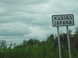
Japana, Georgia
Village in Lanchkhuti Municipality
You can help expand this article with text translated from the corresponding article in Georgian. (December 2021) Click [show] for important translation instructions.
- View a machine-translated version of the Georgian article.
- Machine translation, like DeepL or Google Translate, is a useful starting point for translations, but translators must revise errors as necessary and confirm that the translation is accurate, rather than simply copy-pasting machine-translated text into the English Wikipedia.
- Do not translate text that appears unreliable or low-quality. If possible, verify the text with references provided in the foreign-language article.
- You must provide copyright attribution in the edit summary accompanying your translation by providing an interlanguage link to the source of your translation. A model attribution edit summary is
Content in this edit is translated from the existing Georgian Wikipedia article at [[:ka:ჯაპანა]]; see its history for attribution. - You may also add the template
{{Translated|ka|ჯაპანა}}to the talk page. - For more guidance, see Wikipedia:Translation.
Village in Guria, Georgia
Japana ჯაპანა | |
|---|---|
Village | |
 Japana | |
42°05′47″N 42°12′04″E / 42.09639°N 42.20111°E / 42.09639; 42.20111 | |
| Country |  Georgia Georgia |
| Region | Guria |
| District | Lanchkhuti |
| Elevation | 50 m (160 ft) |
| Population (2014)[1] | |
| • Total | 306 |
| Time zone | UTC+4 (Georgian Time) |
Japana (Georgian: ჯაპანა, IPA: [dʒapʼana]) is a village in Lanchkhuti Municipality, which is in the Nigoti community. It is located in North Guria, 50 m above sea level and 7.45 miles (12 km) away from Lanchkhuti. In the village, there is a railway station on the Samtredia-Makhinjauri line and the road of international importance passes. Abasha, a path of domestic importance, also passes. Georgia Highway 12 passes through the village. There are three lakes in the village: Japana Lake, Didi Narional and Small Orange.
Architecture
Medieval fortress
The monument of Georgian architecture - the medieval fortress, is preserved in the village. The fortress is located on a rocky hill. Near the fortress is a large village with the remains of 3 churches, one of which is called "Little Booth".[2]
Citadel
The highest place is a citadel surrounded by a wall with towers. The walls are constructed with bricks and mortar.
Population
This list is incomplete; you can help by adding missing items. (December 2021) |
| Year | People | Percentage of increase or decrease |
|---|---|---|
| 1908 | 350 | |
| 1911 |  407 407 | +16.29% |
| 2002 |  361 361 | -11.3% |
| 2014 | 306 | -15.24% |
Fishing
During Soviet Times in 1934, a fish farm was arranged in the village with an area of 140 hectares (0.54 mi2). The floodwaters were taken from the Rioni and Kheviskali rivers. It produced 70 - 80 tons of fish.[3]
See also
References
- ^ "Population Census 2014". www.geostat.ge. National Statistics Office of Georgia. November 2014. Retrieved 28 June 2021.
- ^ "საქართველოს კულტურული მემკვიდრეობის პორტალი". Archived from the original on 2019-09-28. Retrieved 2019-09-28.
- ^ ღლონტი გ., ცერცვაძე გ., „გურიის რეგიონის აგრარული სექტორის ეკონომიკა“ გვ. 97 — თბილისი, 2014, ISBN 978-9941-10-913-3


