Kibulala, Hoima
Place in Western Region, Uganda
01°09′00″N 31°00′00″E / 1.15000°N 31.00000°E / 1.15000; 31.00000 Uganda
Kibulala, Hoima, commonly referred to as "Kibulala", is a hill in Hoima District in the Western Region of Uganda.[citation needed] The name also refers to the human settlement that sits on that hill.[citation needed]
Location
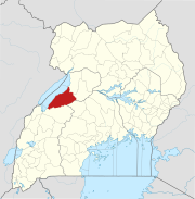
Kibulala, Hoima is approximately 62 kilometres (39 mi), by road, south-west of Hoima, the nearest large city and the location of the district headquarters, off the Hoima-Kyenjojo road.[1] This location is approximately 250 kilometres (160 mi), by road, west of Kampala, the capital and largest city of Uganda.[2] The approximate coordinates of Kibulala, Hoima are 1°09'00.0"N, 31°00'00.0"E (Latitude:1.1500; Longitude:31.0000).[3]
See also
- Kaiso, Uganda
- Tonya, Uganda
- Bunyoro
References
- ^ "Map Showing Hoima And Kibulala With Distance Marker". Globefeed.com. Retrieved 31 August 2014.
- ^ "Travel Distance Between Kampala And Kibulala, Hoima With Map". Globefeed.com. Retrieved 31 August 2014.
- ^ Google. "Location of Kibulala, Hoima At Google Maps". Google Maps. Retrieved 31 August 2014.
{{cite web}}:|last=has generic name (help)
01°09′00″N 31°00′00″E / 1.15000°N 31.00000°E / 1.15000; 31.00000
- v
- t
- e
 Hoima District
Capital: Hoima
- Lake Albert
- Buseruka Power Station
- Nkusi Power Station
- Nzizi Power Station
- Uganda Oil Refinery
- Albertine Graben Refinery Consortium
- Hoima–Kampala Petroleum Products Pipeline
- Uganda–Tanzania Crude Oil Pipeline
- Muzizi Hydroelectric Power Station
- Waki Hydroelectric Power Station
- Nkenda–Fort Portal–Hoima High Voltage Power Line
- Hoima–Kinyara–Kafu High Voltage Power Line
- Simon Mugenyi Byabakama
- Henry Kajura
- Vincent Kirabo
- Grace Mary Mugasa
- Beatrice Byenkya
- Tophace Kaahwa


