King's Road (Hong Kong)
Road in Eastern District, Hong Kong
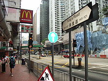 Fortress Hill section of King's Road | |
| Native name | 英皇道 (Yue Chinese) |
|---|---|
| Former name(s) | Shaukiwan Road |
| Namesake | King George V |
| Length | 4.2 kilometres (2.6 mi) |
| Location | Eastern District, Hong Kong |
| East end | Causeway Road / Hing Fat Road |
| West end | Shau Kei Wan Road / Tai Koo Shing Road |
 | |
| King's Road | |||||||||||
|---|---|---|---|---|---|---|---|---|---|---|---|
| Chinese | 英皇道 | ||||||||||
| |||||||||||


King's Road is a major east–west road along the north of Hong Kong Island, Hong Kong, stretching from Causeway Bay (Tin Hau), where it joins Causeway Road, to Sai Wan Ho, where it joins Shau Kei Wan Road.
History
Originally part of the Shaukiwan Road, it was renamed in 1935 in honour of the Silver Jubilee of King George V's reign.[1]
Features
From West to East.
In Tin Hau:
- No. 1: Park Towers
In North Point:
- No. 238-240: Fortress Towers and C&MA North Point Church
- No. 277-291: Former State Theatre
- No. 423: Sunbeam Theatre[2]
- Note that The boundary between North Point and Quarry Bay is at Man Hong Street / Healthy Street West
In Quarry Bay:
- No. 611: WSD Hong Kong Regional Building
- No. 668-702: Healthy Village
- No. 740-774: Model Housing Estate
- No. 888: North Point Government Primary School
- No.979-981: Taikoo Place
- No. 986: The Former Quarry Bay School is a Grade III historic building.[3] Currently vacant, it was built in 1924–1926.[4]
- No. 1032-1044: Fook Cheong Building (福昌樓)
- No. 1048-1056: Yick Fat Building (益發大廈). Housing the Hong Kong Aquarium Plaza.
- No. 1111: Cityplaza (太古城中心)
Traffic
The road is shared between automobile traffic and the Hong Kong Tramways system, and the east bound of the section between eastern Causeway Bay and Quarry Bay bus lane. This tram line runs between Shau Kei Wan to Kennedy Town. Before the opening of Island Eastern Corridor and Island line of the MTR in the 1980s, the road was plagued with traffic congestion. Various measures like creation of bus lanes were taken to address the problem.
Part of the MTR Island line runs underneath the road, and the following stations serve the Road: Tin Hau (exit A1), Fortress Hill (exits A and B), North Point (exits B1/B2/B3), Quarry Bay (exit A), Tai Koo.
See also
References
- ^ Yanne, Andrew; Heller, Gillis (2009). Signs of a Colonial Era. Hong Kong University Press. pp. 15, 126. ISBN 9789622099449.
- ^ Ticketing through Cityline
- ^ List of the Historic Buildings in Building Assessment (as of 21 September 2012) Archived 15 December 2011 at the Wayback Machine
- ^ Brief Information on proposed Grade III Items. Item #829 Archived 2013-09-22 at the Wayback Machine
External links
Wikimedia Commons has media related to King's Road.
- Google Maps of King's Road
- v
- t
- e
- Aberdeen Street
- Arbuthnot Road
- Battery Path
- Belcher's Street
- Bonham Road
- Bonham Strand
- Bonham Strand West
- Bridges Street
- Caine Road
- Centre Street
- Chater Road
- Cochrane Street
- Conduit Road
- Connaught Road Central
 Connaught Road West
- Connaught Place
- Davis Street
- Des Voeux Road Central
- Des Voeux Road West
- Duddell Street
- Elgin Street
- Eastern Street
- Gage Street
- Garden Road
- Glenealy
- Gutzlaff Street
- Harcourt Road
- Hollywood Road
- Ice House Street
- Jubilee Street
- Ladder Street
- Lan Kwai Fong
- Lugard Road
- MacDonnell Road
- Magazine Gap Road
- Mosque Street
- Old Bailey Street
- On Lan Street
- Po Hing Fong
- Pottinger Street
- Peel Street
- Queen Victoria Street
- Queen's Road Central
- Queen's Road West
- Queensway
- Robinson Road
- Shelley Street
- Smithfield
- Staveley Street
- Tai Ping Shan Street
- Upper Albert Road
- Upper Lascar Row
- Water Street
- Wellington Street
- Western Street
- Wing Kut Street
- Wing On Street
- Wing Sing Street
- Wyndham Street

- Arsenal Street
- Amoy Street
- Blue Pool Road
 Canal Road
- Causeway Road
- Gloucester Road
- Gresson Street
- Hennessy Road
- Jaffe Road
- Jardine's Bazaar
- Johnston Road
- Lee Tung Street
- Lockhart Road
- Luard Road
- Oi Kwan Road
- Paterson Street
- Queen's Road East
- Stone Nullah Lane
- Stubbs Road
- Swatow Street
- Tai Yuen Street
- Thomson Road
- Victoria Park Road
- Yee Wo Street

22°17′06″N 114°13′05″E / 22.28493°N 114.21802°E / 22.28493; 114.21802


