Komborodougou
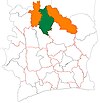
Place in Savanes, Ivory Coast
9°20′N 5°26′W / 9.333°N 5.433°W / 9.333; -5.433 Ivory Coast
 (2014)[1]
Komborodougou is a town in northern Ivory Coast. It is a sub-prefecture and commune of Korhogo Department in Poro Region, Savanes District. The border of Vallée du Bandama District is six kilometres east of the town.
In 2014, the population of the sub-prefecture of Komborodougou was 12,947.[2]
Villages
The 43 villages of the sub-prefecture of Komborodougou and their population in 2014 are:[2]
- Dabakaha (124)
- Dandoumakaha (301)
- Dossemekaha (177)
- Komborodougou (4 329)
- Lagbokaha (541)
- Nabieriguekaha (104)
- Naborikaha (132)
- Nangakaha (114)
- Nongogninekaha (65)
- Sibirikaha (1 023)
- Tiafiguekaha (112)
- Tiefannakaha (26)
- Zonhouakaha (134)
- Bossodougou (126)
- Dabokaha (185)
- Dogninekaha (152)
- Gnamatoloh (228)
- Gneguidiokaha (227)
- Gnenedokaha (92)
- Kafonnonkaha (140)
- Katiekaha (73)
- Kpokaha (223)
- Lelekaha (127)
- Nakaha (731)
- Nakalakaha (208)
- Nambatiokaha (54)
- Nambekaha (189)
- Nangounonkaha (45)
- Nazinekaha (264)
- Nemelokaha (492)
- Nibolikaha (76)
- Ouonsorikaha (486)
- Pangbakaha (129)
- Pederikaha (85)
- Pevrokaha (149)
- Pliguetiankaha (80)
- Sanlokaha (186)
- Siekaha (292)
- Sologokaha (96)
- Tchangakaha (228)
- Tchonkaha (187)
- Tenenakaha (130)
- Yereminkaha (85)
Notes
- ^ "Côte d'Ivoire". geohive.com. Retrieved 7 December 2015.
- ^ a b "RGPH 2014, Répertoire des localités, Région Poro" (PDF). ins.ci. Retrieved 5 August 2019.
- v
- t
- e
Departments and sub-prefectures of Poro Region, Savanes DistrictRegional seat: Korhogo
- Dassoungboho
- Kanoroba
- Karakoro*
- Kiémou
- Kombolokoura
- Komborodougou*
- Koni
- Korhogo*
- Lataha
- Nafoun
- Napiéolédougou*
- N'Ganon
- Niofoin*
- Sirasso*
- Sohouo
- Tioroniaradougou*
* also a commune
 | This Savanes District location article is a stub. You can help Wikipedia by expanding it. |
- v
- t
- e


