Kumbalam, Ernakulam
Locality in Kerala, India
Kumbalam കുമ്പളം | |
|---|---|
Locality | |
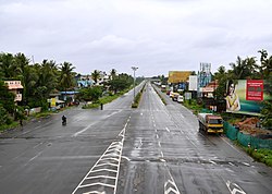 NH 47 view from Kumbalam | |
9°54′N 76°19′E / 9.90°N 76.31°E / 9.90; 76.31 | |
| State | Kerala |
| District | Ernakulam |
| Government | |
| • Body | Kumbalam Grama Panchayath |
| Elevation | 3 m (10 ft) |
| Population | |
| • Total | 24,143 |
| • Density | 1,161/km2 (3,010/sq mi) |
| Languages | |
| • Official | Malayalam, English |
| Time zone | UTC+5:30 (IST) |
| PIN | 682506 |
| Lok Sabha constituency | Ernakulam |
| Civic agency | Kumbalam Grama Panchayath |
| Climate | Tropical monsoon (Köppen) |
| Avg. summer temperature | 35 °C (95 °F) |
| Avg. winter temperature | 20 °C (68 °F) |
Kumbalam is a region of Kochi, in the state of Kerala, India, that includes Vembanad Lake. It is situated around 9 km (5.6 mi) from Vytilla Junction.[1]

Location
Kumbalam is surrounded by Thevara in the north, Willingdon Island in the northwest, Edakochi in the west, Kumbalangi in the southwest, Aroor in the south, Panangad in the east, and Nettoor in the northeast.
Places around Kumbalam | ||||||||||||||||
|---|---|---|---|---|---|---|---|---|---|---|---|---|---|---|---|---|
| ||||||||||||||||


References
- ^ "Pay more at Kumbalam toll plaza from today". The Times of India. 1 April 2018. Retrieved 21 January 2023.
External links
![]() Media related to Kumbalam, Ernakulam at Wikimedia Commons
Media related to Kumbalam, Ernakulam at Wikimedia Commons
- v
- t
- e
Neighbourhoods of Kochi
- Aluva
- Ambalamugal
- Edappally
- Elamkulam
- Fort Kochi
- Gandhi Nagar
- Kadavanthra
- Kathrikadavu
- Kakkanad
- Kalamassery
- Kaloor
- Kumbalam
- Marine Drive
- Mattancherry
- Mulavukad
- Old Kochi
- Pachalam
- Palarivattom
- Palluruthy
- Panampilly Nagar
- Panangad
- Pattimattom
- Puthuvype
- Thevara
- Thoppumpady
- Thrikkakkara
- Thrippunithura
- Vaduthala
- Vallarpadam
- Vennala
- Vypin
- Vyttila
- Willingdon Island
 | This article related to a location in Ernakulam district, Kerala, India is a stub. You can help Wikipedia by expanding it. |
- v
- t
- e


