List of Ramsar sites in the Republic of Ireland
This list of Ramsar sites in the Republic of Ireland includes wetlands that are considered to be of international importance under the Ramsar Convention. Ireland currently has 45 sites designated as "Wetlands of International Importance" with a surface area of 66,994 hectares (669.94 km2).[1][2][3] For a full list of all Ramsar sites worldwide, see List of Ramsar wetlands of international importance.
Map all coordinates using OpenStreetMap
Download coordinates as:
- KML
- GPX (all coordinates)
- GPX (primary coordinates)
- GPX (secondary coordinates)
List of Ramsar sites
| Name[4] | Location | Area (km2) | Designated | Description | Image |
|---|---|---|---|---|---|
| Baldoyle Bay | Dublin 53°24′N 6°8′W / 53.400°N 6.133°W / 53.400; -6.133 (Baldoyle Bay) | 2.03 | 25 October 1988 | ||
| Ballyallia Lough | County Clare 52°53′N 8°55′W / 52.883°N 8.917°W / 52.883; -8.917 (Ballyallia Lough) | 3.08 | 11 June 1996 | Lowest lake on the River Fergus | |
| Ballycotton Bay | County Cork 51°50′N 8°0′W / 51.833°N 8.000°W / 51.833; -8.000 (Ballycotton Bay) | 0.92 | 11 June 1996 | ||
| Ballymacoda | County Cork 51°52′N 7°55′W / 51.867°N 7.917°W / 51.867; -7.917 (Ballymacoda) | 3.75 | 11 June 1996 | ||
| Bannow Bay | County Wexford 52°27′N 6°17′W / 52.450°N 6.283°W / 52.450; -6.283 (Bannow Bay) | 9.58 | 11 June 1996 | ||
| Blacksod Bay and Broadhaven Bay | County Mayo 54°03′N 10°0′W / 54.050°N 10.000°W / 54.050; -10.000 (Blacksod Bay and Broadhaven Bay) | 6.83 | 11 June 1996 | Broadhaven Bay includes Atlantic salt marsh, tidal mudflats, reefs and shallow bays. | 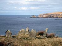 |
| Blackwater Estuary | County Cork, County Waterford51°57′N 7°48′W / 51.950°N 7.800°W / 51.950; -7.800 (Blackwater Estuary) | 4.68 | 11 June 1996 | ||
| Broadmeadow Estuary | 53°27′N 6°10′W / 53.450°N 6.167°W / 53.450; -6.167 (Broadmeadow Estuary) | 5.46 | 11 June 1996 | ||
| Castlemaine Harbour | County Kerry 52°7′N 9°55′W / 52.117°N 9.917°W / 52.117; -9.917 (Castlemaine Harbour) | 29.73 | 30 May 1990 | ||
| Clara Bog | County Offaly 53°19′N 7°37′W / 53.317°N 7.617°W / 53.317; -7.617 (Clara Bog) | 4.60 | 6 December 1988 | ||
| Coole Lough and Garryland Wood | County Galway 53°5′N 8°51′W / 53.083°N 8.850°W / 53.083; -8.850 (Coole Lough and Garryland Wood) | 3.64 | 30 May 1990 | ||
| Cork Harbour | County Cork 51°50′N 8°15′W / 51.833°N 8.250°W / 51.833; -8.250 (Cork Harbour) | 14.36 | 11 June 1996 | ||
| Cummeen Strand | County Sligo 54°17′N 8°30′W / 54.283°N 8.500°W / 54.283; -8.500 (Cummeen Strand) | 14.91 | 11 June 1996 | ||
| Dundalk Bay | County Louth 54°00′N 6°20′W / 54.000°N 6.333°W / 54.000; -6.333 (Dundalk Bay) | 47.68 | 11 June 1996 | ||
| Dungarvan Harbour | County Waterford52°3′N 7°35′W / 52.050°N 7.583°W / 52.050; -7.583 (Dungarvan Harbour) | 10.41 | 11 June 1996 | ||
| Easky Bog | County Sligo 54°11′N 8°49′W / 54.183°N 8.817°W / 54.183; -8.817 (Easky Bog) | 6.07 | 30 May 1990 | ||
| The Gearagh | County Cork 51°52′N 9°1′W / 51.867°N 9.017°W / 51.867; -9.017 (The Gearagh) | 3.07 | 30 May 1990 | ||
| Inner Galway Bay | 53°12′N 9°10′W / 53.200°N 9.167°W / 53.200; -9.167 (Inner Galway Bay) | 119.05 | 11 June 1996 | ||
| Killala Bay and Moy Estuary | County Mayo, County Sligo 54°15′N 9°10′W / 54.250°N 9.167°W / 54.250; -9.167 (Killala Bay and Moy Estuary) | 10.61 | 11 June 1996 | ||
| Knockmoyle and Sheskin | County Mayo 54°12′N 9°33′W / 54.200°N 9.550°W / 54.200; -9.550 (Knockmoyle and Sheskin) | 11.98 | 1 June 1987 | ||
| Lough Barra Bog | County Donegal 54°57′N 8°7′W / 54.950°N 8.117°W / 54.950; -8.117 (Lough Barra Bog) | 1.76 | 1 June 1987 |  | |
| Lough Corrib | 53°30′N 9°15′W / 53.500°N 9.250°W / 53.500; -9.250 (Lough Corrib) | 177.28 | 11 June 1996 | 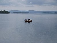 | |
| Lough Derravaragh | County Westmeath 53°40′N 7°20′W / 53.667°N 7.333°W / 53.667; -7.333 (Lough Derravaragh) | 11.20 | 11 June 1996 | 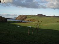 | |
| Lough Ennell | County Westmeath 53°27′N 7°23′W / 53.450°N 7.383°W / 53.450; -7.383 (Lough Ennell) | 14.04 | 11 June 1996 |  | |
| Lough Gara | County Sligo, County Roscommon 53°56′N 8°25′W / 53.933°N 8.417°W / 53.933; -8.417 (Lough Gara) | 17.42 | 11 June 1996 | ||
| Lough Glen | County Westmeath 53°25′N 7°23′W / 53.417°N 7.383°W / 53.417; -7.383 (Lough Glen) | 0.81 | 11 June 1996 | ||
| Lough Iron | County Westmeath 53°37′N 7°17′W / 53.617°N 7.283°W / 53.617; -7.283 (Lough Iron) | 1.82 | 11 June 1996 | ||
| Lough Oughter | 54°2′N 7°25′W / 54.033°N 7.417°W / 54.033; -7.417 (Lough Oughter) | 14.64 | 11 June 1996 | 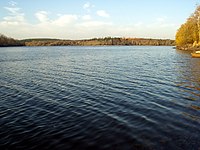 | |
| Lough Owel | County Westmeath 53°35′N 7°23′W / 53.583°N 7.383°W / 53.583; -7.383 (Lough Owel) | 10.32 | 11 June 1996 |  | |
| Meenachullion Bog | County Donegal 54°54′N 8°7′W / 54.900°N 8.117°W / 54.900; -8.117 (Meenachullion Bog) | 1.94 | 30 May 1990 | ||
| Mongan Bog | County Offaly 53°19′N 7°58′W / 53.317°N 7.967°W / 53.317; -7.967 (Mongan Bog) | 1.27 | 6 December 1988 | ||
| North Bull Island | Dublin 53°22′N 6°8′W / 53.367°N 6.133°W / 53.367; -6.133 (North Bull Island) | 14.36 | 6 September 1988 |  | |
| Owenboy | County Mayo 54°6′N 9°28′W / 54.100°N 9.467°W / 54.100; -9.467 (Owenboy) | 3.97 | 1 June 1987 | ||
| Owenduff catchment | County Mayo 54°3′N 9°40′W / 54.050°N 9.667°W / 54.050; -9.667 (Owenduff catchment) | 13.82 | 31 July 1986 | ||
| Pettigo Plateau | County Donegal 54°37′N 7°57′W / 54.617°N 7.950°W / 54.617; -7.950 (Pettigo Plateau) | 9.00 | 31 July 1986 | ||
| Pollardstown Fen | County Kildare 53°11′N 6°51′W / 53.183°N 6.850°W / 53.183; -6.850 (Pollardstown Fen) | 1.30 | 30 May 1990 |  | |
| Raheenmore Bog | County Offaly 53°20′N 7°21′W / 53.333°N 7.350°W / 53.333; -7.350 (Raheenmore Bog) | 1.62 | 6 December 1988 | ||
| The Raven | County Wexford 52°20′N 6°19′W / 52.333°N 6.317°W / 52.333; -6.317 (The Raven) | 5.89 | 31 July 1986 |  | |
| Rogerstown Estuary | Dublin 53°30′N 6°8′W / 53.500°N 6.133°W / 53.500; -6.133 (Rogerstown Estuary) | 1.95 | 25 October 1988 | ||
| Sandymount Strand and Tolka Estuary | 53°20′N 6°12′W / 53.333°N 6.200°W / 53.333; -6.200 (Sandymount Strand and Tolka Estuary) | 6.54 | 11 June 1996 |  | |
| Slieve Bloom Mountains | County Offaly, County Laois 53°3′N 7°38′W / 53.050°N 7.633°W / 53.050; -7.633 (Slieve Bloom Mountains) | 22.30 | 31 July 1986 | 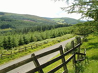 | |
| Tralee Bay | County Kerry 52°16′N 9°48′W / 52.267°N 9.800°W / 52.267; -9.800 (Tralee Bay) | 8.61 | 10 July 1989 |  | |
| Tramore Backstrand | County Waterford 52°10′N 7°7′W / 52.167°N 7.117°W / 52.167; -7.117 (Tramore Backstrand) | 3.67 | 11 June 1996 | ||
| Trawbreaga Bay | County Donegal 55°17′N 7°15′W / 55.283°N 7.250°W / 55.283; -7.250 (Trawbreaga Bay) | 10.03 | 11 June 1996 | ||
| Wexford Wildfowl Reserve | County Wexford 52°30′N 6°20′W / 52.500°N 6.333°W / 52.500; -6.333 (Wexford Wildfowl Reserve) | 1.94 | 15 November 1984 |
See also
- Ramsar Convention
- List of Ramsar sites worldwide
- List of Special Protection Areas in the Republic of Ireland
References
- ^ "Discover Ramsar Wetlands in the Republic of Ireland | Title". www.wetlandsurveysireland.com. 7 September 2017. Retrieved 30 August 2020.
- ^ "Ramsar Sites In Ireland". Ramsar Sites Information Service. Retrieved 30 August 2020.
- ^ "Annotated List of Wetlands of International Importance: Ireland" (PDF). Ramsar Sites Information Service. Retrieved 30 August 2020.
- ^ "Ramsar List" (PDF). Ramsar.org. Retrieved 1 April 2013.


