List of crossings of the Rahway River

The Rahway River drainage basin encompasses approximately 41 square miles in Union, Essex, and Middlesex counties in the northeastern part of the U.S. state of New Jersey.
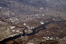
The Rahway River consists of four separate branches that converge in Rahway, from whence it flows as a single waterway to its mouth at the Arthur Kill. The longest, or West Branch, courses for 24 miles from Verona. The East Branch rises in West Orange/Montclair and joins the West Branch in Springfield, forming the main stem of the river. The South Branch, which originates in Woodbridge, and the Robinson's Branch, which begins in Scotch Plains, join the main stem in Rahway. The upper portion above Rahway consists of floodplains, woodlands and freshwater marshes; the lower portion includes saltwater marshes and tidal flats.[1] The river is tidal for approximately five mies upstream.[2]
Many of the crossings of the river were built in the late 19th and early 20th century[3] and are part of the Rahway River Parkway, a greenway along the banks of the river.
Crossings (main stem)
| Crossing | Image | Carries | Location | Coordinates | References |
|---|---|---|---|---|---|
| Conrail (CRCX) | Garden State Secondary | Linden/Carteret | 40°35′56″N 74°13′51″W / 40.5989°N 74.2307°W / 40.5989; -74.2307 (CNJ Rahway River Bridge) | [4][5] | |
| New Jersey Turnpike | Interstate 95   | 40°35′56″N 74°13′54″W / 40.5990°N 74.2318°W / 40.5990; -74.2318 (I-95 bridges) | [6] | ||
| Lawrence Street | CR 514  | Rahway | 40°35′57″N 74°16′07″W / 40.5992°N 74.2687°W / 40.5992; -74.2687 (Lawrence Street Bridge) | [7][3] | |
| U.S. Route 1/9 |  | 40°35′58″N 74°16′12″W / 40.5994°N 74.2701°W / 40.5994; -74.2701 (U.S. Route 1/9 Bridge) | [3][8] | ||
| South Branch enters from south | |||||
| Milton Avenue | CR 648  | Rahway | 40°36′16″N 74°16′18″W / 40.60454°N 74.27162°W / 40.60454; -74.27162 (Milton Avenue Bridge) | [3][9] | |
| Monroe Street | 40°36′29″N 74°16′23″W / 40.60808°N 74.27298°W / 40.60808; -74.27298 (Monroe Street Bridge) | [3] | |||
| Bridge Street | 40°36′32″N 74°16′25″W / 40.6089°N 74.2735°W / 40.6089; -74.2735 (Bridge Street Bridge) | ||||
| Rahway River Bridge |  | Northeast Corridor (MP 19.13) Amtrak (Northeast Regional) New Jersey Transit Northeast Corridor Line North Jersey Coast Line | 40°36′33″N 74°16′26″W / 40.60909°N 74.27377°W / 40.60909; -74.27377 (Rahway River (Rail) Bridge) | [10] | |
| Elizabeth Avenue | 40°36′36″N 74°16′29″W / 40.61001°N 74.27482°W / 40.61001; -74.27482 (Elizabeth Avenue Bridge) | ||||
| Robinson's Branch enters from west | |||||
| Grand Avenue | CR 613  | Rahway | 40°36′43″N 74°16′27″W / 40.61184°N 74.27420°W / 40.61184; -74.27420 (Grand Avenue Bridge) | ||
| Whitter Street | 40°36′57″N 74°16′31″W / 40.61594°N 74.27535°W / 40.61594; -74.27535 (Whittier Street Bridge) | [3][11][12] | |||
| Church Street | 40°37′05″N 74°16′42″W / 40.61810°N 74.27836°W / 40.61810; -74.27836 (Church Street Bridge) | [3] | |||
| St. George's Avenue | New Jersey Route 27  | 40°37′09″N 74°16′57″W / 40.61905°N 74.28249°W / 40.61905; -74.28249 (St. George's Avenue Bridge) | [13][14] | ||
| Rahway River Water Supply Dam | 40°37′08″N 74°17′22″W / 40.61882°N 74.28953°W / 40.61882; -74.28953 (Rahway River Water Supply Dam) | ||||
| Valley Road | CR 608  | Clark | 40°37′39″N 74°17′07″W / 40.62763°N 74.28520°W / 40.62763; -74.28520 (Valley Road Bridge) | [3] | |
| Jacksons Pond Dam aka Valley Road Dam | 40°37′41″N 74°17′07″W / 40.62804°N 74.28519°W / 40.62804; -74.28519 (Jacksons Pond Dam) | [15][16] | |||
| Bloodgoods Pond Dam | 40°37′43″N 74°17′53″W / 40.62864°N 74.29814°W / 40.62864; -74.29814 (Bloodgoods Pond Dam) | [17][16] | |||
| Garden State Parkway |  (MP 137.08) (MP 137.08) | Cranford/Clark | 40°38′23″N 74°17′26″W / 40.63971°N 74.29046°W / 40.63971; -74.29046 (Garden State Parkway Bridge) | [18] | |
| Raritan Road | CR 607  | 40°38′24″N 74°17′26″W / 40.63992°N 74.29042°W / 40.63992; -74.29042 (Raritan Road Bridge) | [3] | ||
| Dam | 40°38′25″N 74°17′26″W / 40.64027°N 74.29063°W / 40.64027; -74.29063 (Dam) | ||||
| Rahway River Parkway Footbridge | Cranford | 40°38′26″N 74°17′38″W / 40.64063°N 74.29397°W / 40.64063; -74.29397 (Rahway River Parkway Footbridge (1)) | |||
| Rahway River Parkway Footbridge aka Crane Parkway River Crossing | 40°38′25″N 74°18′10″W / 40.64015°N 74.30284°W / 40.64015; -74.30284 (Rahway River Parkway Footbridge (2)) | ||||
| Conrail Lehigh Line | 40°38′31″N 74°18′15″W / 40.64185°N 74.30414°W / 40.64185; -74.30414 (Lehigh Line Bridge) | [19] | |||
| Rahway River Parkway Footbridge | 40°38′44″N 74°18′04″W / 40.64566°N 74.30118°W / 40.64566; -74.30118 (Rahway River Parkway Footbridge (3)) | ||||
| High Street |  | aka Lincoln Avenue | 40°39′01″N 74°18′06″W / 40.65019°N 74.30175°W / 40.65019; -74.30175 (High Street Bridge) | ||
| Droeschers Mill Dam | 40°39′02″N 74°18′05″W / 40.65064°N 74.30126°W / 40.65064; -74.30126 (Droeschers Mill Dam) | ||||
| South Avenue East | CR 610  | 40°39′18″N 74°18′03″W / 40.65505°N 74.30074°W / 40.65505; -74.30074 (South Avenue East Bridge) | |||
| Raritan Valley Line | New Jersey Transit | 40°39′21″N 74°18′02″W / 40.65586°N 74.30063°W / 40.65586; -74.30063 (Raritan Valley Line Bridge) | |||
| North Avenue East | New Jersey Route 28 | 40°39′24″N 74°18′03″W / 40.65662°N 74.30071°W / 40.65662; -74.30071 (North Avenue East Bridge) | [3][20] | ||
| Union Avenue | 40°39′31″N 74°18′06″W / 40.65863°N 74.30171°W / 40.65863; -74.30171 (Union Avenue Bridge) | [3][21] | |||
| Hansel's Dam |  | 40°39′32″N 74°18′09″W / 40.65884°N 74.30253°W / 40.65884; -74.30253 (Hansel's Dam) | |||
| Springfield Avenue | CR 615  | 40°39′36″N 74°18′22″W / 40.66000°N 74.30603°W / 40.66000; -74.30603 (Springfield Avenue Bridge (1)) | [3] | ||
| Eastman Street (2x) | 40°39′27″N 74°18′31″W / 40.65757°N 74.30854°W / 40.65757; -74.30854 (Eastman Street Bridge (1)) 40°39′30″N 74°18′36″W / 40.65844°N 74.31001°W / 40.65844; -74.31001 (Eastman Street Bridge (2)) | [3] | |||
| Springfield Avenue | CR 615 | 40°39′41″N 74°18′30″W / 40.66143°N 74.30838°W / 40.66143; -74.30838 (Springfield Avenue Bridge (2)) | [3] | ||
| Balmiere Parkway Footbridge | 40°39′55″N 74°18′36″W / 40.66540°N 74.31002°W / 40.66540; -74.31002 (Balmiere Parkway Footbridge) | ||||
| Boulevard aka Kenilworth Boulevard |  | New Jersey CR 509  | Cranford/Kenilworth | 40°40′24″N 74°18′47″W / 40.67326°N 74.31293°W / 40.67326; -74.31293 (Boulevard Bridge) | [22][3] |
| Lenape Park Dam | 40°40′26″N 74°18′48″W / 40.67385°N 74.31325°W / 40.67385; -74.31325 (Lenape Park Dam) | [23] | |||
| U.S. Route 22 dual bridges |  |  (MP 52.09) (MP 52.09) | Union/Springfield | 40°41′16″N 74°18′43″W / 40.68779°N 74.31182°W / 40.68779; -74.31182 (US 22 Bridge (1)) 40°41′19″N 74°18′43″W / 40.68857°N 74.31185°W / 40.68857; -74.31185 (US 22 Bridge (2)) | [3][24][25] |
| Dam |  | Union | 40°41′27″N 74°18′32″W / 40.69072°N 74.30899°W / 40.69072; -74.30899 (Dam) | ||
| Milltown Road | Union/Springfield | 40°41′37″N 74°18′24″W / 40.69362°N 74.30660°W / 40.69362; -74.30660 (Milltown Road Bridge) | |||
| Rahway Valley Railroad |  | 40°42′06″N 74°18′36″W / 40.70160°N 74.30995°W / 40.70160; -74.30995 (Rahway Valley Railroad Bridge) | [26] | ||
| Morris Avenue | New Jersey Route 82  | 40°42′29″N 74°18′07″W / 40.70795°N 74.30189°W / 40.70795; -74.30189 (Morris Avenue Bridge) | [27][28] | ||
| Springfield Avenue | New Jersey Route 124  | 40°42′44″N 74°17′58″W / 40.71218°N 74.29944°W / 40.71218; -74.29944 (Springfield Avenue Bridge) | [29] | ||
| West Branch and East Branch converge | |||||
| Phillipsburg-Newark Expressway | Interstate 78  | Hobart Gap Springfield/Millburn | 40°42′50″N 74°17′59″W / 40.71402°N 74.29967°W / 40.71402; -74.29967 (I-78 bridges) | [30] | |
Crossings West Branch
This transport-related list is incomplete; you can help by adding missing items. (August 2018) |
| Crossing | Image | Carries | Location | Coordinates | References |
|---|---|---|---|---|---|
| Ridgewood Road | Millburn | 40°43′14″N 74°18′24″W / 40.72053°N 74.30657°W / 40.72053; -74.30657 (Ridgewood Road Bridge) | |||
| Taylor Pond Dam | 40°43′18″N 74°18′22″W / 40.72155°N 74.30619°W / 40.72155; -74.30619 (Taylor Pond Dam) | ||||
| Footbridge | 40°43′22″N 74°18′23″W / 40.72279°N 74.30640°W / 40.72279; -74.30640 (Footbridge) | ||||
| Millburn Avenue | CR 527  | 40°43′26″N 74°18′25″W / 40.72402°N 74.30682°W / 40.72402; -74.30682 (Millburn Avenue Bridge) | |||
| Essex Street | 40°43′30″N 74°18′23″W / 40.72506°N 74.30636°W / 40.72506; -74.30636 (Essex Street Bridge) | ||||
| Morristown Line | New Jersey Transit | 40°43′33″N 74°18′27″W / 40.72588°N 74.30755°W / 40.72588; -74.30755 (Morristown Line Bridge) | [31] | ||
| Footbridge | 40°43′34″N 74°18′27″W / 40.72599°N 74.30763°W / 40.72599; -74.30763 (Footbridge) | ||||
| Glen Avenue | 40°43′44″N 74°18′28″W / 40.72875°N 74.30791°W / 40.72875; -74.30791 (Glen Avenue Bridge) | ||||
| Diamond Mill Pond Dam | South Mountain Reservation Millburn | 40°43′52″N 74°18′25″W / 40.73117°N 74.30707°W / 40.73117; -74.30707 (Diamond Mill Pond Dam) | |||
| Campbells Pond Dam | 40°44′11″N 74°18′18″W / 40.73637°N 74.30509°W / 40.73637; -74.30509 (Campbells Pond Dam) | ||||
| Dam | 40°44′29″N 74°18′07″W / 40.74125°N 74.30203°W / 40.74125; -74.30203 (Dam) | ||||
| Overlook Trail Footbridge | 40°44′39″N 74°18′01″W / 40.74429°N 74.30020°W / 40.74429; -74.30020 (Overlook Trail Footbridge) | ||||
| Rahway Trail Footbridge | 40°44′49″N 74°17′47″W / 40.74687°N 74.29629°W / 40.74687; -74.29629 (Rahway Trail Footbridge) | ||||
| South Orange Avenue | CR 510  | 40°45′14″N 74°17′33″W / 40.75380°N 74.29255°W / 40.75380; -74.29255 (South Orange Avenue Bridge) | |||
| Lenape Trail Footbridge | 40°45′20″N 74°17′32″W / 40.75551°N 74.29231°W / 40.75551; -74.29231 (Lenape Trail Footbridge) | ||||
| Tulip Spring Bridge | Cherry Lane | 40°45′24″N 74°17′30″W / 40.75669°N 74.29162°W / 40.75669; -74.29162 (Tulip Spring Bridge) | [32] | ||
| Orange Reservoir Dam | South Mountain Reservation West Orange | 40°45′33″N 74°17′15″W / 40.75917°N 74.28756°W / 40.75917; -74.28756 (Orange Reservoir Dam) | |||
| Footbridge | 40°46′08″N 74°17′00″W / 40.76896°N 74.28337°W / 40.76896; -74.28337 (Footbridge) | ||||
| Northfield Avenue | CR 508  | West Orange | 40°46′10″N 74°17′00″W / 40.76958°N 74.28330°W / 40.76958; -74.28330 (Northfield Avenue culvert) | ||
| Mount Pleasant Avenue | New Jersey Route 10  | 40°47′34″N 74°16′09″W / 40.79266°N 74.26910°W / 40.79266; -74.26910 (Mount Pleasant Avenue culvert) | |||
| Essex Freeway | Interstate 280  | 40°47′52″N 74°15′54″W / 40.79772°N 74.26509°W / 40.79772; -74.26509 (I-280 culverts) |
Map all coordinates using OpenStreetMap
Download coordinates as:
- KML
- GPX (all coordinates)
- GPX (primary coordinates)
- GPX (secondary coordinates)
See also
- List of crossings of the Elizabeth River
- List of county routes in Union County, New Jersey
- List of county routes in Essex County, New Jersey
- List of county routes in Middlesex County, New Jersey
- List of bridges documented by the Historic American Engineering Record in New Jersey
- List of crossings of the Raritan River
References
- ^ Rahway River Greenway Plan (PDF) (Report). Edward J. Bloustein School of Planning and Public Policy, Rutgers University. February 2009. Retrieved 10 January 2018.
- ^ New Jersey Coastal Management Program: Environmental Impact Statement, National Oceanic and Atmospheric Administration, 1980
- ^ a b c d e f g h i j k l m n o p "Historic Bridge Survey Union County (1991-1994)" (PDF). NJDOT. 2001. Retrieved 10 January 2018.
- ^ "CRCX - Rahway River Bridge". Bridgehunter.com. Retrieved 16 January 2019.
- ^ "Archived copy" (PDF). Archived from the original (PDF) on 2018-01-24. Retrieved 2018-01-23.
{{cite web}}: CS1 maint: archived copy as title (link) - ^ Staff. "Route 700 Straight Line Diagram" (PDF). New Jersey Department of Transportation. Retrieved March 25, 2016.
- ^ "Rahway River Bridge". Bridgehunter.com. Retrieved 11 January 2018.
- ^ "US 1 straight line diagram" (PDF). New Jersey Department of Transportation. Retrieved 2009-11-25.
- ^ "Rahway Bridge Permit Asked". timesmachine.nytimes.com. Retrieved 16 January 2019.
- ^ "Amtrak - Rahway River Bridge". Bridgehunter.com. Retrieved 11 January 2018.
- ^ "Rahway River Bridge". Bridgehunter.com. Retrieved 11 January 2018.
- ^ "Whittier Street Bridge". Bridgehunter.com. Retrieved 11 January 2018.
- ^ "Route 27 straight line diagram" (PDF). New Jersey Department of Transportation. Retrieved 2018-01-08.
- ^ "Rahway River Bridge". Bridgehunter.com. Retrieved 11 January 2018.
- ^ "Rahway River Parkway, NJ". gonehikin.blogspot.nl. 19 April 2013. Retrieved 11 January 2018.
- ^ a b "Before and After: Valley Road Dam, Waterfall, Bridge and Jackson's Pond in Clark". 28 August 2011. Retrieved 21 January 2018.
- ^ http://gardenstatelegacy.co/file/New_Jerseys_Oldest_Felt_Mill_DAndrea_Russo_GSL33.pdf [permanent dead link]
- ^ "Garden State Parkway straight line diagram" (PDF). New Jersey Department of Transportation. Retrieved 2018-01-09.
- ^ "Electronic Code of Federal Regulations Title 33 → Chapter I → Subchapter J → Part 117 117.743 Rahway River". January 18, 2018. Retrieved 21 January 2018.
- ^ "Route 28 straight line diagram" (PDF). New Jersey Department of Transportation. Retrieved 2018-01-09.
- ^ "North Union Avenue Bridge". Bridgehunter.com. Retrieved 11 January 2018.
- ^ "County Route 509 (straight line diagram)" (PDF). New Jersey Department of Transportation. Retrieved 11 January 2018.
- ^ "Rahway River Basin Flood Risk Management Feasibility Study Essex and Union Counties, NJ" (PDF). US Army Corps of Engineers. June 2015.
- ^ "US 22 straight line diagram" (PDF). New Jersey Department of Transportation. Retrieved 2018-01-09.
- ^ "Rahway River Bridge". Bridgehunter.com. Retrieved 11 January 2018.
- ^ "RVRR - Rahway River Bridge". Bridgehunter.com. Retrieved 11 January 2018.
- ^ "New Jersey Route 82 (straight line diagram)" (PDF). New Jersey Department of Transportation. Retrieved 11 January 2018.
- ^ "Rahway River Bridge". Bridgehunter.com. Retrieved 11 January 2018.
- ^ "Route 124 straight line diagram" (PDF). New Jersey Department of Transportation. Retrieved 2018-01-10.
- ^ "I-78 Straight Line Diagram" (PDF). New Jersey Department of Transportation. Retrieved 2018-01-09.
- ^ "West Branch Rahway River Bridge". Bridgehunter.com. Retrieved 21 January 2018.
- ^ "Tulip Spring Bridge". Bridgehunter.com. Retrieved 21 January 2018.
External links
- "Bridgehunter.com - Rahway River". bridgehunter.com. Retrieved 11 January 2018.
- "Historic Bridge Survey Union County (1991-1994)" (PDF). NJDOT. 2001.
- "Historic Bridge Survey Essex County (1991-1994)" (PDF). NJDOT. 2001.
- The Rahway River Watershed (PDF) (Report). MAYOR’S COUNCIL RAHWAY RIVER. Retrieved 20 January 2018.
- Rahway River Basin Flood Risk Management Feasibility Study (Report). U.S. Army Corps of Engineers, New York District. January 2017. Retrieved 20 January 2018.
- v
- t
- e
Rahway River watershed
| Essex County | |
|---|---|
| Middlesex County | |
| Union County |


