List of historic places in Ottawa
Map all coordinates using OpenStreetMap
Download coordinates as:
- KML
- GPX (all coordinates)
- GPX (primary coordinates)
- GPX (secondary coordinates)
This article is a list of historic places in the City of Ottawa, Ontario entered on the Canadian Register of Historic Places, whether they are federal, provincial, or municipal.
See also List of historic places in Ontario.
List of historic places
| Name | Address | Coordinates | Government recognition (CRHP №) | Image | |
|---|---|---|---|---|---|
| The Beggs House | 2323 Roger Stevens Drive Ottawa (North Gower) ON | 45°07′54″N 75°42′57″W / 45.1317°N 75.7159°W / 45.1317; -75.7159 (The Beggs House) | Ottawa (North Gower) municipality (14209) |  Upload Photo | |
| Building 7; Health Protection Building (Former Department of Health & Welfare, Food and Drug Laboratory) | Tunney's Pasture Campus Ottawa ON | 45°24′27″N 75°44′09″W / 45.4076°N 75.7359°W / 45.4076; -75.7359 (Building 7; Health Protection Building (Former Department of Health & Welfare, Food and Drug Laboratory)) | Federal (12897) |  | |
| Cheney House | 176 Bronson Avenue Ottawa ON | 45°24′52″N 75°42′27″W / 45.4144°N 75.7075°W / 45.4144; -75.7075 (Cheney House) | Ottawa municipality (18596) | Upload Photo | |
| Commissariat Building | 3 Canal Lane, Rideau Canal National Historic Site of Canada Ottawa (Downtown Ottawa) ON | 45°25′33″N 75°41′52″W / 45.4258°N 75.6978°W / 45.4258; -75.6978 (Commissariat Building) | Federal (11116) | 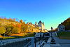 More images | |
| Davidson House | 3150 Donnelly Drive Ottawa ON | 45°02′23″N 75°42′22″W / 45.0397°N 75.7062°W / 45.0397; -75.7062 (Davidson House) | Ottawa municipality (10298) | Upload Photo | |
| The Kelly House | 6576 Main Street (Fourth Line) Ottawa (North Gower) ON | 45°07′58″N 75°43′05″W / 45.1327°N 75.718°W / 45.1327; -75.718 (The Kelly House) | Ottawa (North Gower) municipality (15291) | Upload Photo | |
| Martin House | 6732 Rideau Valley Drive South Ottawa (Kars) ON | 45°08′57″N 75°38′49″W / 45.1491°N 75.6470°W / 45.1491; -75.6470 (Martin House) | Ottawa (Kars) municipality (19796) | Upload Photo | |
| Trinity United Church | 6656 Rideau Valley Drive S Ottawa (Kars) ON | 45°09′17″N 75°38′56″W / 45.1546°N 75.6489°W / 45.1546; -75.6489 (Trinity United Church) | Ottawa (Kars) municipality (14208) | Upload Photo | |
| Weatherhead House | 6924 Gallagher Road Ottawa (Pierces Corners) ON | 45°03′31″N 75°45′46″W / 45.0586°N 75.7627°W / 45.0586; -75.7627 (Weatherhead House) | Ottawa (Pierces Corners) municipality (16323) | Upload Photo | |
| Bryan House | 6700 Rideau Valley Drive South Ottawa (Kars) ON | 45°09′08″N 75°38′53″W / 45.1522°N 75.648°W / 45.1522; -75.648 (Bryan House) | Ottawa (Kars) municipality (10142) | Upload Photo | |
| The Weaver's House | 1131 Mill Street Ottawa (Manotick) ON | 45°13′34″N 75°41′01″W / 45.2262°N 75.6837°W / 45.2262; -75.6837 (The Weaver's House) | Ottawa (Manotick) municipality (14212) |  More images | |
| New Edinburgh Heritage Conservation District | along the Rideau River, bounded by Sussex, MacKay, Dufferin and Stanley Ottawa (New Edinburgh) ON | 45°26′28″N 75°41′20″W / 45.441°N 75.689°W / 45.441; -75.689 (New Edinburgh Heritage Conservation District) | Ottawa (New Edinburgh) municipality (8447) |  | |
| "N" Division, Stable Building | 1 Sandridge Rd Ottawa (Manor Park) ON | 45°27′24″N 75°39′19″W / 45.4568°N 75.6552°W / 45.4568; -75.6552 ("N" Division, Stable Building) | Federal (4631) |  | |
| Aberdeen Pavilion | Ottawa (The Glebe) ON | 45°24′0″N 75°40′58″W / 45.40000°N 75.68278°W / 45.40000; -75.68278 (Aberdeen Pavilion) | Federal (4114) | Q4666960 |  More images |
| Hay House | 700 Echo Drive Ottawa (Old Ottawa South) ON | 45°23′51″N 75°40′47″W / 45.3975309°N 75.679682°W / 45.3975309; -75.679682 (Hay House) | Ottawa (Old Ottawa South) municipality (14211) |  More images | |
| Victoria Memorial Museum Building (Canadian Museum of Nature) | Ottawa (Centretown) ON | 45°24′46″N 75°41′20″W / 45.41278°N 75.68889°W / 45.41278; -75.68889 (Victoria Memorial Museum Building) | Federal (9657, (4483) | Q1032232 |  More images |
| Central Experimental Farm | Ottawa (River Ward) ON | 45°22′57″N 75°42′49″W / 45.38250°N 75.71361°W / 45.38250; -75.71361 (Central Experimental Farm) | Federal (13811) | Q4504150 |  More images |
| Château Laurier | Ottawa (Downtown Ottawa) ON | 45°25′32″N 75°41′42″W / 45.42556°N 75.69500°W / 45.42556; -75.69500 (Château Laurier) | Federal (14549) | Q2089212 |  More images |
| CFS Carp (Diefenbunker) | Ottawa (Carp) ON | 45°21′6″N 76°2′50″W / 45.35167°N 76.04722°W / 45.35167; -76.04722 (CFS Carp) | Federal (4169) | Q5010827 |  More images |
| Government Conference Centre | 2 Rideau Street Ottawa (Sandy Hill) ON | 45°25′29″N 75°41′37″W / 45.4246°N 75.6937°W / 45.4246; -75.6937 (Government Conference Centre) | Federal (4305) | 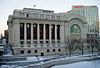 More images | |
| National Research Council of Canada, Building M-12 | 1200 Montreal Road Ottawa (Rideau-Rockcliffe Ward) ON | 45°26′54″N 75°37′00″W / 45.4482°N 75.6167°W / 45.4482; -75.6167 (National Research Council of Canada, Building M-12) | Federal (10160) | Upload Photo | |
| Notre-Dame Cathedral Basilica | Ottawa (Lowertown) ON | 45°25′47″N 75°41′47″W / 45.42972°N 75.69639°W / 45.42972; -75.69639 (Notre-Dame Cathedral Basilica) | Federal (12135), Ottawa (Lowertown) municipality (8448) | Q1051168 | 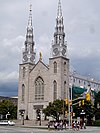 More images |
| Former Ottawa Teachers' College (Ottawa Normal School) | Ottawa (Ottawa City Hall) ON | 45°25′12″N 75°41′27″W / 45.42000°N 75.69083°W / 45.42000; -75.69083 (Former Ottawa Teachers' College National Historic Site) | Federal (7437) | Q7109219 |  More images |
| Rideau Canal | Rideau Street, Ottawa / Kingston ON | 45°25′35″N 75°41′53″W / 45.42639°N 75.69806°W / 45.42639; -75.69806 (Rideau Canal National Historic Site) | Federal (5727) | Q651323 | 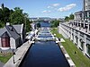 More images |
| Rideau Hall, Complex as a whole | 1 Sussex Drive Ottawa (New Edinburgh) ON | 45°26′38″N 75°41′09″W / 45.4439°N 75.6859°W / 45.4439; -75.6859 (Rideau Hall, Complex as a whole) | Federal (16881) |  More images | |
| Rideau Hall Visitor Centre | 11 Rideau Gate Ottawa (New Edinburgh) ON | 45°26′39″N 75°41′29″W / 45.4442°N 75.6915°W / 45.4442; -75.6915 (Rideau Hall Visitor Centre) | Federal (21062) | 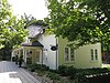 | |
| Saint Brigid's Church | 314 St. Patrick Street Ottawa (Byward Market) ON | 45°25′53″N 75°41′27″W / 45.4314°N 75.6907°W / 45.4314; -75.6907 (Saint Brigid's Church) | Ontario (8906), Ottawa (Byward Market) municipality (18642) |  More images | |
| Church of St. Alban the Martyr | 125 Daly Street Ottawa (Sandy Hill) ON | 45°25′39″N 75°41′06″W / 45.4275°N 75.6849°W / 45.4275; -75.6849 (Church of St. Alban the Martyr) | Ontario (10422) | 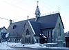 More images | |
| Central Heating Plant | Tunney's Pasture Ottawa (Tunney's Pasture) ON | 45°24′19″N 75°44′15″W / 45.4052°N 75.7374°W / 45.4052; -75.7374 (Central Heating Plant) | Federal (12921) |  | |
| Coach House for Prime Minister's Residence | 10 Sussex Drive Ottawa ON | 45°26′41″N 75°41′33″W / 45.4447°N 75.6926°W / 45.4447; -75.6926 (Coach House for Prime Minister's Residence) | Federal (19636) |  More images | |
| Statistics Canada - Main Building (Former Dominion Bureau of Statistics Building) | Ottawa (Tunney's Pasture) ON | 45°24′21″N 75°44′3″W / 45.40583°N 75.73417°W / 45.40583; -75.73417 (Statistics Canada Main Building) | Federal (13122) | Q6735940 |  More images |
| 304-312 Queen Elizabeth Driveway | 0, 304-312 Queen Elizabeth Driveway Ottawa (The Glebe) ON | 45°24′24″N 75°40′58″W / 45.4067°N 75.6828°W / 45.4067; -75.6828 (304-312 Queen Elizabeth Driveway) | Ottawa (The Glebe) municipality (10058) |  More images | |
| 41 York Street | 41 York Street Ottawa (Byward Market) ON | 45°25′41″N 75°41′37″W / 45.428°N 75.6936°W / 45.428; -75.6936 (41 York Street) | Ottawa (Byward Market) municipality (13413) |  | |
| 419-423 Sussex Drive | 419-423 Sussex Drive Ottawa (Byward Market) ON | 45°25′50″N 75°41′47″W / 45.4305°N 75.6965°W / 45.4305; -75.6965 (419-423 Sussex Drive) | Federal (4627) | 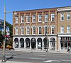 | |
| Administration Building | 588 Booth Street Ottawa (Glebe Annex) ON | 45°23′59″N 75°42′20″W / 45.3998°N 75.7056°W / 45.3998; -75.7056 (Administration Building) | Federal (11137) |  | |
| Arc Biotech Building (No. 34) | Ottawa (River Ward) ON | 45°23′30.4″N 75°42′47.1″W / 45.391778°N 75.713083°W / 45.391778; -75.713083 (Arc Biotech Building (No. 34)) | Federal (9591) | Q24046200 |  More images |
| Bank of Montreal | 144 Wellington St. Ottawa (Downtown) ON | 45°25′20″N 75°41′59″W / 45.4222°N 75.6997°W / 45.4222; -75.6997 (Bank of Montreal) | Federal (16147) |  More images | |
| Bank of Nova Scotia | 125 Sparks Street Ottawa (Downtown) ON | 45°25′21″N 75°41′54″W / 45.4225°N 75.6984°W / 45.4225; -75.6984 (Bank of Nova Scotia) | Federal (16481) | 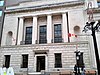 More images | |
| Bate Building | 109-111 Sparks Street Ottawa (Downtown) ON | 45°25′22″N 75°41′53″W / 45.4228°N 75.6981°W / 45.4228; -75.6981 (Bate Building) | Federal (7392) |  More images | |
| Beechwood Cemetery | Ottawa (Rideau-Rockcliffe Ward) ON | 45°26′49″N 75°39′36″W / 45.44694°N 75.66000°W / 45.44694; -75.66000 (Beechwood Cemetery) | Federal (1210) | Q4087599 | 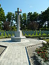 More images |
| Billings Estate | Ottawa (Alta Vista) ON | 45°23′23″N 75°40′20″W / 45.38972°N 75.67222°W / 45.38972; -75.67222 (Billings Estate) | Federal (12622) | Q4911946 |  More images |
| Birks Building | 107 Sparks Street Ottawa (Downtown) ON | 45°25′22″N 75°41′52″W / 45.4227°N 75.6979°W / 45.4227; -75.6979 (Birks Building) | Federal (7391) | Upload Photo | |
| Blackburn Building | 85 Sparks Street Ottawa (Downtown) ON | 45°25′24″N 75°41′50″W / 45.4233°N 75.6973°W / 45.4233; -75.6973 (Blackburn Building) | Federal (4042) |  More images | |
| Boathouse | 501 Rockcliffe Driveway Ottawa ON | 45°27′18″N 75°41′15″W / 45.4550°N 75.6876°W / 45.4550; -75.6876 (Boathouse) | Federal (19615) | Upload Photo | |
| Booth Building | 165 Sparks Street Ottawa (Downtown) ON | 45°25′20″N 75°41′59″W / 45.4222°N 75.6997°W / 45.4222; -75.6997 (Booth Building) | Federal (4058) | Upload Photo | |
| Booth Street Complex, Surveys and Mapping Building | 615 Booth Street Ottawa (Glebe Annex) ON | 45°24′03″N 75°42′18″W / 45.4007°N 75.705°W / 45.4007; -75.705 (Booth Street Complex, Surveys and Mapping Building) | Federal (10145) |  More images | |
| Bronson Company Office | 150 Middle Street Ottawa (Victoria Island) ON | 45°25′13″N 75°42′51″W / 45.42014°N 75.71414°W / 45.42014; -75.71414 (Bronson Company Office) | Federal (4721) | Upload Photo | |
| Brooke Claxton Building | Colombine Driveway Ottawa (Tunney's Pasture) ON | 45°24′32″N 75°44′14″W / 45.4088°N 75.7373°W / 45.4088; -75.7373 (Brooke Claxton Building) | Federal (13173) |  More images | |
| Brouse Building | 181-183 Sparks Street Ottawa (Downtown) ON | 45°25′18″N 75°42′01″W / 45.4218°N 75.7003°W / 45.4218; -75.7003 (Brouse Building) | Federal (4059) |  More images | |
| Burritts Rapids Lockstation, Bridgehouse | near Burritts Rapids Lock, on an island between the Rideau River and Canal Ottawa (Burritts Rapids) ON | 44°58′50″N 75°47′47″W / 44.9805°N 75.7964°W / 44.9805; -75.7964 (Burritts Rapids Lockstation, Bridgehouse) | Federal (4713) | Upload Photo | |
| Bus Shelter; Vincent Massey Park | 701 Heron Road Ottawa ON | 45°22′42″N 75°41′49″W / 45.3782°N 75.6970°W / 45.3782; -75.6970 (Bus Shelter; Vincent Massey Park) | Federal (21076) | Upload Photo | |
| Byward Market Heritage Conservation District | St. Patrick Street, George Street, MacKenzie Avenue, Dalhousie Street Ottawa (Byward Market) ON | 45°25′44″N 75°41′35″W / 45.4289°N 75.693°W / 45.4289; -75.693 (Byward Market Heritage Conservation District) | Ottawa (Byward Market) municipality (8438) |  More images | |
| Canada's Four Corners Building | 93 Sparks Street Ottawa (Downtown) ON | 45°25′23″N 75°41′51″W / 45.423°N 75.6976°W / 45.423; -75.6976 (Canada's Four Corners Building) | Federal (4640) |  More images | |
| Canadian Imperial Bank of Commerce | 119 Sparks Street Ottawa (Downtown) ON | 45°25′22″N 75°41′54″W / 45.4227°N 75.6984°W / 45.4227; -75.6984 (Canadian Imperial Bank of Commerce) | Federal (4641) |  More images | |
| Carleton County Court House | 2, Daly Avenue Ottawa (Sandy Hill) ON | 45°25′30″N 75°41′20″W / 45.425°N 75.6889°W / 45.425; -75.6889 (Carleton County Court House) | Ottawa (Sandy Hill) municipality (8442) |  More images | |
| Carleton County Gaol | 75, Nicholas Street Ottawa (Sandy Hill) ON | 45°25′30″N 75°41′20″W / 45.425°N 75.6889°W / 45.425; -75.6889 (Carleton County Gaol) | Ottawa (Sandy Hill) municipality (8443) |  More images | |
| Carleton Place Town Hall | 175, Bridge Street Carleton Place ON | 45°14′00″N 75°45′00″W / 45.2333°N 75.75°W / 45.2333; -75.75 (Carleton Place Town Hall) | Carleton Place municipality (9810) | 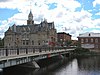 More images | |
| Carpenter's Shop | Ottawa (River Ward) ON | 45°23′2″N 75°42′54″W / 45.38389°N 75.71500°W / 45.38389; -75.71500 (Carpenter's Shop) | Federal (9604) | Q24046202 |  More images |
| CBC Building | 1500 Bronson Avenue Ottawa (Confederation Heights) ON | 45°22′42″N 75°41′14″W / 45.3784°N 75.6873°W / 45.3784; -75.6873 (CBC Building) | Federal (1865) | 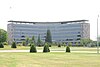 More images | |
| CEF, Horticulture Building, No. 74 | 74 Central Experimental Farm Ottawa (River Ward) ON | 45°23′27″N 75°42′23″W / 45.3907°N 75.7065°W / 45.3907; -75.7065 (CEF, Horticulture Building, No. 74) | Federal (4692) |  More images | |
| Central Chambers | Ottawa (Downtown Ottawa) ON | 45°25′24″N 75°41′43″W / 45.42333°N 75.69528°W / 45.42333; -75.69528 (Central Chambers) | Federal (2857) | Q5060536 | 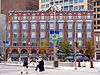 More images |
| Centretown Heritage Conservation District | south of Parliament Hill, north of Queensway corridor, and west of the Rideau Canal Ottawa (Centretown) ON | 45°24′53″N 75°41′28″W / 45.4146°N 75.691°W / 45.4146; -75.691 (Centretown Heritage Conservation District) | Ottawa (Centretown) municipality (8439) | 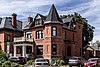 More images | |
| Cereal Barn | Ottawa (River Ward) ON | 45°23′17″N 75°42′32″W / 45.38806°N 75.70889°W / 45.38806; -75.70889 (Cereal Barn) | Federal (14830) | Q24046225 | 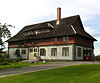 More images |
| Cereal Crops Building | CEF campus Building 75 Ottawa ON | 45°23′21″N 75°42′32″W / 45.3892°N 75.7088°W / 45.3892; -75.7088 (Cereal Crops Building) | Federal (11056) | 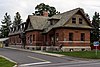 More images | |
| Service Building | CEF campus Building 56 Ottawa ON | 45°23′21″N 75°42′34″W / 45.3891°N 75.7094°W / 45.3891; -75.7094 (Service Building) | Federal (4658) |  | |
| K.W. Neatby Building | Ottawa (River Ward) ON | 45°23′33″N 75°43′0″W / 45.39250°N 75.71667°W / 45.39250; -75.71667 (K.W. Neatby Building) | Federal (4673) | Q6323030 | 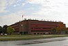 More images |
| Chemical Radioactive Ores Building | 555 Booth Street Ottawa (Glebe Annex) ON | 45°24′08″N 75°42′22″W / 45.4023°N 75.7061°W / 45.4023; -75.7061 (Chemical Radioactive Ores Building) | Federal (9828) | Upload Photo | |
| Commercial Building | 13-15 Clarence Street Ottawa ON | 45°25′42″N 75°41′42″W / 45.4282°N 75.6950°W / 45.4282; -75.6950 (Commercial Building (13-15 Clarence Street)) | Federal (4726) | Upload Photo | |
| Commercial Building | 461-456 Sussex Drive Ottawa ON | 45°25′42″N 75°41′44″W / 45.4282°N 75.6956°W / 45.4282; -75.6956 (Commercial Building (461-465 Sussex Drive)) | Federal (11408) |  | |
| Commercial Building | 457-459 Sussex Drive Ottawa (Byward Market) ON | 45°25′42″N 75°41′44″W / 45.4283°N 75.6955°W / 45.4283; -75.6955 (Commercial Building (457-459 Sussex Drive)) | Federal (4715) |  | |
| Confederation Building | 229 Wellington Street (Downtown) Ottawa ON | 45°25′19″N 75°42′10″W / 45.422°N 75.7028°W / 45.422; -75.7028 (Confederation Building) | Federal (3586) | 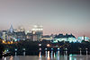 More images | |
| Confederation Square | Ottawa (Downtown) ON | 45°25′26″N 75°41′44″W / 45.42389°N 75.69556°W / 45.42389; -75.69556 (Confederation Square) | Federal (12073) | Q4365607 | 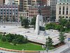 More images |
| Connaught Building | 550 Sussex Drive Ottawa (Byward Market) ON | 45°25′37″N 75°41′43″W / 45.427°N 75.6952°W / 45.427; -75.6952 (Connaught Building) | Federal (4029, (4165) | 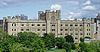 More images | |
| Dairy Technology Annex | Building 57, Central Experimental Farm Ottawa (River Ward) ON | 45°23′02″N 75°42′54″W / 45.384°N 75.715°W / 45.384; -75.715 (Dairy Technology Annex) | Federal (4637) |  More images | |
| Defensible Lockmaster's House | at the top of the Hartwell Locks Ottawa (River Ward) ON | 45°23′02″N 75°42′00″W / 45.384°N 75.7°W / 45.384; -75.7 (Defensible Lockmaster's House) | Federal (11055) |  More images | |
| Store House | Hartwell Locks Ottawa (River Ward) ON | 45°23′03″N 75°42′03″W / 45.3841°N 75.7007°W / 45.3841; -75.7007 (Store House) | Federal (11054) | Upload Photo | |
| Dominion Observatory | Central Experimental Farm, bounded by Carling Avenue and Observatory Drive Ottawa (River Ward) ON | 45°23′37″N 75°42′51″W / 45.3936°N 75.7143°W / 45.3936; -75.7143 (Dominion Observatory) | Federal (4376) |  More images | |
| Dover Building | 185-187 Sparks Street Ottawa (Downtown) ON | 45°25′18″N 75°42′01″W / 45.4218°N 75.7004°W / 45.4218; -75.7004 (Dover Building) | Federal (4643) | 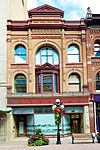 More images | |
| Drill Hall | 1 Cartier Square Ottawa ON | 45°25′18″N 75°41′21″W / 45.4217°N 75.6892°W / 45.4217; -75.6892 (Drill Hall) | Federal (15942) |  More images | |
| Earnscliffe | Ottawa (Lower Town) ON | 45°26′15″N 75°41′56″W / 45.43750°N 75.69889°W / 45.43750; -75.69889 (Earnscliffe) | Federal (12684) | Q5326955 |  More images |
| East Memorial Building | 284 Wellington Street Ottawa (Downtown) ON | 45°25′12″N 75°42′17″W / 45.42°N 75.7048°W / 45.42; -75.7048 (East Memorial Building) | Federal (9541) |  More images | |
| EMR Complex: Fuel Testing Laboratory | 562 Booth Street Ottawa (Glebe Annex) ON | 45°24′07″N 75°42′23″W / 45.4019°N 75.7063°W / 45.4019; -75.7063 (EMR Complex: Fuel Testing Laboratory) | Federal (4666) |  More images | |
| Energy, Mines and Resources Complex, Ore Dressing Laboratory | 552 Booth Street Ottawa (Glebe Annex) ON | 45°14′56″N 75°25′21″W / 45.249°N 75.4225°W / 45.249; -75.4225 (Energy, Mines and Resources Complex, Ore Dressing Laboratory) | Federal (4667) |  More images | |
| Engineering Research Building | Central Experimental Farm Ottawa (River Ward) ON | 45°23′18″N 75°42′40″W / 45.3883°N 75.711°W / 45.3883; -75.711 (Engineering Research Building) | Federal (9505) |  More images | |
| First Avenue Public School | 73 First Avenue Ottawa (The Glebe) ON | 45°24′22″N 75°41′07″W / 45.4061°N 75.6852°W / 45.4061; -75.6852 (First Avenue Public School) | Ottawa (The Glebe) municipality (10299) | 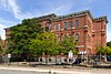 More images | |
| Forintek Building | 800 Montreal Road Ottawa (Rideau-Rockcliffe Ward) ON | 45°26′39″N 75°38′02″W / 45.4441°N 75.634°W / 45.4441; -75.634 (Forintek Building) | Federal (4659) | Upload Photo | |
| Former Archives Building and former War Museum | Ottawa (Lower Town) ON | 45°25′50″N 75°41′55″W / 45.43056°N 75.69861°W / 45.43056; -75.69861 (Former Archives Building) | Federal (3462, (13220) | Q5570166 | 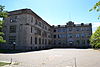 More images |
| Former Geological Survey of Canada Building | Ottawa (Byward Market) ON | 45°25′35″N 75°41′38″W / 45.42639°N 75.69389°W / 45.42639; -75.69389 (Former Geological Survey of Canada Building) | Federal (4649, (1142) | Q15218037 | 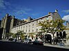 More images |
| Former NCC Building (demolished) | 401 Lebreton Street Ottawa (Glebe Annex) ON | 45°24′01″N 75°42′09″W / 45.4002°N 75.7025°W / 45.4002; -75.7025 (Former NCC Building (demolished)) | Federal (4661) | Upload Photo | |
| Former Ottawa City Hall | 111 Sussex Drive Ottawa (Green Island) ON | 45°26′23″N 75°41′38″W / 45.4398°N 75.694°W / 45.4398; -75.694 (Former Ottawa City Hall) | Federal (6629) |  More images | |
| Former U.S. Embassy | 100 Wellington Street Ottawa (Downtown) ON | 45°25′24″N 75°41′54″W / 45.4232°N 75.6984°W / 45.4232; -75.6984 (Former U.S. Embassy) | Federal (15144) | 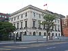 More images | |
| Fraser School House | 62 John Street Ottawa (New Edinburgh) ON | 45°26′33″N 75°41′36″W / 45.4425°N 75.6932°W / 45.4425; -75.6932 (Fraser School House) | Federal (4694) |  More images | |
| Fry House | 4148 Donnelly Drive Ottawa (Burritts Rapids) ON | 44°59′27″N 75°46′28″W / 44.9909°N 75.7745°W / 44.9909; -75.7745 (Fry House) | Ottawa (Burritts Rapids) municipality (15269) | Upload Photo | |
| Geological Survey of Canada Building | 601 Booth Street Ottawa (Glebe Annex) ON | 45°23′59″N 75°42′20″W / 45.3998°N 75.7056°W / 45.3998; -75.7056 (Geological Survey of Canada Building) | Federal (11135) | Upload Photo | |
| George Sparks House | 936-940 River Road Ottawa (Manotick) ON | 45°14′12″N 75°41′09″W / 45.2368°N 75.6859°W / 45.2368; -75.6859 (George Sparks House) | Federal (4630) | Upload Photo | |
| Gilroy Farm | 7406 Gilroy Road Ottawa (Burritts Rapids) ON | 44°58′09″N 75°49′43″W / 44.9693°N 75.8285°W / 44.9693; -75.8285 (Gilroy Farm) | Ottawa (Burritts Rapids) municipality (10300) | Upload Photo | |
| Hangar H 11 / VIP Reception Building | Ottawa International Airport Ottawa (Gloucester-Southgate Ward) ON | 45°19′N 75°40′W / 45.32°N 75.66°W / 45.32; -75.66 (Hangar H 11 / VIP Reception Building) | Federal (2740) | Upload Photo | |
| Hangar H 14 | Ottawa International Airport Ottawa (Gloucester-Southgate Ward) ON | 45°19′N 75°40′W / 45.32°N 75.66°W / 45.32; -75.66 (Hangar H 14) | Federal (2751) | Upload Photo | |
| Health Care Centre | Valour Drive Ottawa (Riverview) ON | 45°24′06″N 75°39′33″W / 45.4016°N 75.6593°W / 45.4016; -75.6593 (Health Care Centre) | Federal (1889) | Upload Photo | |
| Heritage House (Building 54) | Central Experimental Farm National Historic Site Ottawa (River Ward) ON | 45°23′22″N 75°42′39″W / 45.38946°N 75.71095°W / 45.38946; -75.71095 (Heritage House (Building 54)) | Federal (9612) |  More images | |
| Heritage House, No. 60 | Central Experimental Farm Ottawa (River Ward) ON | 45°23′25″N 75°42′31″W / 45.3904°N 75.7085°W / 45.3904; -75.7085 (Heritage House, No. 60) | Federal (4711) | 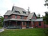 More images | |
| Hollywood Parade | 103 James Street Ottawa ON | 45°24′42″N 75°41′55″W / 45.4118°N 75.6986°W / 45.4118; -75.6986 (Hollywood Parade) | Ontario (18640) | Upload Photo | |
| Hope Building | 61-63 Sparks Street Ottawa (Downtown) ON | 45°25′25″N 75°41′48″W / 45.4235°N 75.6966°W / 45.4235; -75.6966 (Hope Building) | Federal (4632) |  More images | |
| Horticulture Building | Building 55, Central Experimental Farm Ottawa (River Ward) ON | 45°23′20″N 75°42′40″W / 45.389°N 75.711°W / 45.389; -75.711 (Horticulture Building) | Federal (4653) |  More images | |
| Industrial Minerals and Ceramics | 405 Rochester Street Ottawa (Glebe Annex) ON | 45°24′09″N 75°42′28″W / 45.4025°N 75.7077°W / 45.4025; -75.7077 (Industrial Minerals and Ceramics) | Federal (4671) |  More images | |
| Jeanne D'Arc Institute | 493 Sussex Drive Ottawa (Byward Market) ON | 45°25′40″N 75°41′42″W / 45.4277°N 75.695°W / 45.4277; -75.695 (Jeanne D'Arc Institute) | Federal (4647) |  | |
| John R. Booth Residence National Historic Site | 252 Metcalfe Street Ottawa (Centretown) ON | 45°24′59″N 75°41′32″W / 45.4164°N 75.6922°W / 45.4164; -75.6922 (John R. Booth Residence National Historic Site) | Federal (12018) |  More images | |
| Justice Building | 294 Wellington Street Ottawa (Downtown) ON | 45°25′17″N 75°42′14″W / 45.4215°N 75.7038°W / 45.4215; -75.7038 (Justice Building) | Federal (4688) |  More images | |
| La Salle Academy | 373 Sussex Drive Ottawa (Lower Town) ON | 45°15′06″N 75°25′19″W / 45.2518°N 75.4219°W / 45.2518; -75.4219 (La Salle Academy) | Federal (3563) | 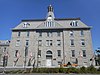 More images | |
| Laboratory Services Building No. 22 | Central Experimental Farm Ottawa (River Ward) ON | 45°23′31″N 75°43′08″W / 45.3919°N 75.7188°W / 45.3919; -75.7188 (Laboratory Services Building No. 22) | Federal (4655) |  | |
| Langevin Block | 62 Wellington Street Ottawa (Downtown) ON | 45°25′25″N 75°41′51″W / 45.4237°N 75.6974°W / 45.4237; -75.6974 (Langevin Block) | Federal (4031) | 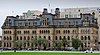 | |
| Langevin Block National Historic Site | 80 Wellington Street Ottawa (Downtown) ON | 45°25′25″N 75°41′50″W / 45.4235°N 75.6972°W / 45.4235; -75.6972 (Langevin Block National Historic Site) | Federal (14127) |  More images | |
| Larocque-Lafortune College | 445-447 Sussex Drive Ottawa (Byward Market) ON | 45°25′43″N 75°41′45″W / 45.4286°N 75.6957°W / 45.4286; -75.6957 (Larocque-Lafortune College) | Federal (4716) |  More images | |
| Laurier House | 335 Laurier Avenue East Ottawa (Sandy Hill) ON | 45°25′39″N 75°40′40″W / 45.4275°N 75.6779°W / 45.4275; -75.6779 (Laurier House) | Federal (4038, (7634) |  More images | |
| Lester B. Pearson Building | 125 Sussex Drive Ottawa ON | 45°26′14″N 75°41′46″W / 45.4371°N 75.6962°W / 45.4371; -75.6962 (Lester B. Pearson Building) | Federal (19637) | 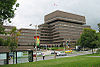 More images | |
| Lindsay House | 6722 Rideau Valley Drive South Ottawa (Kars) ON | 45°09′01″N 75°38′51″W / 45.1503°N 75.6474°W / 45.1503; -75.6474 (Lindsay House) | Ottawa (Kars) municipality (10302) | Upload Photo | |
| Lisgar Collegiate Institute | 29 Lisgar Street Ottawa (Golden Triangle) ON | 45°25′13″N 75°41′20″W / 45.4204°N 75.689°W / 45.4204; -75.689 (Lisgar Collegiate Institute) | Ottawa (Golden Triangle) municipality (15277) | 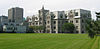 More images | |
| Lock Office | upper end of the Ottawa Locks Ottawa (Downtown) ON | 45°25′30″N 75°41′45″W / 45.4249°N 75.6958°W / 45.4249; -75.6958 (Lock Office) | Federal (11088) |  | |
| Lowertown West Heritage Conservation District | North of the Byward Market, south of the Ottawa River and east of the Rideau Canal Ottawa (Lowertown) ON | 45°25′59″N 75°41′38″W / 45.433°N 75.694°W / 45.433; -75.694 (Lowertown West Heritage Conservation District) | Ottawa (Lowertown) municipality (8446) |  More images | |
| Machine Shop (#4) | Observatory Campus, Central Experimental Farm Ottawa (River Ward) ON | 45°23′02″N 75°42′54″W / 45.384°N 75.715°W / 45.384; -75.715 (Machine Shop (#4)) | Federal (4701) | Upload Photo | |
| MacKay Castle | 1 Sussex Drive Ottawa (New Edinburgh) ON | 45°26′41″N 75°41′29″W / 45.444611°N 75.691457°W / 45.444611; -75.691457 (MacKay Castle) | Federal (4302) |  More images | |
| Main Dairy Barn | Building 88 Central Experimental Farm Ottawa (River Ward) ON | 45°23′19″N 75°42′37″W / 45.3886°N 75.7104°W / 45.3886; -75.7104 (Main Dairy Barn) | Federal (3460) | 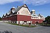 More images | |
| Main Greenhouse Range | Central Experimental Farm Ottawa (River Ward) ON | 45°23′25″N 75°42′43″W / 45.3902°N 75.712°W / 45.3902; -75.712 (Main Greenhouse Range) | Federal (4670) |  More images | |
| Maintenance Building | Major's Hill Park Ottawa (Byward Market) ON | 45°25′42″N 75°41′56″W / 45.4283°N 75.6989°W / 45.4283; -75.6989 (Maintenance Building) | Federal (9947) | 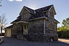 More images | |
| Manotick United Church | 5567 Manotick Main Street Ottawa (Manotick) ON | 45°13′27″N 75°40′57″W / 45.2242°N 75.6826°W / 45.2242; -75.6826 (Manotick United Church) | Ottawa (Manotick) municipality (10308) | 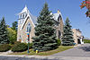 More images | |
| Mansfield Building | 481 Sussex Drive Ottawa (Byward Market) ON | 45°25′40″N 75°41′42″W / 45.4277°N 75.695°W / 45.4277; -75.695 (Mansfield Building) | Federal (4645) |  | |
| Maplelawn | 529 Richmond Road Ottawa (Westboro) ON | 45°23′17″N 75°45′41″W / 45.3881°N 75.7614°W / 45.3881; -75.7614 (Maplelawn) | Federal (15836) |  More images | |
| Maplelawn & Gardens National Historic Site | 529 Richmond Road Ottawa (Westboro) ON | 45°23′18″N 75°45′42″W / 45.3883°N 75.7617°W / 45.3883; -75.7617 (Maplelawn & Gardens National Historic Site) | Federal (16461) | 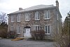 More images | |
| Marlborough Township Office | 3048 Pierce Road Ottawa (Malakoff) ON | 45°05′30″N 75°45′26″W / 45.0916°N 75.7571°W / 45.0916; -75.7571 (Marlborough Township Office) | Ottawa (Malakoff) municipality (10309) | Upload Photo | |
| Marshall Building | 14 Metcalfe Street Ottawa (Downtown) ON | 45°25′23″N 75°41′52″W / 45.4231°N 75.6978°W / 45.4231; -75.6978 (Marshall Building) | Federal (4718) | Upload Photo | |
| May Building | 489 Sussex Drive Ottawa (Byward Market) ON | 45°25′39″N 75°41′42″W / 45.4276°N 75.6949°W / 45.4276; -75.6949 (May Building) | Federal (4648) |  | |
| Miller's Oven | 1137 Mill Street Ottawa (Manotick) ON | 45°13′34″N 75°41′02″W / 45.2262°N 75.684°W / 45.2262; -75.684 (Miller's Oven) | Ottawa (Manotick) municipality (10310) | 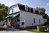 More images | |
| Monastère du Précieux Sang | 774 Echo Drive Ottawa (Old Ottawa South) ON | 45°23′54″N 75°40′44″W / 45.3982°N 75.679°W / 45.3982; -75.679 (Monastère du Précieux Sang) | Ottawa (Old Ottawa South) municipality (10311) | Upload Photo | |
| Mutchmor Public School | 185 Fifth Avenue Ottawa (The Glebe) ON | 45°24′03″N 75°41′25″W / 45.4008°N 75.6904°W / 45.4008; -75.6904 (Mutchmor Public School) | Ottawa (The Glebe) municipality (18490) | 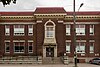 More images | |
| National Arts Centre National Historic Site | 53 Elgin Street Ottawa (Downtown Ottawa) ON | 45°25′25″N 75°41′36″W / 45.4235°N 75.6934°W / 45.4235; -75.6934 (National Arts Centre National Historic Site) | Federal (9091) |  More images | |
| National Press Building | 150 Wellington St. / Sparks Street Ottawa (Downtown) ON | 45°25′20″N 75°42′01″W / 45.4223°N 75.7003°W / 45.4223; -75.7003 (National Press Building) | Federal (4690) |  More images | |
| National Research Council Canada Laboratories | 100 Sussex Drive Ottawa (Lowertown) ON | 45°26′19″N 75°41′51″W / 45.4386°N 75.6976°W / 45.4386; -75.6976 (National Research Council Canada Laboratories) | Federal (4030) | 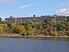 More images | |
| National Research Council of Canada, Building M-20 | 1200 Montreal Road Ottawa (Rideau-Rockcliffe Ward) ON | 45°26′51″N 75°37′12″W / 45.4476°N 75.6201°W / 45.4476; -75.6201 (National Research Council of Canada, Building M-20) | Federal (10794) | Upload Photo | |
| North Gower Old Town Hall | 6581 Fourth Line Road Ottawa (North Gower) ON | 45°07′58″N 75°43′04″W / 45.1327°N 75.7177°W / 45.1327; -75.7177 (North Gower Old Town Hall) | Ottawa (North Gower) municipality (10312) | Upload Photo | |
| Nutrition Building | Central Experimental Farm Ottawa (River Ward) ON | 45°23′25″N 75°42′30″W / 45.3902°N 75.7082°W / 45.3902; -75.7082 (Nutrition Building) | Federal (4709) | 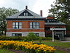 More images | |
| Observatory House | Central Experimental Farm Ottawa (River Ward) ON | 45°23′38″N 75°42′48″W / 45.3939°N 75.7132°W / 45.3939; -75.7132 (Observatory House) | Federal (4704) | 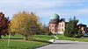 | |
| Office Building | 35 George Street Ottawa (Byward Market) ON | 45°25′37″N 75°41′35″W / 45.427°N 75.6931°W / 45.427; -75.6931 (Office Building (35 George Street)) | Federal (4717) | Upload Photo | |
| Office Building | 17-19 York Street Ottawa ON | 45°25′40″N 75°41′39″W / 45.4277°N 75.6943°W / 45.4277; -75.6943 (Office Building (17-19 York Street)) | Federal (4719) | Upload Photo | |
| Official Guest Residence | 7 Rideau Gate Ottawa (New Edinburgh) ON | 45°26′39″N 75°41′32″W / 45.4441°N 75.6921°W / 45.4441; -75.6921 (Official Guest Residence) | Federal (4650) | 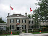 More images | |
| Ore Dressing Laboratory (550 Booth Street) | 552 Booth Street Ottawa (Glebe Annex) ON | 45°24′08″N 75°42′23″W / 45.4021°N 75.7065°W / 45.4021; -75.7065 (Ore Dressing Laboratory (550 Booth Street)) | Federal (4665) | Upload Photo | |
| Ottawa Electric Railway Company Steam Plant | Middle Street Ottawa (Victoria Island) ON | 45°25′11″N 75°42′58″W / 45.4196°N 75.716°W / 45.4196; -75.716 (Ottawa Electric Railway Company Steam Plant) | Federal (4714) | Upload Photo | |
| Ottawa Hydro Generating Station No. 2 | Mill Street Ottawa (Victoria Island) ON | 45°25′09″N 75°42′49″W / 45.4193°N 75.7137°W / 45.4193; -75.7137 (Ottawa Hydro Generating Station No. 2) | Federal (4360) |  More images | |
| Parkdale Fire Station | 424 Parkdale Avenue Ottawa (Wellington Street West) ON | 45°23′59″N 75°43′44″W / 45.3998°N 75.7289°W / 45.3998; -75.7289 (Parkdale Fire Station) | Ottawa (Wellington Street West) municipality (1199) |  More images | |
| Parliament Hill | Ottawa (Downtown) ON | 45°25′29″N 75°41′58″W / 45.42472°N 75.69944°W / 45.42472; -75.69944 (Parliament Hill) | Federal (17943, (18470) | Q1589289 |  More images |
| Centre Block | Ottawa (Downtown) ON | 45°25′30″N 75°41′59″W / 45.42500°N 75.69972°W / 45.42500; -75.69972 (Parliament Hill (Centre Block)) | Federal (4675) | Q5062237 |  More images |
| East Block | Ottawa (Downtown) ON | 45°25′29″N 75°41′51″W / 45.42472°N 75.69750°W / 45.42472; -75.69750 (Parliament Hill (East Block)) | Federal (4680) | Q5327883 | 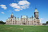 More images |
| Library of Parliament | Ottawa (Downtown) ON | 45°25′32″N 75°42′1″W / 45.42556°N 75.70028°W / 45.42556; -75.70028 (Library of Parliament) | Federal (4679) | Q1125633 |  More images |
| West Block | Ottawa (Downtown) ON | 45°25′24″N 75°42′2″W / 45.42333°N 75.70056°W / 45.42333; -75.70056 (Parliament Hill (West Block)) | Federal (4681) | Q7984482 | 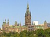 More images |
| Patterson Creek Pavilion | Linden Terrace Ottawa (The Glebe) ON | 45°24′29″N 75°40′57″W / 45.4081°N 75.6825°W / 45.4081; -75.6825 (Patterson Creek Pavilion) | Federal (4677) |  More images | |
| Pavilion A | 1495 Heron Road Ottawa (Alta Vista) ON | 45°22′52″N 75°39′10″W / 45.3812°N 75.6527°W / 45.3812; -75.6527 (Pavilion A) | Federal (13968) | Upload Photo | |
| Pavilion B | 1495 Heron Road Ottawa (Alta Vista) ON | 45°22′53″N 75°39′10″W / 45.3813°N 75.6527°W / 45.3813; -75.6527 (Pavilion B) | Federal (13043) | Upload Photo | |
| Pavilion C at the Federal Study Centre | 1495 Heron Road Ottawa (Alta Vista) ON | 45°22′53″N 75°39′10″W / 45.3814°N 75.6527°W / 45.3814; -75.6527 (Pavilion C at the Federal Study Centre) | Federal (15841) | Upload Photo | |
| Pavilion D at the Federal Study Centre | 1495 Heron Road Ottawa (Alta Vista) ON | 45°22′53″N 75°39′10″W / 45.3815°N 75.6527°W / 45.3815; -75.6527 (Pavilion D at the Federal Study Centre) | Federal (15842) | Upload Photo | |
| Pavilion E at the Federal Study Centre | 1495 Heron Road Ottawa (Alta Vista) ON | 45°22′54″N 75°39′10″W / 45.3816°N 75.6527°W / 45.3816; -75.6527 (Pavilion E at the Federal Study Centre) | Federal (15843) | Upload Photo | |
| Pavilion F at the Federal Study Centre | 1495 Heron Road Ottawa (Alta Vista) ON | 45°22′53″N 75°39′09″W / 45.3814°N 75.6525°W / 45.3814; -75.6525 (Pavilion F at the Federal Study Centre) | Federal (15844) | Upload Photo | |
| Pavilion H at the Federal Study Centre | 1495 Heron Road Ottawa (Alta Vista) ON | 45°22′53″N 75°39′09″W / 45.3814°N 75.6526°W / 45.3814; -75.6526 (Pavilion H at the Federal Study Centre) | Federal (15846) | Upload Photo | |
| Pavilion I at the Federal Study Centre | 1495 Heron Road Ottawa (Alta Vista) ON | 45°22′53″N 75°39′10″W / 45.3814°N 75.6528°W / 45.3814; -75.6528 (Pavilion I at the Federal Study Centre) | Federal (15847) | Upload Photo | |
| Pavilion J at the Federal Study Centre | 1495 Heron Road Ottawa (Alta Vista) ON | 45°22′53″N 75°39′10″W / 45.3814°N 75.6529°W / 45.3814; -75.6529 (Pavilion J at the Federal Study Centre) | Federal (15854) | Upload Photo | |
| Pavilion K at the Federal Study Centre | 1495 Heron Road Ottawa (Alta Vista) ON | 45°22′53″N 75°39′09″W / 45.3813°N 75.6525°W / 45.3813; -75.6525 (Pavilion K at the Federal Study Centre) | Federal (15855) | Upload Photo | |
| Pavilion L at the Federal Study Centre | 1495 Heron Road Ottawa (Alta Vista) ON | 45°22′53″N 75°39′09″W / 45.3813°N 75.6526°W / 45.3813; -75.6526 (Pavilion L at the Federal Study Centre) | Federal (15857) | Upload Photo | |
| Photo Equatorial Building | Central Experimental Farm Ottawa (River Ward) ON | 45°23′36″N 75°42′50″W / 45.3934°N 75.714°W / 45.3934; -75.714 (Photo Equatorial Building) | Federal (4378) |  More images | |
| Physical Metallurgy Laboratory, Building A | 568 Booth Street Ottawa (Glebe Annex) ON | 45°24′05″N 75°42′22″W / 45.4015°N 75.7061°W / 45.4015; -75.7061 (Physical Metallurgy Laboratory, Building A) | Federal (4698) | Upload Photo | |
| Physical Metallurgy Laboratory, Building B | 568 Booth Street Ottawa (Glebe Annex) ON | 45°24′05″N 75°42′22″W / 45.4013°N 75.7062°W / 45.4013; -75.7062 (Physical Metallurgy Laboratory, Building B) | Federal (4699) | Upload Photo | |
| Physical Metallurgy Laboratory, Building C | 568 Booth Street Ottawa (Glebe Annex) ON | 45°24′06″N 75°42′23″W / 45.4016°N 75.7065°W / 45.4016; -75.7065 (Physical Metallurgy Laboratory, Building C) | Federal (4702) | Upload Photo | |
| Physical Metallurgy Laboratory, Building D | 568 Booth Street Ottawa (Glebe Annex) ON | 45°24′04″N 75°42′24″W / 45.4011°N 75.7067°W / 45.4011; -75.7067 (Physical Metallurgy Laboratory, Building D) | Federal (4705) | Upload Photo | |
| Physical Metallurgy Laboratory, Building E | 568 Booth Street Ottawa (Glebe Annex) ON | 45°24′05″N 75°42′25″W / 45.4014°N 75.707°W / 45.4014; -75.707 (Physical Metallurgy Laboratory, Building E) | Federal (4708) | Upload Photo | |
| Postal Station B | 47-59 Sparks Street Ottawa (Downtown) ON | 45°25′25″N 75°41′47″W / 45.4236°N 75.6963°W / 45.4236; -75.6963 (Postal Station B) | Federal (16388) |  More images | |
| Potting Shed | CEF campus Building 77 Ottawa ON | 45°23′17″N 75°42′35″W / 45.3881°N 75.7097°W / 45.3881; -75.7097 (Potting Shed) | Federal (11345) | Upload Photo | |
| Prime Minister's Residence | 24 Sussex Drive Ottawa (New Edinburgh) ON | 45°26′40″N 75°41′38″W / 45.4444°N 75.6938°W / 45.4444; -75.6938 (Prime Minister's Residence) | Federal (4298) | 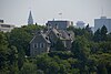 More images | |
| Public Archives and National Library Building | 395 Wellington Street Ottawa (Downtown) ON | 45°25′11″N 75°42′28″W / 45.4196°N 75.7078°W / 45.4196; -75.7078 (Public Archives and National Library Building) | Federal (13053) |  | |
| Public Grounds of the Parliament Buildings National Historic Site | Wellington St Ottawa (Downtown) ON | 45°25′29″N 75°41′58″W / 45.4246°N 75.6995°W / 45.4246; -75.6995 (Public Grounds of the Parliament Buildings National Historic Site) | Federal (17422) |  | |
| Refreshment Stand | Hogs Back Ottawa (River Ward) ON | 45°22′18″N 75°41′46″W / 45.3716°N 75.696°W / 45.3716; -75.696 (Refreshment Stand) | Federal (4664) | 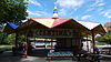 More images | |
| Residence | 9 Rideau Gate Street Ottawa (New Edinburgh) ON | 45°26′37″N 75°41′12″W / 45.4436°N 75.6867°W / 45.4436; -75.6867 (Residence) | Federal (9656) | Upload Photo | |
| Revere Hotel | 475 Sussex Drive Ottawa (Byward Market) ON | 45°25′40″N 75°41′43″W / 45.4279°N 75.6952°W / 45.4279; -75.6952 (Revere Hotel) | Federal (4644) | 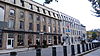 More images | |
| Rideau Cottage | Ottawa (New Wdinburgh) ON | 45°26′37.291″N 75°40′57.857″W / 45.44369194°N 75.68273806°W / 45.44369194; -75.68273806 (Rideau Cottage) | Federal (4652) | Q21209442 | 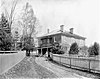 More images |
| Rideau Hall and Landscaped Grounds National Historic Site | 1 Sussex Drive Ottawa (New Edinburgh) ON | 45°26′41″N 75°41′30″W / 45.4448°N 75.6918°W / 45.4448; -75.6918 (Rideau Hall and Landscaped Grounds National Historic Site) | Federal (7692) | | |
| Rideau Hall, Cricket Clubhouse | 1 Sussex Drive Ottawa (New Edinburgh) ON | 45°26′32″N 75°41′13″W / 45.4422°N 75.6869°W / 45.4422; -75.6869 (Rideau Hall, Cricket Clubhouse) | Federal (4662) | Upload Photo | |
| Rideau Hall, Dairy Building | 1 Sussex Drive Ottawa (New Edinburgh) ON | 45°26′38″N 75°41′13″W / 45.444°N 75.687°W / 45.444; -75.687 (Rideau Hall, Dairy Building) | Federal (4657) | Upload Photo | |
| Rideau Hall, Gasometer | 1 Sussex Drive Ottawa (New Edinburgh) ON | 45°26′39″N 75°41′13″W / 45.4442°N 75.687°W / 45.4442; -75.687 (Rideau Hall, Gasometer) | Federal (4656) | 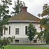 | |
| Rideau Hall, Gate Lodge | 1 Sussex Drive Ottawa (New Edinburgh) ON | 45°26′41″N 75°41′30″W / 45.4446°N 75.6916°W / 45.4446; -75.6916 (Rideau Hall, Gate Lodge) | Federal (4654) |  | |
| Rideau Hall, Main Gate | 1 Sussex Drive Ottawa (New Edinburgh) ON | 45°26′40″N 75°41′30″W / 45.4445°N 75.6918°W / 45.4445; -75.6918 (Rideau Hall, Main Gate) | Federal (4304) | 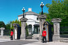 More images | |
| Rideau Hall, Secondary gates and fences | 1 Sussex Drive Ottawa (New Edinburgh) ON | 45°26′38″N 75°41′15″W / 45.444°N 75.6875°W / 45.444; -75.6875 (Rideau Hall, Secondary gates and fences) | Federal (9815) |  | |
| Rochon Residence | 138 St. Patrick Street Ottawa (Byward Market) ON | 45°25′45″N 75°41′47″W / 45.4293°N 75.6964°W / 45.4293; -75.6964 (Rochon Residence) | Federal (4720) |  More images | |
| Rockcliffe Pavilion | Rockcliffe Parkway Ottawa (Rockcliffe Park) ON | 45°26′38″N 75°41′13″W / 45.444°N 75.687°W / 45.444; -75.687 (Rockcliffe Pavilion) | Federal (4674) | Upload Photo | |
| Royal Canadian Mint | 320 Sussex Drive Ottawa (Lowertown) ON | 45°26′04″N 75°41′57″W / 45.4344°N 75.6992°W / 45.4344; -75.6992 (Royal Canadian Mint) | Federal (9212, (3339) | 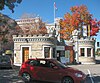 More images | |
| Royal Canadian Mounted Police Headquarters Building | 1200 Vanier Parkway Ottawa (Overbrook) ON | 45°25′10″N 75°39′33″W / 45.4195°N 75.6593°W / 45.4195; -75.6593 (Royal Canadian Mounted Police Headquarters Building) | Federal (4706) | Upload Photo | |
| Sandy Hill West Heritage Conservation District | east of the Rideau canal, south of the Byward Market and north of the University of Ottawa Ottawa (Sandy Hill) ON | 45°25′35″N 75°41′13″W / 45.4265°N 75.687°W / 45.4265; -75.687 (Sandy Hill West Heritage Conservation District) | Ottawa (Sandy Hill) municipality (8462) |  More images | |
| Saxe Building | 75 Sparks Street Ottawa (Downtown) ON | 45°25′25″N 75°41′48″W / 45.4235°N 75.6967°W / 45.4235; -75.6967 (Saxe Building) | Federal (4635) | 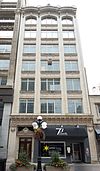 More images | |
| Scottish Ontario Chambers | 42-50 Sparks Street Ottawa (Downtown) ON | 45°25′25″N 75°41′45″W / 45.4235°N 75.6958°W / 45.4235; -75.6958 (Scottish Ontario Chambers) | Federal (4623) |  More images | |
| Seismology Survey Building | Central Experimental Farm National Historic Site Ottawa (River Ward) ON | 45°23′38″N 75°42′54″W / 45.394°N 75.7151°W / 45.394; -75.7151 (Seismology Survey Building) | Federal (4700) |  More images | |
| Geophysical Laboratory 3 | Building No. 3 at Central Experimental Farm National Historic Site Ottawa (River Ward) ON | Federal (4703) | Upload Photo | ||
| Silver Springs Farm, Barn | 3502 Richmond Road Ottawa (College Ward) ON | 45°20′02″N 75°48′54″W / 45.334°N 75.8149°W / 45.334; -75.8149 (Silver Springs Farm, Barn) | Federal (4325) |  More images | |
| Silver Springs Farm, House | 3501 Richmond Road Ottawa (College Ward) ON | 45°20′02″N 75°48′53″W / 45.3338°N 75.8148°W / 45.3338; -75.8148 (Silver Springs Farm, House) | Federal (11516) |  More images | |
| Sir Charles Tupper Building | 2250 Riverside Drive Ottawa (Billings Bridge) ON | 45°22′31″N 75°41′34″W / 45.3753°N 75.6929°W / 45.3753; -75.6929 (Sir Charles Tupper Building) | Federal (7660) |  More images | |
| Sir John Carling Building | 930 Carling Avenue Ottawa (River Ward) ON | 45°23′38″N 75°42′40″W / 45.394°N 75.711°W / 45.394; -75.711 (Sir John Carling Building) | Federal (4263) | 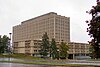 More images | |
| Sir Leonard Tilley Building | 719 Heron Road Ottawa (Confederation Heights) ON | 45°22′N 75°41′W / 45.37°N 75.69°W / 45.37; -75.69 (Sir Leonard Tilley Building) | Federal (2898) | 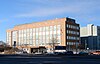 | |
| Slater Building | 177-179 Sparks Street Ottawa (Downtown) ON | 45°25′19″N 75°42′01″W / 45.4219°N 75.7002°W / 45.4219; -75.7002 (Slater Building) | Federal (4642) |  More images | |
| Small Dairy Barn | Building 95, Central Experimental Farm Ottawa (River Ward) ON | 45°23′16″N 75°42′42″W / 45.3879°N 75.7116°W / 45.3879; -75.7116 (Small Dairy Barn) | Federal (9946) | 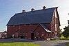 More images | |
| South Azimuth Building | Central Experimental Farm National Historic Site Ottawa (River Ward) ON | 45°23′36″N 75°42′53″W / 45.3932°N 75.7147°W / 45.3932; -75.7147 (South Azimuth Building) | Federal (4377) | 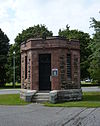 More images | |
| Sparrow Building | 489 Sussex Drive Ottawa (Byward Market) ON | 45°25′41″N 75°41′43″W / 45.428°N 75.6952°W / 45.428; -75.6952 (Sparrow Building) | Federal (4646) | Upload Photo | |
| St. Louis House | 1579 Washington Street Ottawa (Kars) ON | 45°09′02″N 75°38′48″W / 45.1506°N 75.6466°W / 45.1506; -75.6466 (St. Louis House) | Ottawa (Kars) municipality (13341) | Upload Photo | |
| Stable / Garage Recognized Federal Heritage Building | 1 Sussex Drive Ottawa (New Edinburgh) ON | 45°26′N 75°41′W / 45.44°N 75.69°W / 45.44; -75.69 (Stable / Garage Recognized Federal Heritage Building) | Federal (2734) | Upload Photo | |
| Stornoway | 541 Acacia Drive Ottawa (Rockcliffe Park) ON | 45°27′10″N 75°40′44″W / 45.4528°N 75.6788°W / 45.4528; -75.6788 (Stornoway) | Federal (4651) |  More images | |
| Supreme Court of Canada Building | 301 Wellington Street Ottawa (Downtown) ON | 45°25′19″N 75°42′20″W / 45.422°N 75.7056°W / 45.422; -75.7056 (Supreme Court of Canada Building) | Federal (3564) |  More images | |
| Swine Showcase Building No. 91 | Central Experimental Farm National Historic Site Ottawa (River Ward) ON | 45°23′16″N 75°42′36″W / 45.3878°N 75.7099°W / 45.3878; -75.7099 (Swine Showcase Building No. 91) | Federal (9601) | 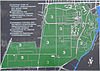 | |
| The Albion Hotel | 1 Daly Ave. Ottawa (Sandy Hill) ON | 45°25′32″N 75°41′22″W / 45.4255°N 75.6894°W / 45.4255; -75.6894 (The Albion Hotel) | Ottawa (Sandy Hill) municipality (17482) | 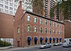 | |
| The Canada Goose Shop | 5538 Manotick Main Street Ottawa (Manotick) ON | 45°13′31″N 75°41′04″W / 45.2252°N 75.6845°W / 45.2252; -75.6845 (The Canada Goose Shop) | Ottawa (Manotick) municipality (10297) | Upload Photo | |
| The City Registry Office | 70 Nicholas Street Ottawa (Sandy Hill) ON | 45°25′30″N 75°41′21″W / 45.425°N 75.6891°W / 45.425; -75.6891 (The City Registry Office) | Ottawa (Sandy Hill) municipality (8463) |  More images | |
| The Eastman House | 6727 Lord Nelson Street Ottawa (Kars) ON | 45°09′00″N 75°38′47″W / 45.1501°N 75.6463°W / 45.1501; -75.6463 (The Eastman House) | Ottawa (Kars) municipality (15224) | Upload Photo | |
| The Grey Nuns Mother House | 9 Bruyere Street Ottawa (Lowertown) ON | 45°25′53″N 75°41′52″W / 45.4313°N 75.6979°W / 45.4313; -75.6979 (The Grey Nuns Mother House) | Ottawa (Lowertown) municipality (15271) |  | |
| The Horticulture Building | 957 Bank Street Ottawa (The Glebe) ON | 45°23′59″N 75°41′11″W / 45.3998°N 75.6865°W / 45.3998; -75.6865 (The Horticulture Building) | Ottawa (The Glebe) municipality (8445) |  More images | |
| The McCulla House | 2944 Pierce Road Ottawa (Pierces Corners) ON | 45°05′46″N 75°44′59″W / 45.0962°N 75.7497°W / 45.0962; -75.7497 (The McCulla House) | Ottawa (Pierces Corners) municipality (14206) | Upload Photo | |
| The McFadden House | 5561 Manotick Main Street Ottawa (Manotick) ON | 45°13′28″N 75°40′58″W / 45.2244°N 75.6829°W / 45.2244; -75.6829 (The McFadden House) | Ottawa (Manotick) municipality (15276) |  More images | |
| The Old Presbyterian Manse | 1130 O'Grady Street Ottawa (Manotick) ON | 45°13′31″N 75°40′55″W / 45.2254°N 75.682°W / 45.2254; -75.682 (The Old Presbyterian Manse) | Ottawa (Manotick) municipality (17481) |  | |
| Powell House | Ridge Road Ottawa (Gloucester) ON | 45°23′35″N 75°33′24″W / 45.3931°N 75.5568°W / 45.3931; -75.5568 (Powell House) | Federal (4152) | Upload Photo | |
| The Powell House | 85 Glebe Ave. Ottawa (The Glebe) ON | 45°24′21″N 75°41′16″W / 45.4059°N 75.6879°W / 45.4059; -75.6879 (The Powell House) | Ottawa (The Glebe) municipality (15267) |  More images | |
| The Pritchard House | 5559 Manotick Main Street Ottawa (Manotick) ON | 45°13′28″N 75°40′59″W / 45.2245°N 75.683°W / 45.2245; -75.683 (The Pritchard House) | Ottawa (Manotick) municipality (15273) |  More images | |
| The Thomas Craig House | 6607 Fourth Line Road Ottawa (North Gower) ON | 45°07′53″N 75°42′58″W / 45.1314°N 75.716°W / 45.1314; -75.716 (The Thomas Craig House) | Ottawa (North Gower) municipality (14207) | Upload Photo | |
| The Williams House | 1126 John Street Ottawa (Manotick) ON | 45°13′31″N 75°40′55″W / 45.2253°N 75.682°W / 45.2253; -75.682 (The Williams House) | Ottawa (Manotick) municipality (14204) |  More images | |
| Toller House | 229 Chapel Street Ottawa (Sandy Hill) ON | 45°25′45″N 75°40′47″W / 45.4293°N 75.6796°W / 45.4293; -75.6796 (Toller House) | Ottawa (Sandy Hill) municipality (17581) | 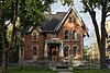 More images | |
| Union Bank Building | 128 Wellington Street Ottawa ON | 45°25′22″N 75°41′58″W / 45.4228°N 75.6995°W / 45.4228; -75.6995 (Union Bank Building) | Federal (4267) | Upload Photo | |
| Union Mission | 47-49 Daly Ave. Ottawa (Sandy Hill) ON | 45°25′35″N 75°41′15″W / 45.4263°N 75.6876°W / 45.4263; -75.6876 (Union Mission) | Ottawa (Sandy Hill) municipality (18641) |  More images | |
| Valade Residence | 142-44 St. Patrick Street Ottawa (Byward Market) ON | 45°25′46″N 75°41′45″W / 45.4295°N 75.6958°W / 45.4295; -75.6958 (Valade Residence) | Federal (4729) |  More images | |
| VIA Rail Station | 200 Tremblay Road Ottawa (Eastway Gardens) ON | 45°24′58″N 75°39′07″W / 45.416°N 75.652°W / 45.416; -75.652 (VIA Rail Station) | Federal (15815) |  More images | |
| Victoria Building | 140 Wellington Street Ottawa (Downtown) ON | 45°25′22″N 75°41′58″W / 45.4227°N 75.6995°W / 45.4227; -75.6995 (Victoria Building) | Federal (4687) |  More images | |
| Wellington Building | 180 Wellington St. / Sparks Ottawa (Downtown) ON | 45°25′18″N 75°42′03″W / 45.4218°N 75.7009°W / 45.4218; -75.7009 (Wellington Building) | Federal (3458) |  More images | |
| West Memorial Building | 344 Wellington Street Ottawa (Downtown) ON | 45°25′10″N 75°42′24″W / 45.4195°N 75.7066°W / 45.4195; -75.7066 (West Memorial Building) | Federal (4374) | | |
| Wilbrod Street Heritage Conservation District | a few blocks within Sandy Hill East, west of the Rideau River and south of Lowertown in Ottawa Ottawa (Sandy Hill) ON | 45°25′46″N 75°40′31″W / 45.4294°N 75.6753°W / 45.4294; -75.6753 (Wilbrod Street Heritage Conservation District) | Ottawa (Sandy Hill) municipality (8464) |  More images | |
| William Saunders Building | Building 49, Central Experimental Farm Ottawa (River Ward) ON | 45°23′28″N 75°42′39″W / 45.391°N 75.7108°W / 45.391; -75.7108 (William Saunders Building) | Federal (4676) |  More images | |
| Willson Carbide Mill | 1 Victoria Island Ottawa (Victoria Island) ON | 45°25′18″N 75°42′44″W / 45.4216°N 75.7122°W / 45.4216; -75.7122 (Willson Carbide Mill) | Federal (4634) | 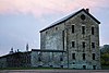 More images | |
| Burritt House | 4390 Donnelly Drive Ottawa (Burritts Rapids) ON | 44°59′03″N 75°47′44″W / 44.9841°N 75.7956°W / 44.9841; -75.7956 (Burritt House) | Ottawa (Burritts Rapids) municipality (10278) | Upload Photo | |
| The (James) Lindsay House | 6836 Rideau Valley Drive South Ottawa (Kars) ON | 45°08′45″N 75°38′47″W / 45.1459°N 75.6465°W / 45.1459; -75.6465 (The (James) Lindsay House) | Ottawa (Kars) municipality (13342) | Upload Photo | |
| Rockcliffe Park Heritage Conservation District | east of Ottawa centre within an elbow of the Ottawa River Ottawa (Rockliffe Park) ON | 45°27′N 75°41′W / 45.45°N 75.68°W / 45.45; -75.68 (Rockcliffe Park Heritage Conservation District) | Ottawa (Rockliffe Park) municipality (8460) |  | |
| 5 Blackburn Avenue | 5 Blackburn Avenue Ottawa (Sandy Hill) ON | 45°25′40″N 75°40′38″W / 45.4277°N 75.6771°W / 45.4277; -75.6771 (5 Blackburn Avenue) | Ontario (17801), Ottawa (Sandy Hill) municipality (19829) |  More images |


