Lohmühlenstraße station
Railway station in Hamburg, Germany
| Preceding station | Hamburg U-Bahn | Following station | ||
|---|---|---|---|---|
| Hauptbahnhof Süd towards Norderstedt Mitte | U1 | Lübecker Straße towards Großhansdorf or Ohlstedt | ||
Location | |
|---|---|
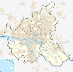  Lohmühlenstraße Location in Hamburg Show map of Hamburg Lohmühlenstraße Location in Schleswig-Holstein Show map of Schleswig-Holstein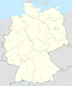 Lohmühlenstraße Location in Germany Show map of Germany Lohmühlenstraße Location in Europe Show map of Europe |
Lohmühlenstraße (German pronunciation: [loːˈmyːlɛnʃtʁaːsə]) is a public transport metro station for the rapid transit trains on the line U1 located in Hamburg, Germany in the quarter St. Georg in the Hamburg-Mitte borough.
The station is close to the St. Georg hospital and the main campus of the Hamburg University of Applied Sciences.
Station layout
The station is underground with an island platform. There are two exits at its ends. In the entrance level is a shop but no lockerboxes. No personnel is attending the station but there are ticket machines, CCTV, and emergency and information telephones.
See also
- Hamburger Verkehrsverbund (Public transport association for the Hamburg area)
- Hamburger Hochbahn (Operator of the Hamburg U-Bahn)
References
- ^ "Tarifplan" (PDF). Hamburger Verkehrsverbund. 9 December 2018. Retrieved 18 October 2019.
External links
![]() Media related to Lohmühlenstrasse (Hamburg U-Bahn station) at Wikimedia Commons
Media related to Lohmühlenstrasse (Hamburg U-Bahn station) at Wikimedia Commons
- Line and route network plans at hvv.de (in German and English)
- v
- t
- e
Rapid transit and commuter rail in Hamburg
Hamburger Verkehrsverbund (HVV) Public transport rail systems and operators in the Hamburg Metropolitan Region

- U-Bahn
- Hamburger Hochbahn
- S-Bahn
- S-Bahn Hamburg GmbH
- A-Bahn
- AKN Eisenbahn
- R-Bahn
- DB Regio
- Erixx
- evb
- Metronom
- Nordbahn
- Start

- Norderstedt Mitte

- Richtweg
- Garstedt
- Ochsenzoll
- Kiwittsmoor
- Langenhorn Nord
- Langenhorn Markt
- Fuhlsbüttel Nord
- Fuhlsbüttel
- Klein Borstel
- Ohlsdorf

- Sengelmannstraße
- Alsterdorf
- Lattenkamp
- Hudtwalckerstraße
- Kellinghusenstraße
- Klosterstern
- Hallerstraße
- Stephansplatz
- Jungfernstieg
- Meßberg
- Steinstraße
- Hauptbahnhof Süd

- Lohmühlenstraße
- Lübecker Straße
- Wartenau
- Ritterstraße
- Wandsbeker Chaussee
- Wandsbek Markt
- Straßburger Straße
- Alter Teichweg
- Wandsbek-Gartenstadt
- Trabrennbahn
- Farmsen
- Oldenfelde
- Berne
- Meiendorfer Weg
- Volksdorf
- Ohlstedt Branch: Buckhorn
- Hoisbüttel
- Ohlstedt
- Großhansdorf Branch: Buchenkamp
- Ahrensburg West
- Ahrensburg Ost
- Schmalenbeck
- Kiekut
- Großhansdorf
53°33′25″N 10°1′12″E / 53.55694°N 10.02000°E / 53.55694; 10.02000
 | This Hamburg rapid transit-related article is a stub. You can help Wikipedia by expanding it. |
- v
- t
- e
This article about a railway station in Hamburg is a stub. You can help Wikipedia by expanding it. |
- v
- t
- e


