Lokitanyala, Uganda
Place in Northern Region, Uganda
02°21′53″N 34°55′13″E / 2.36472°N 34.92028°E / 2.36472; 34.92028 Uganda
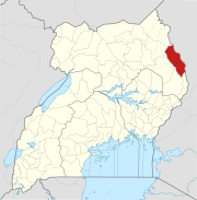
Lokitanyala, Uganda is a settlement in the Moroto District in the Northern Region of Uganda. It lies directly across from Lokitanyala, Kenya, separated by the international border between Uganda and Kenya.
Location
The settlement is in the Karamoja sub-region and is approximately 40 kilometres (25 mi), by road, southeast of Moroto, the nearest large town and the location of the district headquarters. The coordinates of Lokitanyala are 2°21'53.0"N, 34°55'13.0"E (Latitude:2.364728; Longitude:34.920284).[1]
Overview
The town is one of the end points of the 208 kilometres (129 mi) Soroti–Katakwi–Moroto–Lokitanyala Road.[2] The town is a border crossing between Uganda and neighboring Kenya.
See also
References
- ^ "Location of Lokitanyala, Moroto District, Uganda" (Map). Google Maps. Google. 19 January 2016. Retrieved 19 January 2016.
- ^ UNRA (19 January 2016). "Upcoming Projects: New Roads for Upgrade to Tarmac". Kampala: Uganda National Roads Authority (UNRA). Archived from the original on 20 January 2016. Retrieved 19 January 2016.
External links
- v
- t
- e

Capital: Moroto
sub-counties
- Bokora County
- Matheniko County
- Moroto Municipality
villages
- Moroto
- Lokitanyala
- Moroto Cement Limited
- Stanbic Bank
landmarks
02°21′53″N 34°55′13″E / 2.36472°N 34.92028°E / 2.36472; 34.92028


