Loring Colony, Montana
Census-designated place in Montana, United States
48°47′21″N 107°58′07″W / 48.78917°N 107.96861°W / 48.78917; -107.96861[1]
[2]
(2020)
59537 (Loring)
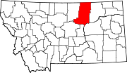
Loring Colony is a Hutterite community[3] and census-designated place (CDP) in Phillips County, Montana, United States. It is in the northwest part of the county, 7 miles (11 km) west of U.S. Route 191, less than one mile south of US-191 passes through the small unincorporated community of Loring. Via US-191, Loring Colony is 44 miles (71 km) north of Malta, the Phillips county seat.
The community was first listed as a CDP prior to the 2020 census.[2]
Demographics
| Census | Pop. | Note | %± |
|---|---|---|---|
| 2020 | 48 | — | |
| U.S. Decennial Census[4] | |||
References
- ^ "ArcGIS REST Services Directory". United States Census Bureau. Retrieved September 5, 2022.
- ^ a b c "Loring Colony Census Designated Place". Geographic Names Information System. United States Geological Survey, United States Department of the Interior.
- ^ Morton, Claudette, ed. (2010). Essential Understandings of Montana Hutterites: A Resource for Educators and Students (PDF). Montana Office of Public Instruction. p. 2. Retrieved June 14, 2021.
- ^ "Census of Population and Housing". Census.gov. Retrieved June 4, 2016.
- v
- t
- e
Municipalities and communities of Phillips County, Montana, United States
County seat: Malta
- East Malta Colony
- Landusky
- Loring Colony
- Sleeping Buffalo
- Whitewater
- Zortman
communities
‡This populated place also has portions in an adjacent county or counties
- Montana portal
- United States portal
 | This Phillips County, Montana state location article is a stub. You can help Wikipedia by expanding it. |
- v
- t
- e


