Lower and Higher Longbeak barrows


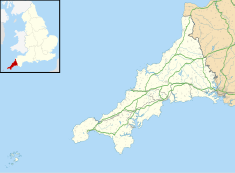
The Lower and Higher Longbeak barrows (also known as the Widemouth Bay tumulus)[1][2] are a scheduled monument located north of Widemouth Bay in Cornwall.[3][4] The two round barrows are Neolithic funerary monuments, built sometime around 2400–1500 BC.[5]
They are designated as "two bowl barrows, one 220m east of Lower Longbeak and the other 320m east of Higher Longbeak" by Historic England.[5] According to a field survey in 1977, "The southern mound measures 14m in diameter and is 1.1m high. It is steep-sided with a central hollow, possibly the result of antiquarian excavation although no details are known. The barrow has views across Widemouth Sand. The northern barrow mound is 16m in diameter and 0.7m high".[6][7][8]
They are protected under the Ancient Monuments and Archaeological Areas Act 1979.[5]
See also
References
- ^ Map, The Megalithic Portal and Megalith. "Widemouth Bay tumulus". The Megalithic Portal. Retrieved 13 November 2017.
- ^ Map, The Megalithic Portal and Megalith. "Widemouth Bay tumulus". The Megalithic Portal. Retrieved 13 November 2017.
- ^ "Higher Longbeak Barrow". www.themodernantiquarian.com. Retrieved 13 November 2017.
- ^ "Lower Longbeak Barrow". www.themodernantiquarian.com. Retrieved 13 November 2017.
- ^ a b c Historic England. "Two bowl barrows, one 220m east of Lower Longbeak and the other 320m east of Higher Longbeak, Marhamchurch (1001723)". National Heritage List for England. Retrieved 13 November 2017.
- ^ "Pastscape - Detailed Result: MONUMENT NO. 31706". www.pastscape.org.uk. Retrieved 13 November 2017.
- ^ "Pastscape - Detailed Result: MONUMENT NO. 31703". www.pastscape.org.uk. Retrieved 13 November 2017.
- ^ Field Investigators Comments F1 NJA 07-OCT-77.
External links
- PastScape Monument No's: 31703 and 31706.
- Historic England. "Details from listed building database (1001723)". National Heritage List for England. - Heritage Category: Scheduling, Location: Marhamchurch, Cornwall.
- SS 1995 0389 Tumulus (NR) Ordnance Survey
- v
- t
- e
- Cornwall Council
- Council of the Isles of Scilly
(cities in italics)
- Bodmin
- Bude
- Callington
- Camborne
- Camelford
- Falmouth
- Fowey
- Hayle
- Helston
- Hugh Town
- Launceston
- Liskeard
- Looe
- Lostwithiel
- Marazion
- Newlyn
- Newquay
- Padstow
- Penryn
- Penzance
- Porthleven
- Redruth
- St Austell
- St Blazey
- St Columb Major
- St Ives
- St Just in Penwith
- Saltash
- Stratton
- Torpoint
- Truro
- Wadebridge
See also: List of civil parishes in Cornwall
 | This article about a building or structure in Cornwall is a stub. You can help Wikipedia by expanding it. |
- v
- t
- e


