Mahalchhari Upazila
Upazila in Chittagong, Bangladesh
Mahalchari মহালছড়ি | |
|---|---|
Upazila | |
 | |
| Coordinates: 22°55.2′N 92°1.5′E / 22.9200°N 92.0250°E / 22.9200; 92.0250 | |
| Country |  Bangladesh Bangladesh |
| Division | Chittagong |
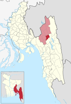
| District | Khagrachhari |
| Area | |
| • Total | 186.48 km2 (72.00 sq mi) |
| Population (2011) | |
| • Total | 42,427 |
| • Density | 230/km2 (590/sq mi) |
| Time zone | UTC+6 (BST) |
| Website | mohalchari |
Mahalchari (Bengali: মহালছড়ি) is an upazila of Khagrachari District[1] in the Division of Chittagong, Bangladesh.
Geography
Mahalchari is located at 22°55′10″N 92°01′30″E / 22.9194°N 92.0250°E / 22.9194; 92.0250. It has a total area of 186.48 km2.
Demographics
| Religions in Mahalchhari upazila (2011)[2] | ||||
|---|---|---|---|---|
| Religion | Percent | |||
| Buddhism | 62.05% | |||
| Islam | 30.18% | |||
| Hinduism | 7.11% | |||
| Christianity | 0.54% | |||
| Other or not stated | 0.12% | |||
As of the 2011 Bangladesh census, the residual Mahalchhari upazila had 9,556 households and a population of 42,427. 10,098 (23.80%) were under 10 years of age. Mahalchhari had an average literacy rate of 47.48%, compared to the national average of 51.8%, and a sex ratio of 929 females per 1000 males. 10,249 (24.16%) of the population lived in urban areas.[2] The ethnic population was 27,857 (65.66%), of which Chakma were 19,328, Marma 6,760 and Tripura 1,636.[3]
As of the 1991 Bangladesh census, Mahalchari has a population of 32,609. Males constitute 52.95% of the population, and females 47.05%. This Upazila's eighteen up population is 16,662. Mahalchari has an average literacy rate of 26.5% (7+ years), and the national average of 32.4% literate.[4]
Administration
Mahalchari Upazila is divided into five union parishads: Kayangghat, Mahalchhari, Maschhari, Mubachhari, and Sindukchhari. The union parishads are subdivided into 13 mauzas and 196 villages.[5]
Upazila Nirbahi Officer (UNO): Parveen Khanam[6]
Upazila Chairman: Bimal Kanti Chakma
Education
Schools
- APBn Ideal School and College[7][8]
- Mohalchari Government High School
- Mohalchari Girls High School
College
- Mohalchari Government College
See also
References
- ^ Mongchen Ching (2012), "Mahalchhari Upazila", in Sirajul Islam and Ahmed A. Jamal (ed.), Banglapedia: National Encyclopedia of Bangladesh (Second ed.), Asiatic Society of Bangladesh
- ^ a b "Bangladesh Population and Housing Census 2011 Zila Report – Khagrachhari" (PDF). bbs.gov.bd. Bangladesh Bureau of Statistics.
- ^ "Community Tables: Khagrachhari district" (PDF). bbs.gov.bd. Bangladesh Bureau of Statistics. 2011.
- ^ "Population Census Wing, BBS". Archived from the original on 2005-03-27. Retrieved November 10, 2006.
- ^ "District Statistics 2011: Khagrachhari" (PDF). Bangladesh Bureau of Statistics. Archived from the original (PDF) on 13 November 2014. Retrieved 14 July 2014.
- ^ উপজেলা নির্বাহী অফিসার. 2024-08-26. Archived from the original on 2024-08-26.
- ^ জঙ্গিবাদ ও মাদক দেশের প্রধান চ্যালেঞ্জ: আইজিপি. Prothom Alo (in Bengali). Retrieved 2020-07-05.
- ^ মহালছড়িতে এপিবিএন স্কুলের উদ্বোধন করলেন আইজিপি. Jago News 24 (in Bengali). Retrieved 2020-07-05.
- v
- t
- e
- Dighinala
- Khagrachhari Sadar
- Lakshmichhari
- Mahalchhari
- Matiranga
- Panchhari
- Ramgarh

- Feni
- Gumti
- R160

 | This Chittagong Division location article is a stub. You can help Wikipedia by expanding it. |
- v
- t
- e


