Maruseppu, Hokkaido
Dissolved municipality in Monbetsu district, Hokkaido, Japan
You can help expand this article with text translated from the corresponding article in Japanese. (June 2022) Click [show] for important translation instructions.
- Machine translation, like DeepL or Google Translate, is a useful starting point for translations, but translators must revise errors as necessary and confirm that the translation is accurate, rather than simply copy-pasting machine-translated text into the English Wikipedia.
- Do not translate text that appears unreliable or low-quality. If possible, verify the text with references provided in the foreign-language article.
- You must provide copyright attribution in the edit summary accompanying your translation by providing an interlanguage link to the source of your translation. A model attribution edit summary is
Content in this edit is translated from the existing Japanese Wikipedia article at [[:ja:丸瀬布町]]; see its history for attribution. - You may also add the template
{{Translated|ja|丸瀬布町}}to the talk page. - For more guidance, see Wikipedia:Translation.
Town in Hokkaido, Japan
Maruseppu 丸瀬布町 まるせっぷちょう | |
|---|---|
 | |
 Seal | |
| Country |  Japan Japan |
| Region | Hokkaido |
| Prefecture | Hokkaido |
| Subprefecture | Abashiri |
| District | Monbetsu |
| Merged | October 1, 2005 (2005-10-01) |
| Area | |
| • Total | 510.13 km2 (196.96 sq mi) |
| Population (2005) | |
| • Total | 2,019 |
| • Density | 4.0/km2 (10/sq mi) |
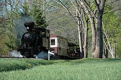
Maruseppu (丸瀬布町, Maruseppu-chō) was a town located in Monbetsu District, Abashiri Subprefecture (now Okhotsk Subprefecture), Hokkaido, Japan. The town's name comes from a word in the Ainu language which means "a wide area where three rivers gather".
As of April 1, 2005, the town had an estimated population of 2,032, with 1,042 households. The total area was 510.13 km2. Over 95 percent of the town is covered with forests. The town's economy relies upon forestry.
On October 1, 2005, Maruseppu, along with the town of Ikutahara, and the village of Shirataki (all from Monbetsu District), was merged into the expanded town of Engaru.[1]
References
- ^ "総務省|令和2年版 地方財政白書|資料編 〔附属資料〕 昭和60年度以降の市町村合併の実績" [Record of Municipal Mergers Since Showa 60]. 総務省 (in Japanese). Retrieved 2024-02-28.
| ||||||||||||
|---|---|---|---|---|---|---|---|---|---|---|---|---|
|  | |||||||||||
|
| ||||||||||||
| ||||||||||||
| ||||||||||||
| ||||||||||||
| ||||||||||||
| ||||||||||||
| ||||||||||||
| ||||||||||||
| ||||||||||||
| ||||||||||||
| ||||||||||||
| ||||||||||||

Authority control databases | |
|---|---|
| International |
|
| National |
|
 | This Hokkaidō location article is a stub. You can help Wikipedia by expanding it. |
- v
- t
- e


