Mubuku
Place in Western Uganda, Uganda
00°15′41″N 30°07′27″E / 0.26139°N 30.12417°E / 0.26139; 30.12417 Uganda
Mubuku is a settlement in Uganda.
Location
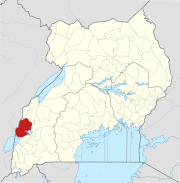
Mubuku is located approximately 16 kilometres (9.9 mi), by road, north of the town of Kasese, where the district headquarters are located.[1] This location lies approximately 14 kilometres (8.7 mi), by road, southwest of the town of Hima, the nearest urban center.[2] The coordinates of Lira are:0° 15' 41.00"N, 30° 7' 27.00"E (Latitude:0.261390; Longitude:30.124167).[3] The town sits at altitude of 1,330 metres (4,360 ft), above sea level.[4]
Overview
Mubuku lies on the main Fort Portal-Kasese Highway, which continues on to Mpondwe at the International border with the Democratic Republic of the Congo. The town sits on the eastern bank of Mubuku River, the location of three hydropower electricity-generating plants; namely: Mubuku I Power Station, Mubuku II Power Station and Mubuku III Power Station. Due to its location, the town serves as a base camp for mountaineers who attempt climbing the Rwenzori Mountains. In the past, it also served as a training camp for the Ugandan national boxing team during preparations for international competitions.
The town is the location of Mubuku Irrigation Scheme, a government-funded irrigation project, covering approximately 2,000 acres (810 ha). Established in the 1960s, the scheme fell into disrepair during the 1980s and 1990s. The Government of Uganda has earmarked nearly 20 billion Uganda Shillings (US$8.2 million), to rehabilitate the project.[5] The crops grown in the irrigated area include: rice, maize, millet, beans, sweet potatoes and groundnuts.
Population
The current population of Mubuku is not publicly known at this time.
See also
References
External links
- Kasese District Webpage
- v
- t
- e

Capital: Kasese
- Barclays Bank of Uganda
- Centenary Bank
- Equity Bank Uganda Limited
- Stanbic Bank Uganda Limited
- PostBank Uganda
- Pride Microfinance Limited
- Hima Cement Limited
- Hotel Margarita
- Kilembe Mines
- Kilembe Cobalt Company Limited
- Bugoye Power Station
- Lubilia Hydroelectric Power Station
- Mubuku I Power Station
- Mubuku II Power Station
- Mubuku III Power Station
- Nkusi Hydroelectric Power Station
- Nyamwamba Hydroelectric Power Station
- Rwimi Hydroelectric Power Station
- Nkenda–Fort Portal–Hoima High Voltage Power Line
- Nkenda–Mpondwe–Beni High Voltage Power Line
- Mbarara–Nkenda High Voltage Power Line
- Rwenzori Mountains
- Rwenzori National Park
- Queen Elizabeth National Park
- Lake Edward
- Lake George
- Kazinga Channel
- Kasese Central Market
- Roman Catholic Diocese of Kasese
0°15′41″N 30°07′27″E / 0.26139°N 30.12417°E / 0.26139; 30.12417


