Mutyalapalem
Village in Andhra Pradesh
16°25′48″N 81°56′0″E / 16.43000°N 81.93333°E / 16.43000; 81.93333 (2011)
533248
Mutyalapalem is a village in East Godavari district in the state of Andhra Pradesh, India.
Geography
Mutyalapalem covers around 412 acres, and has approximately 210 houses. The total population of the village is around 1000. Mutyalapalem is about 3 km (1.9 mi) from the Bay of Bengal. It is part of the Konaseema delta, a triangle formed by the waters of the Godavari River and the delta.
Gallery
-
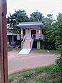 Ramalayam
 -
 Primary School
 -
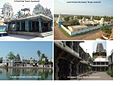 Near by Tourism Places


References
This article about a location in East Godavari district, Andhra Pradesh is a stub. You can help Wikipedia by expanding it. |
- v
- t
- e


