Nakla Upazila
Upazila in Mymensingh, Bangladesh
Nakla Upazila নকলা | |
|---|---|
Upazila | |
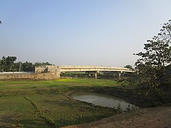 Vaitkamari Khal | |
 | |
| Coordinates: 24°59′N 90°11′E / 24.983°N 90.183°E / 24.983; 90.183 | |
| Country |  Bangladesh Bangladesh |
| Division | Mymensingh |
| District | Sherpur |
| Government | |
| • UNO | Zahidur Rahman |
| Area | |
| • Total | 173.84 km2 (67.12 sq mi) |
| Population (2011) | |
| • Total | 189,685 |
| • Density | 1,100/km2 (2,800/sq mi) |
| Time zone | UTC+6 (BST) |
| Website | nokla |
Nakla (Bengali: নকলা) is an upazila of Sherpur District in the Division of Mymensingh, Bangladesh.[1]
Geography

Nakla is located at 24°59′00″N 90°11′00″E / 24.9833°N 90.1833°E / 24.9833; 90.1833. It had 33,482 units of household and total area 174.8 km2.
The Nakla was freed from Pakistani military on 9 December 1971. Pakistani military forces surrendered in the village named Pathakata. It is a historical place for Nakla. Every day many of tourists who are interested in its liberation war come to see the place. Nowadays there is a market named Pathakata Baazar.
Nakla is the major upazila of Sherpur district. Many famous persons were born there.
Demographics
| Religions in Nakla upazila (2011)[2] | ||||
|---|---|---|---|---|
| Religion | Percent | |||
| Islam | 97.88% | |||
| Hinduism | 2.09% | |||
| Other or not stated | 0.03% | |||
According to the 2011 Bangladesh census, Nakla Upazila had 47,349 households and a population of 189,685. 48,275 (25.45%) were under 10 years of age. Nakla had a literacy rate (age 7 and over) of 43.03%, compared to the national average of 51.8%, and a sex ratio of 1042 females per 1000 males. 33,086 (17.44%) lived in urban areas.[2][3]
As of the 1991 Bangladesh census, Nakla had a population of 162952. Males constituted 51.03% of the population, and females 48.97%. This Upazila's eighteen up population was 81345. Nakla had an average literacy rate of 22.4% (7+ years), and the national average of 32.4% literate.[4]
Administration
Nakla Thana, now an upazila, was formed in 1930.[1]
Nakla Upazila is divided into Nakla Municipality and nine union parishads: Baneshwardi, Chandrakona, Char Ashtadhar, Ganapaddi, Kursa Badagair, Nakla, Pathakata, Talki, and Urpha. The union parishads are subdivided into 88 mauzas and 108 villages.[3]
Nakla Municipality is subdivided into 9 wards and 16 mahallas.[3]
See also
References
- ^ a b Muhammad Raisul Islam RiFat (2012), "Nakla Upazila", in Raisul RiFat, Sirajul Islam and Ahmed A. Jamal (ed.), Banglapedia: National Encyclopedia of Bangladesh (Second ed.), Asiatic Society of Bangladesh
- ^ a b "Community Tables: Sherpur district" (PDF). bbs.gov.bd. 2011.
- ^ a b c "Bangladesh Population and Housing Census 2011 Zila Report – Sherpur" (PDF). bbs.gov.bd. Bangladesh Bureau of Statistics.
- ^ "Population Census Wing, BBS". Archived from the original on 2005-03-27. Retrieved November 10, 2006.

Upazilas of the Mymensingh Division | ||
|---|---|---|
Headquarters: Mymensingh | ||
| Jamalpur District |  | |
| Mymensingh District | ||
| Netrokona District | ||
| Sherpur District |
| |
 | This Mymensingh Division location article is a stub. You can help Wikipedia by expanding it. |
- v
- t
- e


