National Register of Historic Places listings in West Warwick, Rhode Island
List of Registered Historic Places in West Warwick, Rhode Island, which has been transferred from and is an integral part of National Register of Historic Places listings in Kent County, Rhode Island
| Bristol | Kent | Newport | Providence | Washington |
This National Park Service list is complete through NPS recent listings posted August 16, 2024.[1]
Map all coordinates using OpenStreetMap
Download coordinates as:
- KML
- GPX (all coordinates)
- GPX (primary coordinates)
- GPX (secondary coordinates)
Current listings
| [2] | Name on the Register[3] | Image | Date listed[4] | Location | City or town | Description |
|---|---|---|---|---|---|---|
| 1 | Centreville Mill |  | June 10, 2005 (#05000582) | 3 Bridal Ave. 41°41′55″N 71°31′15″W / 41.698611°N 71.520833°W / 41.698611; -71.520833 (Centreville Mill) | West Warwick | |
| 2 | Silas Clapp House |  | May 7, 1973 (#73000049) | E. Greenwich Ave. 41°40′25″N 71°30′49″W / 41.673611°N 71.513611°W / 41.673611; -71.513611 (Silas Clapp House) | West Warwick | |
| 3 | Crompton Free Library |  | November 20, 1978 (#78000062) | Main St. 41°41′06″N 71°31′27″W / 41.685°N 71.524167°W / 41.685; -71.524167 (Crompton Free Library) | West Warwick | |
| 4 | Crompton Mill Historic District |  | July 14, 2006 (#06000577) | 20 Remington St., 53 and 65 Manchester St. 41°41′10″N 71°31′31″W / 41.686111°N 71.525278°W / 41.686111; -71.525278 (Crompton Mill Historic District) | West Warwick | |
| 5 | Lippitt Mill | 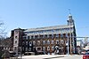 | January 11, 1974 (#74000053) | 825 Main St. 41°43′12″N 71°31′38″W / 41.72°N 71.527222°W / 41.72; -71.527222 (Lippitt Mill) | West Warwick | |
| 6 | Royal Mill Complex |  | April 29, 2004 (#04000377) | 125 Providence St. 41°42′49″N 71°31′00″W / 41.713714°N 71.516694°W / 41.713714; -71.516694 (Royal Mill Complex) | West Warwick | |
| 7 | St. Mary's Church and Cemetery |  | November 21, 1978 (#78000065) | Church St. 41°41′12″N 71°31′08″W / 41.686667°N 71.518889°W / 41.686667; -71.518889 (St. Mary's Church and Cemetery) | West Warwick | |
| 8 | William B. Spencer House |  | February 14, 2012 (#08000716) | 11 Fairview Ave. 41°43′11″N 71°31′59″W / 41.719824°N 71.533003°W / 41.719824; -71.533003 (William B. Spencer House) | West Warwick | |
| 9 | Valley Queen Mill |  | January 19, 1984 (#84001880) | 700 Providence St. 41°43′11″N 71°29′29″W / 41.719714°N 71.491469°W / 41.719714; -71.491469 (Valley Queen Mill) | West Warwick | |
| 10 | West Winds |  | May 20, 1993 (#93000425) | 300 Wakefield St. 41°43′30″N 71°30′52″W / 41.725047°N 71.514511°W / 41.725047; -71.514511 (West Winds) | West Warwick |
Former listings
| [2] | Name on the Register | Image | Date listed | Date removed | Location | City or town | Description |
|---|---|---|---|---|---|---|---|
| 1 | Phenix Baptist Church | Upload image | June 30, 1976 (#76002272) | Unknown | 10 Fairview Ave. | West Warwick |
See also
- National Register of Historic Places listings in Kent County, Rhode Island
- List of National Historic Landmarks in Rhode Island
References
- ^ National Park Service, United States Department of the Interior, "National Register of Historic Places: Weekly List Actions", retrieved August 16, 2024.
- ^ a b Numbers represent an alphabetical ordering by significant words. Various colorings, defined here, differentiate National Historic Landmarks and historic districts from other NRHP buildings, structures, sites or objects.
- ^ "National Register Information System". National Register of Historic Places. National Park Service. March 13, 2009.
- ^ The eight-digit number below each date is the number assigned to each location in the National Register Information System database, which can be viewed by clicking the number.
- v
- t
- e

| Bristol County | |
|---|---|
| Kent County |
|
| Newport County | |
| Providence County | |
| Washington County |
 Category
 NRHP portal
- Rhode Island portal


