Pirarajá
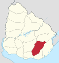
Village in Lavalleja Department, Uruguay
33°44′25″S 54°45′30″W / 33.74028°S 54.75833°W / -33.74028; -54.75833 Uruguay
 (2011)
30002
Pirarajá is a village in the Lavalleja Department of southeastern Uruguay.
Geography
It is located on Route 8 and on its junction with Route 58, about 34 kilometres (21 mi) north of Mariscala and 95 kilometres (59 mi) northeast of Minas.
History
Its status was elevated to "Pueblo" (village) on 22 December 1906 by decree Ley Nº 3.136.[1]
Population
In 2011 Pirarajá had a population of 713.[2]
| Year | Population |
|---|---|
| 1963 | 914 |
| 1975 | 910 |
| 1985 | 773 |
| 1996 | 737 |
| 2004 | 967 |
| 2011 | 713 |
Source: Instituto Nacional de Estadística de Uruguay[1]
References
- ^ a b "Statistics of urban localities (1963–2004)" (PDF). INE. 2012. Retrieved 4 September 2012.
- ^ "Censos 2011 Lavalleja (needs flash plugin)". INE. 2012. Retrieved 31 August 2012.
External links
- INE map of Pirarajá
- v
- t
- e
 Lavalleja Department of Uruguay
Capital: Minas
villages
- José Batlle y Ordoñez
- José Pedro Varela
- Mariscala
- Minas
- Pirarajá
- Solís de Mataojo
- Zapicán
- Salto del Penitente
- Villa Serrana
 | This article about a place in Lavalleja Department is a stub. You can help Wikipedia by expanding it. |
- v
- t
- e


