Pryorsburg, Kentucky
Census-designated place in Kentucky, United States
36°41′20″N 88°42′53″W / 36.68889°N 88.71472°W / 36.68889; -88.71472 United States
 Kentucky
[1]
(2020)
42066
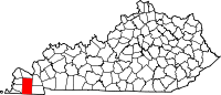
Pryorsburg (also Pryors)[2] is an unincorporated community and census-designated place (CDP) in Graves County, Kentucky, United States.[3] As of the 2010 census the population was 311.[4]
The community is located along U.S. Route 45, 6 miles (10 km) southwest of Mayfield, the county seat.
Demographics
| Census | Pop. | Note | %± |
|---|---|---|---|
| 2020 | 262 | — | |
| U.S. Decennial Census[5] | |||
References
- ^ "2020 U.S. Gazetteer Files". United States Census Bureau. Retrieved March 18, 2022.
- ^ U.S. Geological Survey Geographic Names Information System: Pryorsburg, Kentucky
- ^ "Feature Detail Report for: Pryorsburg, Kentucky." USGS. U.S. Geological Survey Geographic Names Information System: Pryorsburg, Kentucky Retrieved May 11, 2011.
- ^ "Geographic Identifiers: 2010 Demographic Profile Data (G001): Pryorsburg CDP, Kentucky". American Factfinder. U.S. Census Bureau. Retrieved December 12, 2016.[dead link]
- ^ "Census of Population and Housing". Census.gov. Retrieved June 4, 2016.
- v
- t
- e
Municipalities and communities of Graves County, Kentucky, United States
County seat: Mayfield
- Fancy Farm
- Farmington
- Hickory
- Lowes
- Pryorsburg
- Sedalia
- Symsonia
- Water Valley
communities
‡This populated place also has portions in an adjacent county or counties
- Kentucky portal
- United States portal
 | This Graves County, Kentucky state location article is a stub. You can help Wikipedia by expanding it. |
- v
- t
- e


