San Augustin Mountains


- San Andres Mountains-N
- San Augustin Pass-S
- Organ Mountains-S
- Organ, NM & Las Cruces, NM-W
- White Sands-NE, E & SE
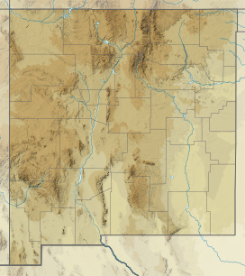
The San Augustin Mountains are a small mountain subrange located at the southern terminus of the San Andres Mountains east of Las Cruces, New Mexico.
Description
The San Augustin Mountains are only about an 8 miles (13 km) long range, trending slightly northeast. The southern border is San Augustin Pass, where U.S. Route 70 goes from Las Cruces and Organ and turns northeast through White Sands to meet Alamogordo.
The north of the range is delimited by Bear Canyon, an east-west canyon with its outlet to the northeast. Also north is the San Andres National Wildlife Refuge which takes up about a 30 mi stretch of the San Andres Mountains ridgeline.
The high Black Mountain section is on the southeast of Bear Canyon and is separated northeast from the ridgeline of the San Augustins.
Communities
Organ lies at the southwest foothills; the townsite, White Sands, NM lies to the southeast. The mountains are southwest of the Tularosa Valley.
Peaks
The ridgeline of the San Augustin Mountains has the range's highpoint, Bear Peak, 7,087 feet (2,160 m)[1] at the north, and the south is terminated by San Augustin Peak, at 7,030 feet (2,143 m). Black Mountain at 7,008 feet (2,136 m), is in the northeast, and an outlier peak at the northwest is Quartzite Mountain, at 6,763 feet (2,061 m). Another outlier mountain is on the southeast, Mineral Hill at 6,154 feet (1,876 m). The highpoint, Bear Peak is located at 32°30′44″N 106°32′19″W / 32.512311°N 106.538608°W / 32.512311; -106.538608 (Bear Peak (New Mexico)).[2]
See also
- San Andres Mountains
- San Andres National Wildlife Refuge
References
External links

Peaks
- San Augustin Peak, (coordinates)
- Bear Peak Summit, mountainzone.com (coordinates)
San Augustin Mountains
- San Augustin Mountains, mountainzone.com, elevation, (incorrect)
- v
- t
- e
- Black Mountain (Catron County)
- McKnight Mountain
- Cerro Grande
- Chicoma Mountain
- Redondo Peak
- South Baldy
- Pyramid Peak
- Salinas Peak
- San Augustin Mountains
(Cibola County)
- Mount Taylor
- West Blue Mountain
| Manzano Mountains | |
|---|---|
| Sandia Mountains |
| Cimarron Range |
|
|---|---|
| Taos Mountains |
|
| Others |
|
- Haystack Mountain
- Mount Sedgwick
- Aden Crater
- Alamo Hueco Mountains
- Animas Mountains
- Brazos Mountains
- Caballo Mountains
- Canjilón Mountain
- Canyon Creek Mountains
- Capitan Mountains
- Capulin Peak
- Cedar Mountain Range
- Datil Mountains
- Dirty Point
- Doña Ana Mountains
- Eagle Peak
- East Potrillo Mountains
- Elephant Butte (Hidalgo County)
- Elephant Butte (Sierra County)
- Fajada Butte
- Florida Mountains
- Franklin Mountains
- Granite Peak
- Guadalupe Mountains
- Guadalupe Mountains (Hidalgo County)
- Hosta Butte
- Hueco Mountains
- Huérfano Mountain
- Jicarilla Mountains
- Jornada del Muerto Volcano
- Ladron Peak
- Little Burro Mountains
- Little Hatchet Mountains
- Little San Pascual Mountain
- Luera Mountains
- Sierra Nacimiento
- Ocate Peak
- Ortiz Mountains
- Picacho Mountain
- Robledo Mountains
- San Antonio Mountain
- San Mateo Mountains (Socorro County)
- Sierra Aguilada
- Sierra Blanca
- Sierra de las Uvas
- West Potrillo Mountains
 | This New Mexico state location article is a stub. You can help Wikipedia by expanding it. |
- v
- t
- e


