San Pedro de Larcay District
District in Ayacucho, Peru
San Pedro de Larcay Larq'ay | |
|---|---|
District | |
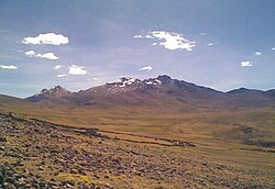 Qarwarasu | |
 Location of San Pedro de Larcay in the Sucre province | |
| Country |  Peru Peru |
| Region | Ayacucho |
| Province | Sucre |
| Founded | July 8, 1964 |
| Capital | San Pedro de Larcay |
| Subdivisions | 25 populated places |
| Area | |
| • Total | 310.07 km2 (119.72 sq mi) |
| Elevation | 3,376 m (11,076 ft) |
| Population (2005 census) | |
| • Total | 1,175 |
| • Density | 3.8/km2 (9.8/sq mi) |
| Time zone | UTC-5 (PET) |
| UBIGEO | 050908 |
| Website | cuspel.pe/es/sanpedrodelarcay |
San Pedro de Larcay is one of 11 districts of the Sucre Province in the Ayacucho region in Peru.
Administrative division
The populated places in the district are:[1]
- San Pedro de Larcay
- Wallacha
- Chicha (San Pablo de Chicha)
- fundo Curita
- Saywa
- Hueccopampa
- Ccehuani
- Sura Sura (San Martín de Porras de Sora Sora)
- Huacuylla
- Q'ara Q'ara
- Huascoto
- Cuchallo
- Susuma
- Rumiwasi
- Ccotaccua
- Cuchopampamnjkhob
- Rayusqa
- Liapucro
- Cullupallcca
- Puka Corral
- Sairosa
- Hatun Urqu
- Ccerencha
- sicuani
- Chuñunchana
- Ccaccentalla
Population
The population of San Pedro de Larcay (2005 census) is 1,175 people, 600 men and 575 women.[1]
See also
- Qarwarasu
References
- ^ a b INEI Archived 2007-06-01 at the Wayback Machine
External links
- https://web.archive.org/web/20120302112033/http://www.cuspel.pe/es/sanpedrodelarcay/
- v
- t
- e

- Districts of Ayacucho Region
- Peru

- Querobamba
- Belén
- Chalcos
- Chilcayoc
- Huacaña
- Morcolla
- Paico
- San Pedro de Larcay
- San Salvador de Quije
- Santiago de Paucaray
- Soras
14°41′38″S 74°07′27″W / 14.69389°S 74.12417°W / -14.69389; -74.12417
 | This Ayacucho Region geography article is a stub. You can help Wikipedia by expanding it. |
- v
- t
- e


