Thrapston Station Quarry
| Site of Special Scientific Interest | |
 | |
| Location | Northamptonshire |
|---|---|
| Grid reference | SP 999 776[1] |
| Interest | Geological |
| Area | 4.5 hectares[1] |
| Notification | 1986[1] |
| Location map | Magic Map |
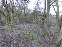
Thrapston Station Quarry is a 4.5-hectare (11-acre) geological Site of Special Scientific Interest south of Thrapston in Northamptonshire.[1][2] It is a Geological Conservation Review site.[3] It was formerly called the Thrapston Midland Railway Station Quarry.[4]
This site has the most important remaining Middle Jurassic Cornbrash geological section in the Midlands. It is the type site for the Bathonian Blisworth Clay section, dating to 168 to 166 million years ago, and it has the only complete exposure of this section. Diagnostic ammonites have helped to date the site, which has also yielded important Bryozoan fossils.[4][5]
The site is on private land with no public access.
References
- ^ a b c d "Designated Sites View: Thrapston Station Quarry". Sites of Special Scientific Interest. Natural England. Retrieved 20 February 2017.
- ^ "Map of Thrapston Station Quarry". Sites of Special Scientific Interest. Natural England. Retrieved 20 February 2017.
- ^ "Thrapston (Bathonian)". Joint Nature Conservation Committee. Retrieved 18 December 2016.
- ^ a b "Thrapston Station Quarry citation" (PDF). Sites of Special Scientific Interest. Natural England. Archived (PDF) from the original on 22 February 2017. Retrieved 20 February 2017.
- ^ "Blisworth Clay Formation". The BGS Lexicon of Named Rock Units — Result Details. British Geological Survey. Archived from the original on 20 August 2017. Retrieved 20 August 2017.
Wikimedia Commons has media related to Thrapston Station Quarry.
52°23′17″N 0°31′59″W / 52.388°N 0.533°W / 52.388; -0.533
- v
- t
- e
- Alder Wood and Meadow
- Aldwincle Marsh
- Ashton Wold
- Badby Wood
- Badsaddle, Withmale Park and Bush Walk Woods
- Banhaw, Spring and Blackthorn's Woods
- Birch Spinney and Mawsley Marsh
- Bosworth Mill Meadow
- Bozeat Meadow
- Bucknell Wood Meadows
- Bugbrooke Meadows
- Bulwick Meadows
- Calender Meadows
- Collyweston Great Wood and Easton Hornstocks
- Collyweston Quarries
- Coombe Hill Hollow
- Dungee Corner Meadow
- Everdon Stubbs
- Geddington Chase
- Glapthorn Cow Pasture
- Hardwick Lodge Meadow
- Helmdon Disused Railway
- High Wood and Meadow
- King's Cliffe Banks
- Mantles Heath
- Mill Crook
- Old Sulehay Forest
- Pipewell Woods
- Pitsford Reservoir
- Plumpton Pasture
- Racecourse Farm Fields
- Ramsden Corner Plantation
- River Ise and Meadows
- Salcey Forest
- Short Wood
- Southfield Farm Marsh
- Stoke and Bowd Lane Woods
- Sudborough Green Lodge Meadows
- Syresham Marshy Meadows
- Titchmarsh Meadow
- Twywell Gullet
- Upper Nene Valley Gravel Pits
- Wadenhoe Marsh and Achurch Meadow
- Wakerley Spinney
- Weldon Park
- Whittlewood Forest
- Wollaston Meadows
- Yardley Chase


