Totoró, Cauca
‹ The template Infobox settlement is being considered for merging. ›
Municipality and town in Cauca Department, Colombia

Flag

Seal
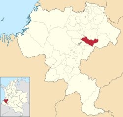
Location of the municipality and town of Totoró, Cauca in the Cauca Department of Colombia.
 Colombia
 (Census 2018[1])
Totoró is a town and municipality in the Cauca Department, Colombia.
Climate
Totoró has a subtropical highland climate (Köppen Cfb) due to its location at approximately 2,570 metres (8,430 ft) altitude. It has moderate rainfall year-round. It is the cloudiest and least sunny town in the world.
| Climate data for Totoró (Gabriel Lopez), elevation 3,000 m (9,800 ft), (1981–2010) | |||||||||||||
|---|---|---|---|---|---|---|---|---|---|---|---|---|---|
| Month | Jan | Feb | Mar | Apr | May | Jun | Jul | Aug | Sep | Oct | Nov | Dec | Year |
| Mean daily maximum °C (°F) | 15.8 (60.4) | 15.7 (60.3) | 15.9 (60.6) | 15.5 (59.9) | 15.2 (59.4) | 14.4 (57.9) | 13.8 (56.8) | 14.1 (57.4) | 14.9 (58.8) | 15.4 (59.7) | 15.4 (59.7) | 15.7 (60.3) | 15.2 (59.4) |
| Daily mean °C (°F) | 10.5 (50.9) | 10.5 (50.9) | 10.6 (51.1) | 10.7 (51.3) | 10.6 (51.1) | 10.2 (50.4) | 9.8 (49.6) | 10.0 (50.0) | 10.4 (50.7) | 10.6 (51.1) | 10.6 (51.1) | 10.5 (50.9) | 10.4 (50.7) |
| Mean daily minimum °C (°F) | 5.3 (41.5) | 5.7 (42.3) | 6.0 (42.8) | 6.6 (43.9) | 6.8 (44.2) | 6.9 (44.4) | 6.5 (43.7) | 6.4 (43.5) | 6.2 (43.2) | 6.1 (43.0) | 6.1 (43.0) | 5.8 (42.4) | 6.2 (43.2) |
| Average precipitation mm (inches) | 65.8 (2.59) | 64.7 (2.55) | 85.1 (3.35) | 96.9 (3.81) | 105.6 (4.16) | 89.2 (3.51) | 116.4 (4.58) | 79.9 (3.15) | 72.0 (2.83) | 101.0 (3.98) | 105.5 (4.15) | 68.2 (2.69) | 1,048.3 (41.27) |
| Average precipitation days | 13 | 14 | 17 | 20 | 22 | 22 | 23 | 21 | 17 | 19 | 19 | 14 | 214 |
| Average relative humidity (%) | 79 | 78 | 79 | 79 | 80 | 81 | 81 | 81 | 79 | 79 | 79 | 78 | 80 |
| Mean monthly sunshine hours | 74.4 | 56.5 | 58.9 | 45.0 | 46.5 | 33.0 | 40.3 | 52.7 | 54.0 | 46.5 | 45.0 | 52.7 | 605.5 |
| Mean daily sunshine hours | 2.4 | 2.0 | 1.9 | 1.5 | 1.5 | 1.1 | 1.3 | 1.7 | 1.8 | 1.5 | 1.5 | 1.7 | 1.7 |
| Source: Instituto de Hidrologia Meteorologia y Estudios Ambientales[2] | |||||||||||||
References
External links
- Official website
- v
- t
- e
Municipalities in the Cauca Department
- Almaguer
- Argelia
- Balboa
- Bolívar
- Buenos Aires
- Cajibio
- Caldono
- Caloto
- Corinto
- El Tambo
- Florencia
- Guachené
- Guapi
- Inzá
- Jambaló
- La Sierra
- La Vega
- López de Micay
- Mercaderes
- Miranda
- Morales
- Padilla
- Páez
- Patía
- Piamonte
- Piendamó
- Popayán
- Puerto Tejada
- Puracé
- Rosas
- San Sebastián
- Santander de Quilichao
- Santa Rosa
- Silvia
- Sotara
- Suárez
- Sucre
- Timbío
- Timbiquí
- Toribío
- Totoró
- Villa Rica

2°30′42″N 76°24′01″W / 2.51167°N 76.40028°W / 2.51167; -76.40028
 | This Department of Cauca location article is a stub. You can help Wikipedia by expanding it. |
- v
- t
- e


