Urahoro, Hokkaido
Town in Hokkaido, Japan
Urahoro  Flag  Seal | |
|---|---|
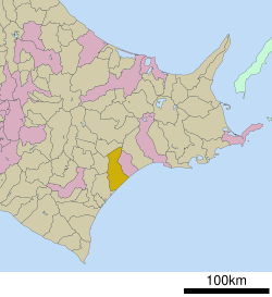 Location of Urahoro in Hokkaido (Tokachi Subprefecture) | |
| 42°49′N 143°40′E / 42.817°N 143.667°E / 42.817; 143.667 | |
| Country | Japan |
| Region | Hokkaido |
| Prefecture | Hokkaido (Tokachi Subprefecture) |
| District | Tokachi |
| Area | |
| • Total | 729.64 km2 (281.72 sq mi) |
| Population (September 30, 2016) | |
| • Total | 5,023 |
| • Density | 6.9/km2 (18/sq mi) |
| Time zone | UTC+09:00 (JST) |
| Climate | Dfb |
| Website | www |
Urahoro (浦幌町, Urahoro-chō) is a town located in Tokachi Subprefecture, Hokkaido, Japan.
As of 2008, the town has an estimated population of 5,023 and a density of 6.9 persons per km2. The total area is 729.64 km2.
Climate
| Climate data for Urahoro (1991−2020 normals, extremes 1977−present) | |||||||||||||
|---|---|---|---|---|---|---|---|---|---|---|---|---|---|
| Month | Jan | Feb | Mar | Apr | May | Jun | Jul | Aug | Sep | Oct | Nov | Dec | Year |
| Record high °C (°F) | 8.6 (47.5) | 11.9 (53.4) | 18.7 (65.7) | 31.6 (88.9) | 37.9 (100.2) | 36.1 (97.0) | 35.6 (96.1) | 36.0 (96.8) | 32.8 (91.0) | 27.5 (81.5) | 21.0 (69.8) | 14.8 (58.6) | 37.9 (100.2) |
| Mean daily maximum °C (°F) | −0.8 (30.6) | 0.1 (32.2) | 4.5 (40.1) | 10.8 (51.4) | 16.1 (61.0) | 19.1 (66.4) | 22.5 (72.5) | 24.1 (75.4) | 21.6 (70.9) | 16.0 (60.8) | 8.9 (48.0) | 1.6 (34.9) | 12.0 (53.7) |
| Daily mean °C (°F) | −6.9 (19.6) | −5.8 (21.6) | −0.7 (30.7) | 5.0 (41.0) | 10.3 (50.5) | 13.9 (57.0) | 17.7 (63.9) | 19.4 (66.9) | 16.4 (61.5) | 10.0 (50.0) | 3.2 (37.8) | −4.0 (24.8) | 6.5 (43.8) |
| Mean daily minimum °C (°F) | −13.2 (8.2) | −12.3 (9.9) | −6.1 (21.0) | −0.4 (31.3) | 5.1 (41.2) | 9.8 (49.6) | 14.2 (57.6) | 15.8 (60.4) | 12.1 (53.8) | 4.4 (39.9) | −2.1 (28.2) | −9.6 (14.7) | 1.5 (34.7) |
| Record low °C (°F) | −25.6 (−14.1) | −26.8 (−16.2) | −20.8 (−5.4) | −11.0 (12.2) | −4.2 (24.4) | 0.0 (32.0) | 6.0 (42.8) | 6.5 (43.7) | 0.9 (33.6) | −5.1 (22.8) | −14.3 (6.3) | −20.5 (−4.9) | −26.8 (−16.2) |
| Average precipitation mm (inches) | 43.9 (1.73) | 28.9 (1.14) | 47.0 (1.85) | 68.5 (2.70) | 103.6 (4.08) | 90.7 (3.57) | 108.0 (4.25) | 139.1 (5.48) | 150.9 (5.94) | 106.9 (4.21) | 63.0 (2.48) | 55.4 (2.18) | 1,005.9 (39.60) |
| Average snowfall cm (inches) | 76 (30) | 67 (26) | 61 (24) | 9 (3.5) | 2 (0.8) | 0 (0) | 0 (0) | 0 (0) | 0 (0) | 0 (0) | 10 (3.9) | 55 (22) | 281 (111) |
| Average precipitation days (≥ 1.0 mm) | 5.1 | 4.3 | 6.0 | 8.3 | 9.5 | 8.5 | 10.1 | 11.0 | 10.5 | 8.1 | 6.9 | 6.3 | 94.6 |
| Average snowy days | 8.8 | 8.1 | 7.6 | 1.2 | 0.2 | 0 | 0 | 0 | 0 | 0 | 1.3 | 6.2 | 33.4 |
| Mean monthly sunshine hours | 181.3 | 182.5 | 213.7 | 192.7 | 184.1 | 150.0 | 126.3 | 130.4 | 145.6 | 177.1 | 172.8 | 167.7 | 2,024 |
| Source: JMA[1][2] | |||||||||||||
Mascots

Urahoro's mascots are Uraha (ウラハ) and Horoma (ホロマ) are grey herons who are siblings. They lived in the forests of Urahoro.
- Uraha is cheerful, mischievous and a little sloppy and gluttonous. His good luck charm is a Japanese rowan branch (which he carries all the time). He can eat delicious food. Because of this he promotes food from the town.[3]
- Horoma is gentle but solid and caring. She usually volunteers for other activities. Her good luck charm is a Japanese rose (which she wears on her head).[4]
Notable people from Urahoro
References
External links
 Media related to Urahoro, Hokkaidō at Wikimedia Commons
- Official Website (in Japanese)
| ||||||||||||
|---|---|---|---|---|---|---|---|---|---|---|---|---|
|  | |||||||||||
|
| ||||||||||||
| ||||||||||||
| ||||||||||||
| ||||||||||||
| ||||||||||||
| ||||||||||||
| ||||||||||||
| ||||||||||||
| ||||||||||||
| ||||||||||||
| ||||||||||||
| ||||||||||||

Authority control databases | |
|---|---|
| International |
|
| National |
|
 | This Hokkaidō location article is a stub. You can help Wikipedia by expanding it. |
- v
- t
- e


