Villaverde (Madrid)
District of Madrid in Spain
Villaverde | |
|---|---|
District of Madrid | |
 | |
| Country | Spain |
| Auton. community | Madrid |
| Municipality | Madrid |
| Area | |
| • Total | 20.29 km2 (7.83 sq mi) |
| Population | 126,802 |
| • Density | 6,249/km2 (16,180/sq mi) |
| Madrid district number | 17 |
 | |
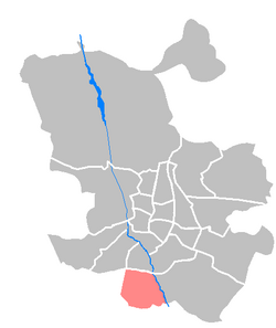
Villaverde is one of the 21 districts of the city of Madrid, Spain.
Geography and history
The municipality was absorbed by Madrid in the 1950s as a result of the plans that the Franco government made to simplify the structure of big city administrations. Since then, is a district. It was in those years when it experimented a massive growth caused by the rural flight in Spain. This is the reason that made Villaverde a typical working class neighbourhood.
This condition leaves a heavy footprint in the district, because it has conditioned the current population composition, with many retired people (some of them returning to their towns in Andalusia, Castile-León, ...) and immigrants attracted by the cheap housing prices.
The district is administratively divided into five wards (barrios):
- Butarque
- Los Ángeles
- Los Rosales
- San Cristóbal de los Ángeles
- Villaverde Alto
External links
![]() Media related to Villaverde District at Wikimedia Commons
Media related to Villaverde District at Wikimedia Commons
- v
- t
- e
- Atocha
- Imperial
- La Chopera
- Las Acacias
- Las Delicias
- Legazpi
- Palos de Moguer


- Aeropuerto
- Alameda de Osuna
- Casco Histórico de Barajas
- Corralejos
- Timón
- Abrantes
- Buenavista
- Comillas
- Opañel
- Puerta Bonita
- San Isidro
- Vista Alegre
- Cortes
- Embajadores
- Justicia
- Universidad
- Palacio
- Sol
- Castilla
- Ciudad Jardín
- El Viso
- Hispanoamérica
- Nueva España
- Prosperidad
- Almagro
- Arapiles
- Gaztambide
- Ríos Rosas
- Trafalgar
- Vallehermoso
- Atalaya
- Colina
- Concepción
- Pinar de Chamartín
- Pueblo Nuevo
- Quintana
- San Juan Bautista
- San Pascual
- Ventas
- Barrio del Pilar
- El Goloso
- El Pardo
- Fuentelarreina
- La Paz
- Mirasierra
- Peñagrande
- Valverde
- Apóstol Santiago
- Canillas
- Palomas
- Pinar del Rey
- Piovera
- Valdefuentes
- Aluche
- Campamento
- Cuatro Vientos
- Las Águilas
- Lucero
- Los Cármenes
- Puerta del Ángel
- Aravaca
- Argüelles
- Casa de Campo
- Ciudad Universitaria
- El Plantío
- Valdemarín
- Valdezarza
- Fontarrón
- Horcajo
- Marroquina
- Media Legua
- Pavones
- Vinateros
- Entrevías
- Numancia
- Palomeras Bajas
- Palomeras Sureste
- Portazgo
- San Diego
- Adelfas
- Estrella
- Ibiza
- Jerónimos
- Niño Jesús
- Pacífico
- Castellana
- Fuente del Berro
- Goya
- Guindalera
- Lista
- Recoletos
- Amposta
- Arcos
- Canillejas
- Hellín
- Rejas
- Rosas
- Salvador
- Simancas
- Almenara
- Bellas Vistas
- Berruguete
- Castillejos
- Cuatro Caminos
- Valdeacederas
- Almendrales
- Moscardó
- Orcasitas
- Orcasur
- Pradolongo
- San Fermín
- Zofío
- Ambroz
- Casco Histórico de Vicálvaro
- Casco Histórico de Vallecas
- Santa Eugenia
- Butarque
- Los Ángeles
- Los Rosales
- San Cristóbal de los Ángeles
- Villaverde Alto
40°26′45″N 3°42′04″W / 40.445945°N 3.701143°W / 40.445945; -3.701143
 | This article about a location in the Community of Madrid, Spain is a stub. You can help Wikipedia by expanding it. |
- v
- t
- e


