Waylla Q'awa
Mountain in Bolivia


Waylla Q'awa
Location in Bolivia
Chile
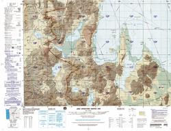
Waylla Q'awa Aymara waylla Stipa obtusa, a kind of feather grass, q'awa little river, ditch, crevice, fissure, gap in the earth,[1][2][3] "stipa brook" or "stipa ravine", also spelled Huaylla Khaua) is a mountain in the Andes of Bolivia, west of the Uyuni salt flat. It is situated in the Potosí Department, Daniel Campos Province, Llica Municipality, Canquella Canton.[4]
See also
- Ch'alla Qullu
- Waylla
- List of mountains in the Andes
References
- ^ Radio San Gabriel, "Instituto Radiofonico de Promoción Aymara" (IRPA) 1993, Republicado por Instituto de las Lenguas y Literaturas Andinas-Amazónicas (ILLLA-A) 2011, Transcripción del Vocabulario de la Lengua Aymara, P. Ludovico Bertonio 1612 (Spanish-Aymara-Aymara-Spanish dictionary)
- ^ Plan de desarollo municipal Municipio de Turco
- ^ "Diccionario Bilingüe, Castellano - Aymara, Para: Tercera Edición". Félix Layme Pairumani. Retrieved August 14, 2014.
- ^ "Llica". Retrieved August 15, 2014. Llica Municipality:population data and map
- v
- t
- e


