Win Green Down
Hill in Wiltshire

Win Green
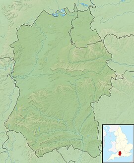
Location in Wiltshire
 England
Win Green Down at grid reference ST927209 in south-western Wiltshire, England is a 26.0 hectares (64 acres) biological Site of Special Scientific Interest, notified in 1971.
Its summit, Win Green, is at grid reference ST924205 and is the highest point of Cranborne Chase at 277 metres (909 ft). There are extensive views, with Bournemouth, the Isle of Wight, Salisbury, Glastonbury Tor, the Mendips, the Quantocks and Milk Hill all visible in clear conditions. It is classed as a Marilyn, and is a landmark due to the clump of trees on the high point. The parent peak is Long Knoll.[1]
References
- ^ Jackson, Mark (July 2010). "More Relative Hills of Britain" (PDF). Marilyn News Centre. p. 143. Archived (PDF) from the original on 12 October 2013.
- Natural England citation sheet for the site (accessed 25 May 2023)
- http://www.ukhillwalking.com/logbook/hill.php?id=14024
- Mapping: OS Explorer 118 (1:25 000), OS Landranger 184 (1:50 000)
External links
- Natural England website (SSSI information)
- v
- t
- e
- Acres Farm Meadow
- River Avon System
- Baverstock Juniper Bank
- Bencroft Hill Meadows
- Bentley Wood
- Bincknoll Dip Woods
- Blackmoor Copse
- Botley Down
- Bowerchalke Downs
- Box Mine
- Bracknell Croft
- Bradley Woods
- Bratton Downs
- Brickworth Down and Dean Hill
- Brimsdown Hill
- Britford Water Meadows
- Burcombe Down
- Burderop Wood
- Calstone and Cherhill Downs
- Camp Down
- Chilmark Quarries
- Chickengrove Bottom
- Chilton Foliat Meadows
- Clattinger Farm
- Clearbury Down
- Cley Hill
- Cloatley Manor Farm Meadows
- Clout's Wood
- Coate Water
- Cockey Down
- Colerne Park and Monk's Wood
- The Coombes, Hinton Parva
- Cotswold Water Park
- Cranborne Chase
- Dank's Down and Truckle Hill
- Distillery Farm Meadows
- East Harnham Meadows
- Ebsbury Down
- Emmett Hill Meadows
- Figsbury Ring
- Fonthill Grottoes
- Fyfield Down
- Gallows Hill
- Goldborough Farm Meadows
- Great Cheverell Hill
- Great Yews
- Gutch Common
- Ham Hill
- Hang Wood
- Harries Ground, Rodbourne
- Haydon Meadow
- Heath Hill Farm
- Homington and Coombe Bissett Downs
- Honeybrook Farm
- Inwood, Warleigh
- Jones's Mill
- River Kennet
- Kennet and Lambourn Floodplain
- King's Play Hill
- Knapp and Barnett's Downs
- Knighton Downs and Wood
- Landford Bog
- Landford Heath
- Langley Wood and Homan's Copse
- Little Grubbins Meadow
- Long Knoll
- Loosehanger Copse and Meadows
- Lower Coombe and Ferne Brook Meadows
- Lower Woodford Water Meadows
- Midford Valley Woods
- Morgan's Hill
- The New Forest
- North Meadow, Cricklade
- Odstock Down
- Out Woods
- Parsonage Down
- Pewsey Downs
- Picket and Clanger Wood
- Piggledene
- Pike Corner
- Pincombe Down
- Porton Down
- Porton Meadows
- Prescombe Down
- Rack Hill
- Ravensroost Wood
- Restrop Farm and Brockhurst Wood
- Rotherley Downs
- Roundway Down and Covert
- Salisbury Plain
- Savernake Forest
- Scratchbury & Cotley Hills
- Silbury Hill
- Spye Park
- Starveall and Stony Down
- Steeple Langford Down
- Stockton Wood and Down
- Stoke Common Meadows
- Stratford Toney Down
- Sutton Lane Meadows
- Throope Down
- River Till
- Tytherington Down
- Upper Waterhay Meadow
- Upton Cow Down
- West Yatton Down
- Whiteparish Common
- Whitesheet Hill
- Win Green Down
- Winklebury Hill
- Winsley Mines
- Wylye and Church Dean Downs
- Yarnbury Castle
- Neighbouring areas
- Avon
- Berkshire
- Dorset
- Gloucestershire
- Hampshire
- Oxfordshire
- Somerset
 | This article about a Site of Special Scientific Interest in England is a stub. You can help Wikipedia by expanding it. |
- v
- t
- e
 | This article about a location in Wiltshire is a stub. You can help Wikipedia by expanding it. |
- v
- t
- e


