Yealand Conyers
Human settlement in England
- The Yealands
- Lancaster
- Lancashire
- North West
- Morecambe and Lunesdale
- List of places
- UK
- England
- Lancashire
Yealand Conyers is a village in the civil parish of The Yealands, in the Lancaster district, in the county of Lancashire, England. In 2011 the former parish of Yealand Conyers had a population of 190.
Community
The community is in the same electoral district as Yealand Redmayne and Silverdale. The Yealands and Silverdale were originally in the same manor of Yealand in Domesday Book.
Yealand Conyers has three religious institutions, the Church of England St John's and Catholic St Mary's but is particularly of note for its early support of Quakerism. Richard Hubberthorne, one of the early Quaker preachers was from the Yealands. George Fox preached a sermon in the village in 1652 and the village's Meeting House dates from 1692. The Quaker's Old School is today used as a simple hostel and can host people visiting the '1652 country'.
The village has both a manor house and a stately home Leighton Hall. The bulk of the Leighton Moss RSPB reserve is in Yealand Conyers but main visitor access is from Silverdale.
Yealand Conyers was for many years home to the noted manchester born Quaker writer Elfrida Vipont Foulds. She was the Headmistress of the Yealand Manor Quaker Evacuation School.[2]
Yealand-Conyers was formerly a township and chapelry in the parish of Warton,[3] in 1866 Yealand Conyers became a separate civil parish,[4] on 1 April 2024 the parish was abolished and merged with Yealand Redmayne to form The Yealands.[5]
Geography
Like its neighbour, Yealand Redmayne, it is north of Lancaster, and close to the border of Cumbria.
To the north is Yealand Redmayne and beyond that is Beetham and Milnthorpe, to its north east is Holme and Arnside, with the River Kent to the north west while Warton is to the south.
Gallery
-

-
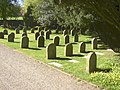 Friends' Meeting House graveyard
 -
 Yealand Old School


See also
 Lancashire portal

References
- ^ UK Census (2011). "Local Area Report – Yealand Conyers Parish (1170215063)". Nomis. Office for National Statistics. Retrieved 17 March 2018.
- ^ Hartshorne, Susan V. The Story of Yealand Manor School. York, England: William Sessions Ltd, 2007. Print
- ^ "History of Yealand Conyers, in Lancaster and Lancashire". A Vision of Britain through Time. Retrieved 4 August 2024.
- ^ "Relationships and changes Yealand Conyers CP/Tn through time". A Vision of Britain through Time. Retrieved 4 August 2024.
- ^ "Lancashire Registration District". UKBMD. Retrieved 4 August 2024.
External links
Wikimedia Commons has media related to Yealand Conyers.
- Yealand Conyers: historical and genealogical information at GENUKI.
- Map sources for Yealand Conyers
- v
- t
- e
Geography of the City of Lancaster
& suburbs
- Abbeystead
- Abraham Heights
- Aldcliffe
- Arkholme
- Aughton
- Bank Houses
- Bare
- Bay Horse
- Bolton-le-Sands
- Borwick
- Cantsfield
- Caton
- Claughton
- Cockerham
- Conder Green
- Cowan Bridge
- Dolphinholme
- Ellel
- Galgate
- Glasson
- Gressingham
- Halton
- Heysham
- Hornby
- Ireby
- Lower Thurnham
- Melling
- Middleton
- Nether Burrow
- Nether Kellet
- Over Kellet
- Overton
- Poulton-le-Sands
- Priest Hutton
- Quernmore
- Scotforth
- Silverdale
- Skerton
- Slyne
- Stodday
- Sunderland
- Tatham
- Tewitfield
- Torrisholme
- Tunstall
- Upper Thurnham
- Warton
- Wennington
- Whittington
- Wray
- Yealand Conyers
- Yealand Redmayne
- Yealand Storrs
- Aldcliffe-with-Stodday
- Arkholme-with-Cawood
- Bolton-le-Sands
- Borwick
- Burrow-with-Burrow
- Cantsfield
- Carnforth
- Caton-with-Littledale
- Claughton
- Cockerham
- Ellel
- Gressingham
- Halton-with-Aughton
- Heaton-with-Oxcliffe
- Hornby-with-Farleton
- Ireby
- Leck
- Melling-with-Wrayton
- Middleton
- Morecambe
- Nether Kellet
- Over Kellet
- Over Wyresdale
- Overton
- Priest Hutton
- Quernmore
- Roeburndale
- Scotforth
- Silverdale
- Slyne-with-Hest
- Tatham
- Thurnham
- Tunstall
- Warton
- Wennington
- Whittington
- Wray-with-Botton
- Yealand Conyers
- Yealand Redmayne
| Footpaths | |
|---|---|
| Hills |
|
| Rivers | |
| River features | |
| Other waterways | |


